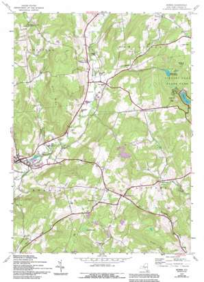
Morris Topo Map New York
To zoom in, hover over the map of Morris
USGS Topo Quad 42075e2 - 1:24,000 scale
| Topo Map Name: | Morris |
| USGS Topo Quad ID: | 42075e2 |
| Print Size: | ca. 21 1/4" wide x 27" high |
| Southeast Coordinates: | 42.5° N latitude / 75.125° W longitude |
| Map Center Coordinates: | 42.5625° N latitude / 75.1875° W longitude |
| U.S. State: | NY |
| Filename: | o42075e2.jpg |
| Download Map JPG Image: | Morris topo map 1:24,000 scale |
| Map Type: | Topographic |
| Topo Series: | 7.5´ |
| Map Scale: | 1:24,000 |
| Source of Map Images: | United States Geological Survey (USGS) |
| Alternate Map Versions: |
Morris NY 1943, updated 1960 Download PDF Buy paper map Morris NY 1943, updated 1973 Download PDF Buy paper map Morris NY 1943, updated 1994 Download PDF Buy paper map Morris NY 2010 Download PDF Buy paper map Morris NY 2013 Download PDF Buy paper map Morris NY 2016 Download PDF Buy paper map |
1:24,000 Topo Quads surrounding Morris
> Back to 42075e1 at 1:100,000 scale
> Back to 42074a1 at 1:250,000 scale
> Back to U.S. Topo Maps home
Morris topo map: Gazetteer
Morris: Lakes
Gilbert Lake elevation 461m 1512′Lake Misery elevation 546m 1791′
Lake of the Twin Fawns elevation 486m 1594′
Morris: Parks
Gilbert Lake State Park elevation 497m 1630′Morris: Populated Places
Elm Grove elevation 347m 1138′Morris elevation 349m 1145′
New Lisbon elevation 380m 1246′
Stetsonville elevation 387m 1269′
Welcome elevation 522m 1712′
West Laurens elevation 455m 1492′
Morris: Streams
Calhoun Creek elevation 330m 1082′Cooper Creek elevation 416m 1364′
Stony Creek elevation 359m 1177′
Morris: Summits
Gill Hill elevation 513m 1683′Morris digital topo map on disk
Buy this Morris topo map showing relief, roads, GPS coordinates and other geographical features, as a high-resolution digital map file on DVD:
New York, Vermont, Connecticut & Western Massachusetts
Buy digital topo maps: New York, Vermont, Connecticut & Western Massachusetts


