Cincinnatus Topo Map New York
To zoom in, hover over the map of Cincinnatus
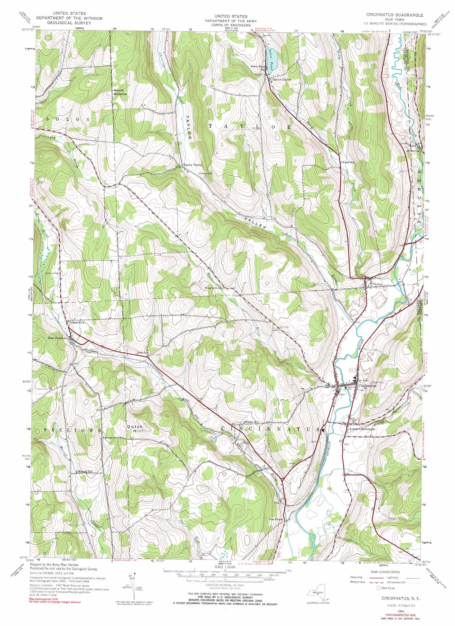
USGS Topo Quad 42075e8 - 1:24,000 scale
| Topo Map Name: | Cincinnatus |
| USGS Topo Quad ID: | 42075e8 |
| Print Size: | ca. 21 1/4" wide x 27" high |
| Southeast Coordinates: | 42.5° N latitude / 75.875° W longitude |
| Map Center Coordinates: | 42.5625° N latitude / 75.9375° W longitude |
| U.S. State: | NY |
| Filename: | o42075e8.jpg |
| Download Map JPG Image: | Cincinnatus topo map 1:24,000 scale |
| Map Type: | Topographic |
| Topo Series: | 7.5´ |
| Map Scale: | 1:24,000 |
| Source of Map Images: | United States Geological Survey (USGS) |
| Alternate Map Versions: |
Cincinnatus NY 1943, updated 1960 Download PDF Buy paper map Cincinnatus NY 1943, updated 1974 Download PDF Buy paper map Cincinnatus NY 1943, updated 1990 Download PDF Buy paper map Cincinnatus NY 2010 Download PDF Buy paper map Cincinnatus NY 2013 Download PDF Buy paper map Cincinnatus NY 2016 Download PDF Buy paper map |
1:24,000 Topo Quads surrounding Cincinnatus
Otisco Valley |
Tully |
De Ruyter |
Erieville |
West Eaton |
Homer |
Truxton |
Cuyler |
South Otselic |
Otselic |
Cortland |
Mcgraw |
Cincinnatus |
Pitcher |
East Pharsalia |
Harford |
Marathon |
Willet |
Smithville Flats |
Tyner |
Richford |
Lisle |
Whitney Point |
Greene |
Brisben |
> Back to 42075e1 at 1:100,000 scale
> Back to 42074a1 at 1:250,000 scale
> Back to U.S. Topo Maps home
Cincinnatus topo map: Gazetteer
Cincinnatus: Lakes
Solon Pond elevation 436m 1430′Cincinnatus: Populated Places
Cincinnatus elevation 320m 1049′East Freetown elevation 405m 1328′
Gee Brook elevation 318m 1043′
Hydeville elevation 368m 1207′
Lower Cincinnatus elevation 319m 1046′
Taylor elevation 338m 1108′
Taylor Center elevation 436m 1430′
Taylor Valley elevation 390m 1279′
Cincinnatus: Streams
Brakel Creek elevation 311m 1020′Mallory Brook elevation 317m 1040′
Mead Brook elevation 311m 1020′
Pond Creek elevation 323m 1059′
Wells Creek elevation 377m 1236′
Cincinnatus: Summits
Dutch Hill elevation 530m 1738′Mount Roderick elevation 582m 1909′
Cincinnatus: Valleys
Taylor Valley elevation 323m 1059′Cincinnatus digital topo map on disk
Buy this Cincinnatus topo map showing relief, roads, GPS coordinates and other geographical features, as a high-resolution digital map file on DVD:
New York, Vermont, Connecticut & Western Massachusetts
Buy digital topo maps: New York, Vermont, Connecticut & Western Massachusetts