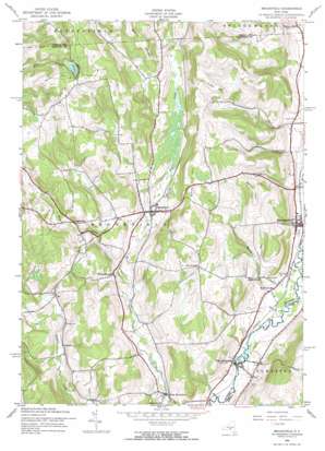
Brookfield Topo Map New York
To zoom in, hover over the map of Brookfield
USGS Topo Quad 42075g3 - 1:24,000 scale
| Topo Map Name: | Brookfield |
| USGS Topo Quad ID: | 42075g3 |
| Print Size: | ca. 21 1/4" wide x 27" high |
| Southeast Coordinates: | 42.75° N latitude / 75.25° W longitude |
| Map Center Coordinates: | 42.8125° N latitude / 75.3125° W longitude |
| U.S. State: | NY |
| Filename: | o42075g3.jpg |
| Download Map JPG Image: | Brookfield topo map 1:24,000 scale |
| Map Type: | Topographic |
| Topo Series: | 7.5´ |
| Map Scale: | 1:24,000 |
| Source of Map Images: | United States Geological Survey (USGS) |
| Alternate Map Versions: |
Brookfield NY 1943, updated 1960 Download PDF Buy paper map Brookfield NY 1943, updated 1973 Download PDF Buy paper map Brookfield NY 2010 Download PDF Buy paper map Brookfield NY 2013 Download PDF Buy paper map Brookfield NY 2016 Download PDF Buy paper map |
1:24,000 Topo Quads surrounding Brookfield
> Back to 42075e1 at 1:100,000 scale
> Back to 42074a1 at 1:250,000 scale
> Back to U.S. Topo Maps home
Brookfield topo map: Gazetteer
Brookfield: Falls
Button Falls elevation 374m 1227′Brookfield: Lakes
Gorton Lake elevation 527m 1729′Brookfield: Populated Places
Brookfield elevation 421m 1381′Guideboard elevation 454m 1489′
Leonardsville elevation 356m 1167′
South Brookfield elevation 365m 1197′
West Edmeston elevation 342m 1122′
Brookfield: Streams
Button Creek elevation 341m 1118′West Creek elevation 396m 1299′
Brookfield: Summits
Beaver Hill elevation 561m 1840′Button Hill elevation 538m 1765′
Gorton Hill elevation 544m 1784′
Witter Hill elevation 532m 1745′
Brookfield digital topo map on disk
Buy this Brookfield topo map showing relief, roads, GPS coordinates and other geographical features, as a high-resolution digital map file on DVD:
New York, Vermont, Connecticut & Western Massachusetts
Buy digital topo maps: New York, Vermont, Connecticut & Western Massachusetts


