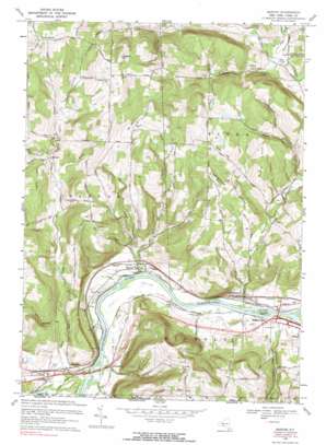
Barton Topo Map New York
To zoom in, hover over the map of Barton
USGS Topo Quad 42076a4 - 1:24,000 scale
| Topo Map Name: | Barton |
| USGS Topo Quad ID: | 42076a4 |
| Print Size: | ca. 21 1/4" wide x 27" high |
| Southeast Coordinates: | 42° N latitude / 76.375° W longitude |
| Map Center Coordinates: | 42.0625° N latitude / 76.4375° W longitude |
| U.S. State: | NY |
| Filename: | o42076a4.jpg |
| Download Map JPG Image: | Barton topo map 1:24,000 scale |
| Map Type: | Topographic |
| Topo Series: | 7.5´ |
| Map Scale: | 1:24,000 |
| Source of Map Images: | United States Geological Survey (USGS) |
| Alternate Map Versions: |
Barton NY 1953, updated 1955 Download PDF Buy paper map Barton NY 1969, updated 1971 Download PDF Buy paper map Barton NY 1969, updated 1986 Download PDF Buy paper map Barton NY 2012 Download PDF Buy paper map Barton NY 2013 Download PDF Buy paper map Barton NY 2016 Download PDF Buy paper map |
1:24,000 Topo Quads surrounding Barton
> Back to 42076a1 at 1:100,000 scale
> Back to 42076a1 at 1:250,000 scale
> Back to U.S. Topo Maps home
Barton topo map: Gazetteer
Barton: Islands
Hoopers Valley Island elevation 233m 764′Barton: Populated Places
Barton elevation 245m 803′Ellistown elevation 247m 810′
Glencairn elevation 337m 1105′
Hoopers Valley elevation 241m 790′
Howland Mobile Home Park elevation 239m 784′
Litchfield elevation 240m 787′
Maple Lane Mobile Home Park elevation 243m 797′
North Barton elevation 484m 1587′
Park Terrace elevation 258m 846′
Smithboro elevation 245m 803′
Barton: Streams
Butson Creek elevation 246m 807′Ellis Brook elevation 233m 764′
Ellis Creek elevation 231m 757′
Evelin Hill Creek elevation 294m 964′
Flag Marsh Run elevation 261m 856′
Little Wapessening Creek elevation 278m 912′
Miami Creek elevation 319m 1046′
Parks Creek elevation 235m 770′
Reed Brook elevation 332m 1089′
Sackett Creek elevation 235m 770′
Barton: Summits
East Whitcomb Hill elevation 415m 1361′Oak Hill elevation 448m 1469′
Poverty Knob elevation 421m 1381′
Prospect Hill elevation 518m 1699′
Ross Hill elevation 415m 1361′
Barton: Valleys
Diamond Valley elevation 277m 908′Frost Hollow elevation 290m 951′
Negro Hollow elevation 283m 928′
Shipman Hollow elevation 362m 1187′
Barton digital topo map on disk
Buy this Barton topo map showing relief, roads, GPS coordinates and other geographical features, as a high-resolution digital map file on DVD:
New York, Vermont, Connecticut & Western Massachusetts
Buy digital topo maps: New York, Vermont, Connecticut & Western Massachusetts


