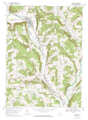
Candor Topo Map New York
To zoom in, hover over the map of Candor
USGS Topo Quad 42076b3 - 1:24,000 scale
| Topo Map Name: | Candor |
| USGS Topo Quad ID: | 42076b3 |
| Print Size: | ca. 21 1/4" wide x 27" high |
| Southeast Coordinates: | 42.125° N latitude / 76.25° W longitude |
| Map Center Coordinates: | 42.1875° N latitude / 76.3125° W longitude |
| U.S. State: | NY |
| Filename: | o42076b3.jpg |
| Download Map JPG Image: | Candor topo map 1:24,000 scale |
| Map Type: | Topographic |
| Topo Series: | 7.5´ |
| Map Scale: | 1:24,000 |
| Source of Map Images: | United States Geological Survey (USGS) |
| Alternate Map Versions: |
Candor NY 1956, updated 1958 Download PDF Buy paper map Candor NY 1969, updated 1971 Download PDF Buy paper map Candor NY 2010 Download PDF Buy paper map Candor NY 2013 Download PDF Buy paper map Candor NY 2016 Download PDF Buy paper map |
1:24,000 Topo Quads surrounding Candor
> Back to 42076a1 at 1:100,000 scale
> Back to 42076a1 at 1:250,000 scale
> Back to U.S. Topo Maps home
Candor topo map: Gazetteer
Candor: Bridges
Turners Bridge elevation 252m 826′Candor: Falls
Buttermilk Falls elevation 280m 918′Candor: Lakes
Zorn Pond elevation 422m 1384′Candor: Parks
Lane Collyer Field elevation 274m 898′Candor: Populated Places
Candor elevation 275m 902′Catatonk elevation 260m 853′
Crimson Mobile Home Court elevation 274m 898′
Fairfield elevation 335m 1099′
Germany Hill elevation 431m 1414′
Gridleyville elevation 285m 935′
Hamar Estates elevation 265m 869′
Hubbardtown elevation 270m 885′
Jewell Mobile Home Park elevation 265m 869′
Owego Heights elevation 270m 885′
Pebble Hill Mobile Home Park elevation 265m 869′
Pine Tree Mobile Home Park elevation 258m 846′
Candor: Streams
Cole Brook elevation 269m 882′East Branch Owego Creek elevation 264m 866′
Hoyt Creek elevation 256m 839′
Hubbard Hill Brook elevation 263m 862′
West Branch Owego Creek elevation 265m 869′
Willseyville Creek elevation 274m 898′
Candor: Summits
Candor Hill elevation 479m 1571′Diamond Peak elevation 461m 1512′
Hubbard Hill elevation 497m 1630′
Candor digital topo map on disk
Buy this Candor topo map showing relief, roads, GPS coordinates and other geographical features, as a high-resolution digital map file on DVD:
New York, Vermont, Connecticut & Western Massachusetts
Buy digital topo maps: New York, Vermont, Connecticut & Western Massachusetts


