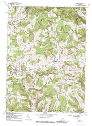
Erin Topo Map New York
To zoom in, hover over the map of Erin
USGS Topo Quad 42076b6 - 1:24,000 scale
| Topo Map Name: | Erin |
| USGS Topo Quad ID: | 42076b6 |
| Print Size: | ca. 21 1/4" wide x 27" high |
| Southeast Coordinates: | 42.125° N latitude / 76.625° W longitude |
| Map Center Coordinates: | 42.1875° N latitude / 76.6875° W longitude |
| U.S. State: | NY |
| Filename: | o42076b6.jpg |
| Download Map JPG Image: | Erin topo map 1:24,000 scale |
| Map Type: | Topographic |
| Topo Series: | 7.5´ |
| Map Scale: | 1:24,000 |
| Source of Map Images: | United States Geological Survey (USGS) |
| Alternate Map Versions: |
Erin NY 1954, updated 1956 Download PDF Buy paper map Erin NY 1969, updated 1971 Download PDF Buy paper map Erin NY 1969, updated 1986 Download PDF Buy paper map Erin NY 2010 Download PDF Buy paper map Erin NY 2013 Download PDF Buy paper map Erin NY 2016 Download PDF Buy paper map |
1:24,000 Topo Quads surrounding Erin
> Back to 42076a1 at 1:100,000 scale
> Back to 42076a1 at 1:250,000 scale
> Back to U.S. Topo Maps home
Erin topo map: Gazetteer
Erin: Airports
Matejka Field elevation 515m 1689′Erin: Lakes
Beaver Pond elevation 346m 1135′Buckeys Pond elevation 375m 1230′
Erin: Populated Places
Breesport elevation 335m 1099′Crestwood Mobile Home Park elevation 394m 1292′
Erin elevation 385m 1263′
Erin Estates elevation 379m 1243′
Erin: Ridges
Tuthill Ridge elevation 536m 1758′Erin: Streams
Jackson Creek elevation 331m 1085′Jackson Creek elevation 318m 1043′
Erin: Summits
Langdon Hill elevation 540m 1771′Laurel Hill elevation 547m 1794′
Mallory Hill elevation 443m 1453′
Park Hill elevation 559m 1833′
Red Chalk Hill elevation 569m 1866′
Erin: Valleys
Wildcat Hollow elevation 365m 1197′Erin digital topo map on disk
Buy this Erin topo map showing relief, roads, GPS coordinates and other geographical features, as a high-resolution digital map file on DVD:
New York, Vermont, Connecticut & Western Massachusetts
Buy digital topo maps: New York, Vermont, Connecticut & Western Massachusetts


