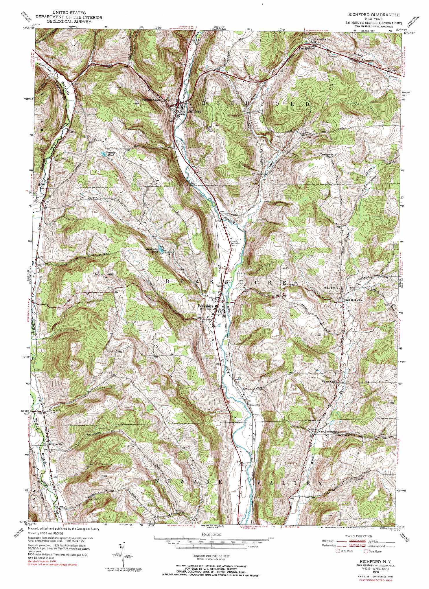
Richford Topo Map New York
To zoom in, hover over the map of Richford
USGS Topo Quad 42076c2 - 1:24,000 scale
| Topo Map Name: | Richford |
| USGS Topo Quad ID: | 42076c2 |
| Print Size: | ca. 21 1/4" wide x 27" high |
| Southeast Coordinates: | 42.25° N latitude / 76.125° W longitude |
| Map Center Coordinates: | 42.3125° N latitude / 76.1875° W longitude |
| U.S. State: | NY |
| Filename: | o42076c2.jpg |
| Download Map JPG Image: | Richford topo map 1:24,000 scale |
| Map Type: | Topographic |
| Topo Series: | 7.5´ |
| Map Scale: | 1:24,000 |
| Source of Map Images: | United States Geological Survey (USGS) |
| Alternate Map Versions: |
Richford NY 1950, updated 1952 Download PDF Buy paper map Richford NY 1950, updated 1965 Download PDF Buy paper map Richford NY 1950, updated 1971 Download PDF Buy paper map Richford NY 1950, updated 1985 Download PDF Buy paper map Richford NY 2010 Download PDF Buy paper map Richford NY 2013 Download PDF Buy paper map Richford NY 2016 Download PDF Buy paper map |
1:24,000 Topo Quads surrounding Richford
West Groton |
Groton |
Cortland |
Mcgraw |
Cincinnatus |
Ithaca East |
Dryden |
Harford |
Marathon |
Willet |
Willseyville |
Speedsville |
Richford |
Lisle |
Whitney Point |
Spencer |
Candor |
Newark Valley |
Maine |
Castle Creek |
Barton |
Owego |
Apalachin |
Endicott |
Binghamton West |
> Back to 42076a1 at 1:100,000 scale
> Back to 42076a1 at 1:250,000 scale
> Back to U.S. Topo Maps home
Richford topo map: Gazetteer
Richford: Lakes
Rightmire Pond elevation 386m 1266′Summit Pond elevation 464m 1522′
Richford: Populated Places
Berkshire elevation 319m 1046′East Berkshire elevation 359m 1177′
East Richford elevation 398m 1305′
Jenksville elevation 315m 1033′
New Connecticut elevation 325m 1066′
Richford elevation 340m 1115′
Wilson Creek elevation 337m 1105′
Richford: Streams
Boyer Creek elevation 324m 1062′Hubby Creek elevation 322m 1056′
Richford: Summits
Nixon Hill elevation 510m 1673′Turkey Hill elevation 500m 1640′
Richford: Valleys
Rawson Hollow elevation 349m 1145′Richford digital topo map on disk
Buy this Richford topo map showing relief, roads, GPS coordinates and other geographical features, as a high-resolution digital map file on DVD:
New York, Vermont, Connecticut & Western Massachusetts
Buy digital topo maps: New York, Vermont, Connecticut & Western Massachusetts