Speedsville Topo Map New York
To zoom in, hover over the map of Speedsville
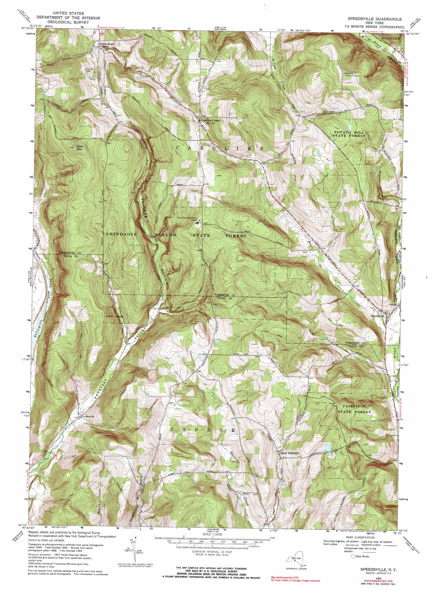
USGS Topo Quad 42076c3 - 1:24,000 scale
| Topo Map Name: | Speedsville |
| USGS Topo Quad ID: | 42076c3 |
| Print Size: | ca. 21 1/4" wide x 27" high |
| Southeast Coordinates: | 42.25° N latitude / 76.25° W longitude |
| Map Center Coordinates: | 42.3125° N latitude / 76.3125° W longitude |
| U.S. State: | NY |
| Filename: | o42076c3.jpg |
| Download Map JPG Image: | Speedsville topo map 1:24,000 scale |
| Map Type: | Topographic |
| Topo Series: | 7.5´ |
| Map Scale: | 1:24,000 |
| Source of Map Images: | United States Geological Survey (USGS) |
| Alternate Map Versions: |
Speedsville NY 1949, updated 1966 Download PDF Buy paper map Speedsville NY 1951 Download PDF Buy paper map Speedsville NY 1969, updated 1971 Download PDF Buy paper map Speedsville NY 1969, updated 1990 Download PDF Buy paper map Speedsville NY 2010 Download PDF Buy paper map Speedsville NY 2013 Download PDF Buy paper map Speedsville NY 2016 Download PDF Buy paper map |
1:24,000 Topo Quads surrounding Speedsville
Ludlowville |
West Groton |
Groton |
Cortland |
Mcgraw |
Ithaca West |
Ithaca East |
Dryden |
Harford |
Marathon |
West Danby |
Willseyville |
Speedsville |
Richford |
Lisle |
Van Etten |
Spencer |
Candor |
Newark Valley |
Maine |
Waverly |
Barton |
Owego |
Apalachin |
Endicott |
> Back to 42076a1 at 1:100,000 scale
> Back to 42076a1 at 1:250,000 scale
> Back to U.S. Topo Maps home
Speedsville topo map: Gazetteer
Speedsville: Forests
Fairfield State Forest elevation 467m 1532′Potato Hill State Forest elevation 506m 1660′
Shindagin Hollow State Forest elevation 501m 1643′
Speedsville: Populated Places
Caroline Center elevation 485m 1591′Speedsville elevation 340m 1115′
Upper Fairfield elevation 415m 1361′
Speedsville: Streams
Danby Creek elevation 288m 944′Speedsville: Summits
Bald Mountain elevation 570m 1870′Speedsville: Valleys
Prospect Valley elevation 285m 935′Shindagin Hollow elevation 339m 1112′
Speedsville digital topo map on disk
Buy this Speedsville topo map showing relief, roads, GPS coordinates and other geographical features, as a high-resolution digital map file on DVD:
New York, Vermont, Connecticut & Western Massachusetts
Buy digital topo maps: New York, Vermont, Connecticut & Western Massachusetts