West Danby Topo Map New York
To zoom in, hover over the map of West Danby
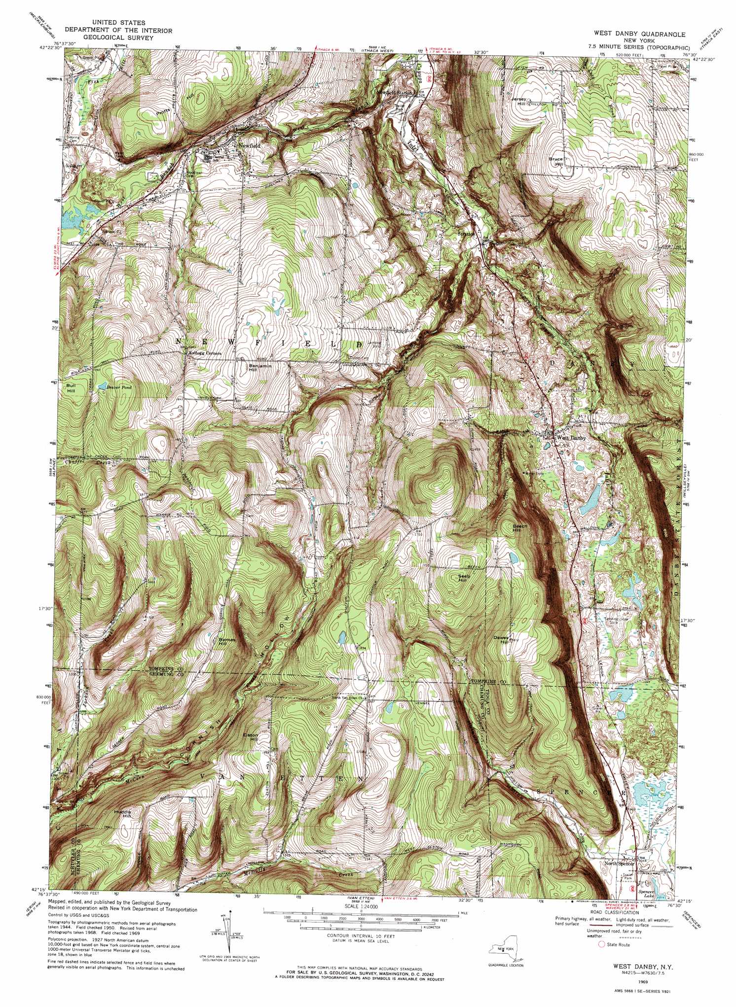
USGS Topo Quad 42076c5 - 1:24,000 scale
| Topo Map Name: | West Danby |
| USGS Topo Quad ID: | 42076c5 |
| Print Size: | ca. 21 1/4" wide x 27" high |
| Southeast Coordinates: | 42.25° N latitude / 76.5° W longitude |
| Map Center Coordinates: | 42.3125° N latitude / 76.5625° W longitude |
| U.S. State: | NY |
| Filename: | o42076c5.jpg |
| Download Map JPG Image: | West Danby topo map 1:24,000 scale |
| Map Type: | Topographic |
| Topo Series: | 7.5´ |
| Map Scale: | 1:24,000 |
| Source of Map Images: | United States Geological Survey (USGS) |
| Alternate Map Versions: |
West Danby NY 1950, updated 1952 Download PDF Buy paper map West Danby NY 1950, updated 1962 Download PDF Buy paper map West Danby NY 1969, updated 1971 Download PDF Buy paper map West Danby NY 1969, updated 1971 Download PDF Buy paper map West Danby NY 2010 Download PDF Buy paper map West Danby NY 2013 Download PDF Buy paper map West Danby NY 2016 Download PDF Buy paper map |
1:24,000 Topo Quads surrounding West Danby
Lodi |
Trumansburg |
Ludlowville |
West Groton |
Groton |
Burdett |
Mecklenburg |
Ithaca West |
Ithaca East |
Dryden |
Montour Falls |
Alpine |
West Danby |
Willseyville |
Speedsville |
Horseheads |
Erin |
Van Etten |
Spencer |
Candor |
Elmira |
Wellsburg |
Waverly |
Barton |
Owego |
> Back to 42076a1 at 1:100,000 scale
> Back to 42076a1 at 1:250,000 scale
> Back to U.S. Topo Maps home
West Danby topo map: Gazetteer
West Danby: Airports
Tom N' Jerry Airport elevation 454m 1489′West Danby: Bridges
Newfield Bridge elevation 305m 1000′West Danby: Lakes
Beaver Pond elevation 534m 1751′West Danby: Populated Places
Cloverland Park elevation 494m 1620′Newfield elevation 320m 1049′
North Spencer elevation 318m 1043′
Shelter Valley Mobile Home Park elevation 163m 534′
Stratton elevation 204m 669′
West Danby elevation 288m 944′
West Danby: Streams
McCorn Creek elevation 350m 1148′West Danby: Summits
Barnes Hill elevation 571m 1873′Beech Hill elevation 561m 1840′
Benjamin Hill elevation 503m 1650′
Bruce Hill elevation 461m 1512′
Bull Hill elevation 553m 1814′
Dawes Hill elevation 552m 1811′
Elston Hill elevation 537m 1761′
Huddle Hill elevation 528m 1732′
Jersey Hill elevation 436m 1430′
Protts Hill elevation 461m 1512′
Seely Hill elevation 582m 1909′
West Danby: Valleys
Cornish Hollow elevation 350m 1148′Hulburt Hollow elevation 323m 1059′
VanBuskirk Gulf elevation 205m 672′
West Danby digital topo map on disk
Buy this West Danby topo map showing relief, roads, GPS coordinates and other geographical features, as a high-resolution digital map file on DVD:
New York, Vermont, Connecticut & Western Massachusetts
Buy digital topo maps: New York, Vermont, Connecticut & Western Massachusetts