Harford Topo Map New York
To zoom in, hover over the map of Harford
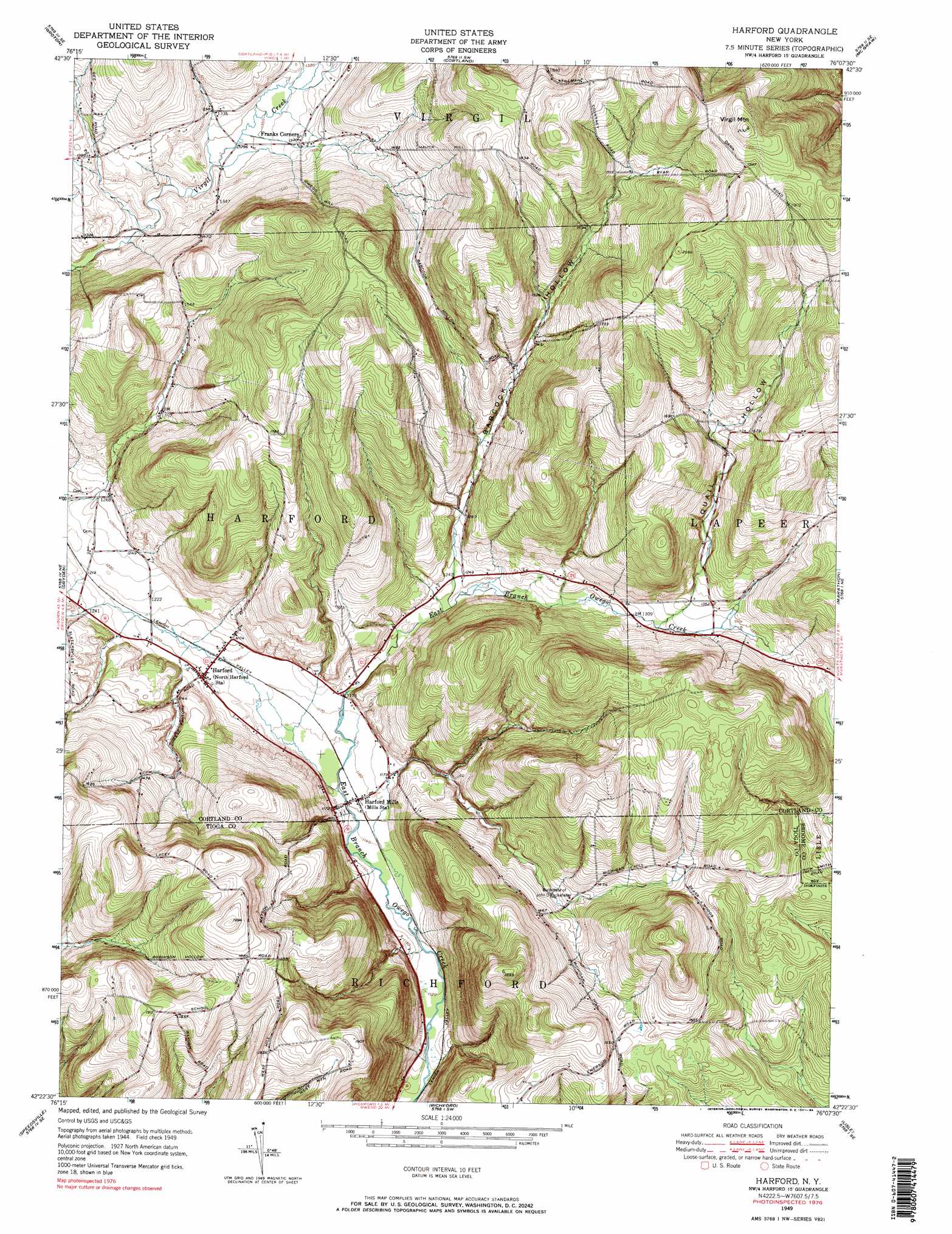
USGS Topo Quad 42076d2 - 1:24,000 scale
| Topo Map Name: | Harford |
| USGS Topo Quad ID: | 42076d2 |
| Print Size: | ca. 21 1/4" wide x 27" high |
| Southeast Coordinates: | 42.375° N latitude / 76.125° W longitude |
| Map Center Coordinates: | 42.4375° N latitude / 76.1875° W longitude |
| U.S. State: | NY |
| Filename: | o42076d2.jpg |
| Download Map JPG Image: | Harford topo map 1:24,000 scale |
| Map Type: | Topographic |
| Topo Series: | 7.5´ |
| Map Scale: | 1:24,000 |
| Source of Map Images: | United States Geological Survey (USGS) |
| Alternate Map Versions: |
Harford NY 1949, updated 1967 Download PDF Buy paper map Harford NY 1951 Download PDF Buy paper map Harford NY 1976, updated 1984 Download PDF Buy paper map Harford NY 1976, updated 1984 Download PDF Buy paper map Harford NY 2010 Download PDF Buy paper map Harford NY 2013 Download PDF Buy paper map Harford NY 2016 Download PDF Buy paper map |
1:24,000 Topo Quads surrounding Harford
Moravia |
Sempronius |
Homer |
Truxton |
Cuyler |
West Groton |
Groton |
Cortland |
Mcgraw |
Cincinnatus |
Ithaca East |
Dryden |
Harford |
Marathon |
Willet |
Willseyville |
Speedsville |
Richford |
Lisle |
Whitney Point |
Spencer |
Candor |
Newark Valley |
Maine |
Castle Creek |
> Back to 42076a1 at 1:100,000 scale
> Back to 42076a1 at 1:250,000 scale
> Back to U.S. Topo Maps home
Harford topo map: Gazetteer
Harford: Populated Places
Harford elevation 365m 1197′Harford Mills elevation 352m 1154′
Harford: Summits
Virgil Mountain elevation 643m 2109′Harford: Valleys
Babcock Hollow elevation 378m 1240′Quail Hollow elevation 413m 1354′
Harford digital topo map on disk
Buy this Harford topo map showing relief, roads, GPS coordinates and other geographical features, as a high-resolution digital map file on DVD:
New York, Vermont, Connecticut & Western Massachusetts
Buy digital topo maps: New York, Vermont, Connecticut & Western Massachusetts