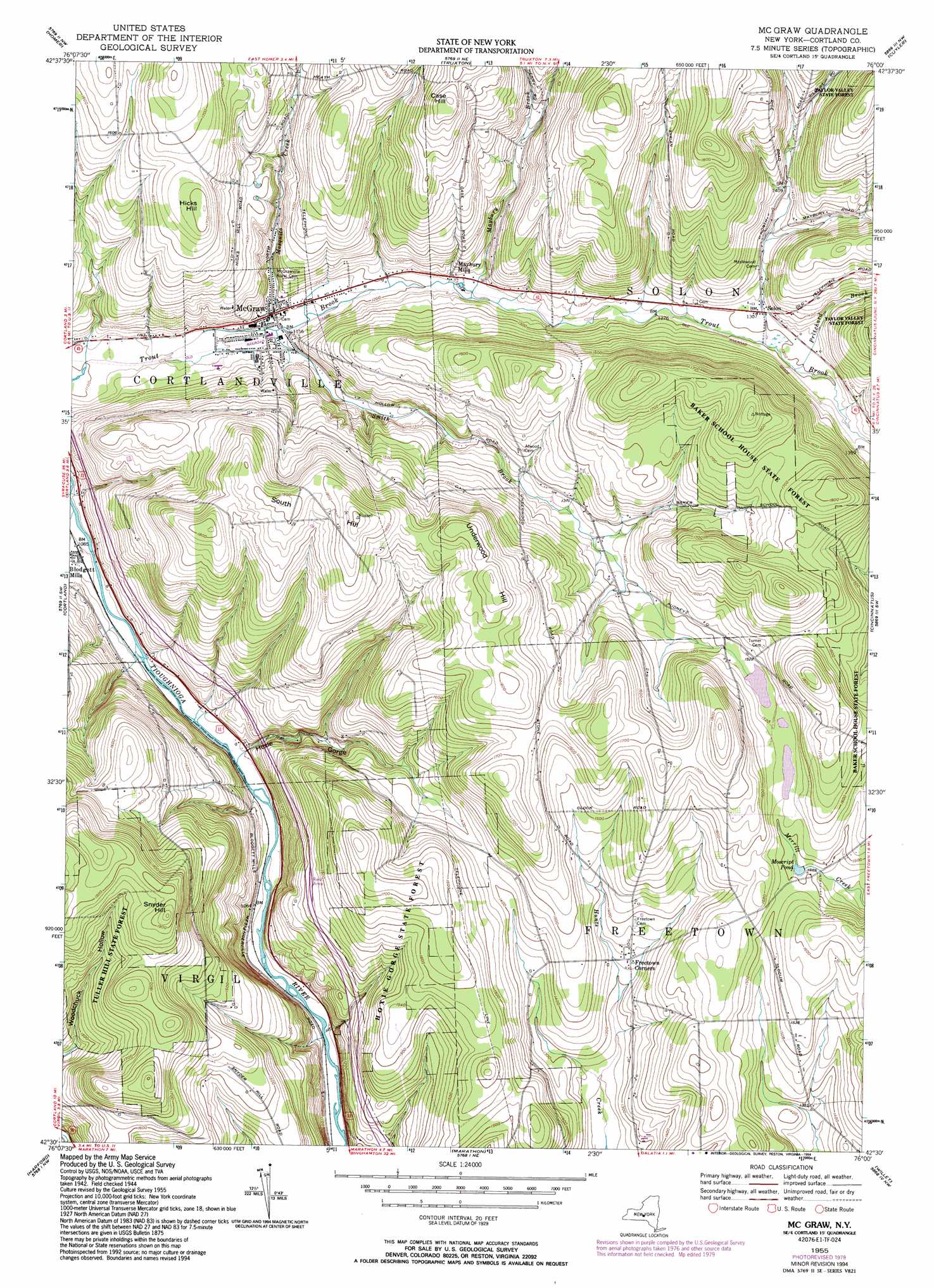
Mcgraw Topo Map New York
To zoom in, hover over the map of Mcgraw
USGS Topo Quad 42076e1 - 1:24,000 scale
| Topo Map Name: | Mcgraw |
| USGS Topo Quad ID: | 42076e1 |
| Print Size: | ca. 21 1/4" wide x 27" high |
| Southeast Coordinates: | 42.5° N latitude / 76° W longitude |
| Map Center Coordinates: | 42.5625° N latitude / 76.0625° W longitude |
| U.S. State: | NY |
| Filename: | o42076e1.jpg |
| Download Map JPG Image: | Mcgraw topo map 1:24,000 scale |
| Map Type: | Topographic |
| Topo Series: | 7.5´ |
| Map Scale: | 1:24,000 |
| Source of Map Images: | United States Geological Survey (USGS) |
| Alternate Map Versions: |
Mc Graw NY 1955, updated 1956 Download PDF Buy paper map Mc Graw NY 1955, updated 1969 Download PDF Buy paper map Mc Graw NY 1955, updated 1979 Download PDF Buy paper map Mc Graw NY 1955, updated 1994 Download PDF Buy paper map McGraw NY 2010 Download PDF Buy paper map McGraw NY 2013 Download PDF Buy paper map McGraw NY 2016 Download PDF Buy paper map |
1:24,000 Topo Quads surrounding Mcgraw
Spafford |
Otisco Valley |
Tully |
De Ruyter |
Erieville |
Sempronius |
Homer |
Truxton |
Cuyler |
South Otselic |
Groton |
Cortland |
Mcgraw |
Cincinnatus |
Pitcher |
Dryden |
Harford |
Marathon |
Willet |
Smithville Flats |
Speedsville |
Richford |
Lisle |
Whitney Point |
Greene |
> Back to 42076e1 at 1:100,000 scale
> Back to 42076a1 at 1:250,000 scale
> Back to U.S. Topo Maps home
Mcgraw topo map: Gazetteer
Mcgraw: Populated Places
Freetown Corners elevation 406m 1332′Maybury Mills elevation 377m 1236′
McGraw elevation 353m 1158′
Solon elevation 400m 1312′
Mcgraw: Reservoirs
Moscript Pond elevation 450m 1476′Mcgraw: Streams
Maybury Brook elevation 371m 1217′Mosquito Creek elevation 350m 1148′
Pritchard Brook elevation 395m 1295′
Smith Brook elevation 351m 1151′
Mcgraw: Summits
Case Hill elevation 561m 1840′Hicks Hill elevation 523m 1715′
Snyder Hill elevation 591m 1938′
South Hill elevation 581m 1906′
Underwood Hill elevation 567m 1860′
Mcgraw: Valleys
Hoxie Gorge elevation 328m 1076′Mcgraw digital topo map on disk
Buy this Mcgraw topo map showing relief, roads, GPS coordinates and other geographical features, as a high-resolution digital map file on DVD:
New York, Vermont, Connecticut & Western Massachusetts
Buy digital topo maps: New York, Vermont, Connecticut & Western Massachusetts