Homer Topo Map New York
To zoom in, hover over the map of Homer
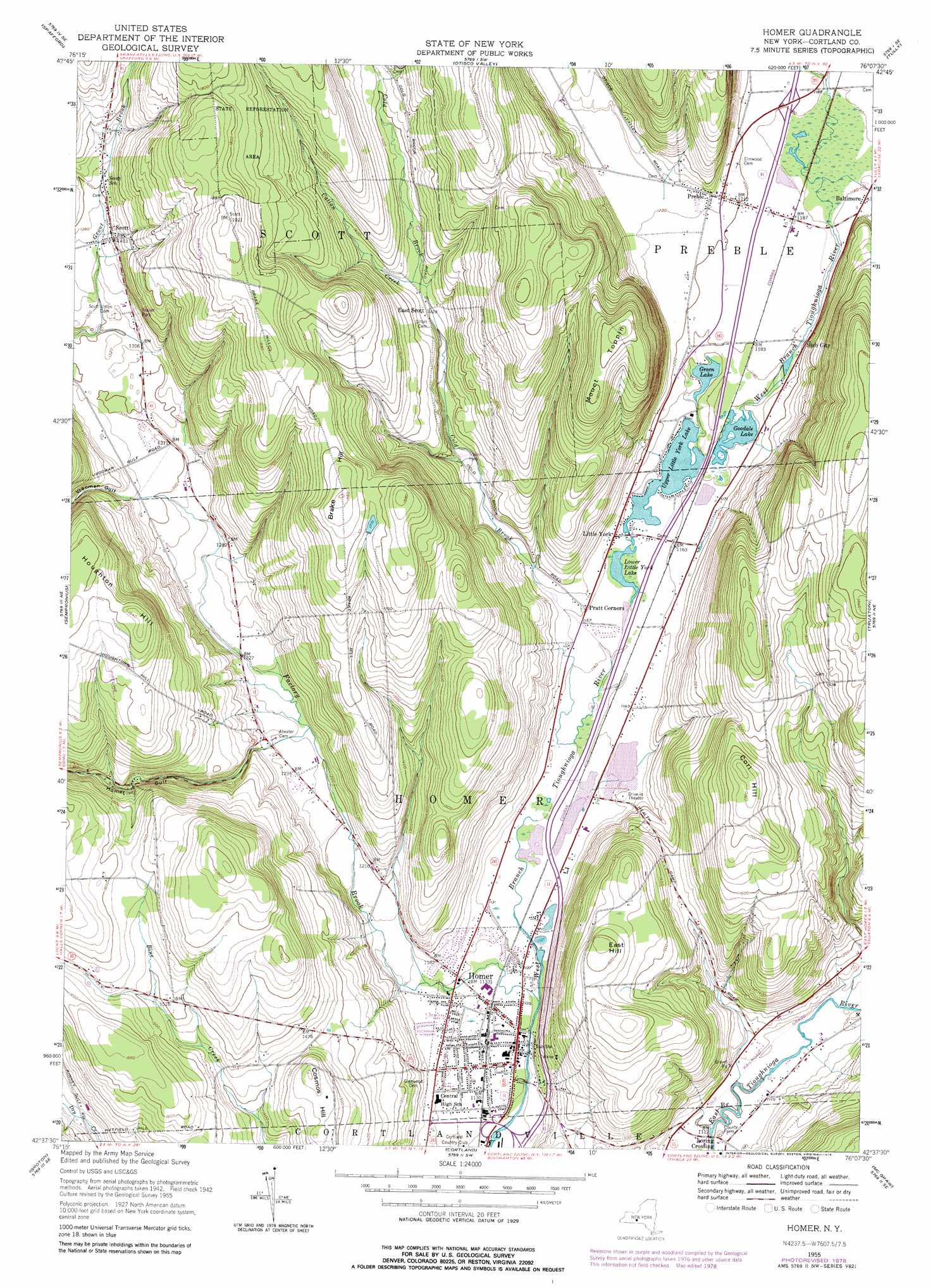
USGS Topo Quad 42076f2 - 1:24,000 scale
| Topo Map Name: | Homer |
| USGS Topo Quad ID: | 42076f2 |
| Print Size: | ca. 21 1/4" wide x 27" high |
| Southeast Coordinates: | 42.625° N latitude / 76.125° W longitude |
| Map Center Coordinates: | 42.6875° N latitude / 76.1875° W longitude |
| U.S. State: | NY |
| Filename: | o42076f2.jpg |
| Download Map JPG Image: | Homer topo map 1:24,000 scale |
| Map Type: | Topographic |
| Topo Series: | 7.5´ |
| Map Scale: | 1:24,000 |
| Source of Map Images: | United States Geological Survey (USGS) |
| Alternate Map Versions: |
Homer NY 1955, updated 1956 Download PDF Buy paper map Homer NY 1955, updated 1966 Download PDF Buy paper map Homer NY 1978, updated 1979 Download PDF Buy paper map Homer NY 2010 Download PDF Buy paper map Homer NY 2013 Download PDF Buy paper map Homer NY 2016 Download PDF Buy paper map |
1:24,000 Topo Quads surrounding Homer
Skaneateles |
Marcellus |
South Onondaga |
Jamesville |
Oran |
Owasco |
Spafford |
Otisco Valley |
Tully |
De Ruyter |
Moravia |
Sempronius |
Homer |
Truxton |
Cuyler |
West Groton |
Groton |
Cortland |
Mcgraw |
Cincinnatus |
Ithaca East |
Dryden |
Harford |
Marathon |
Willet |
> Back to 42076e1 at 1:100,000 scale
> Back to 42076a1 at 1:250,000 scale
> Back to U.S. Topo Maps home
Homer topo map: Gazetteer
Homer: Lakes
Goodale Lake elevation 353m 1158′Green Lake elevation 353m 1158′
Lower Little York Lake elevation 350m 1148′
Upper Little York Lake elevation 351m 1151′
Homer: Parks
Homer Green elevation 343m 1125′Homer: Populated Places
Baltimore elevation 362m 1187′East Scott elevation 404m 1325′
Homer elevation 343m 1125′
Little York elevation 354m 1161′
Loring Crossing elevation 338m 1108′
Parker Manor elevation 409m 1341′
Pine Hill Mobile Home Park elevation 347m 1138′
Pratt Corners elevation 354m 1161′
Preble elevation 373m 1223′
Scott elevation 430m 1410′
Slab City elevation 359m 1177′
Homer: Streams
Callan Creek elevation 406m 1332′Cold Brook elevation 347m 1138′
Dry Creek elevation 360m 1181′
Factory Brook elevation 337m 1105′
Homer: Summits
Brake Hill elevation 574m 1883′Corl Hill elevation 544m 1784′
Cosmos Hill elevation 473m 1551′
East Hill elevation 496m 1627′
Houghton Hill elevation 562m 1843′
Mount Toppin elevation 561m 1840′
Homer: Valleys
Homer Gulf elevation 378m 1240′Vrooman Gulf elevation 402m 1318′
Homer digital topo map on disk
Buy this Homer topo map showing relief, roads, GPS coordinates and other geographical features, as a high-resolution digital map file on DVD:
New York, Vermont, Connecticut & Western Massachusetts
Buy digital topo maps: New York, Vermont, Connecticut & Western Massachusetts