Genoa Topo Map New York
To zoom in, hover over the map of Genoa
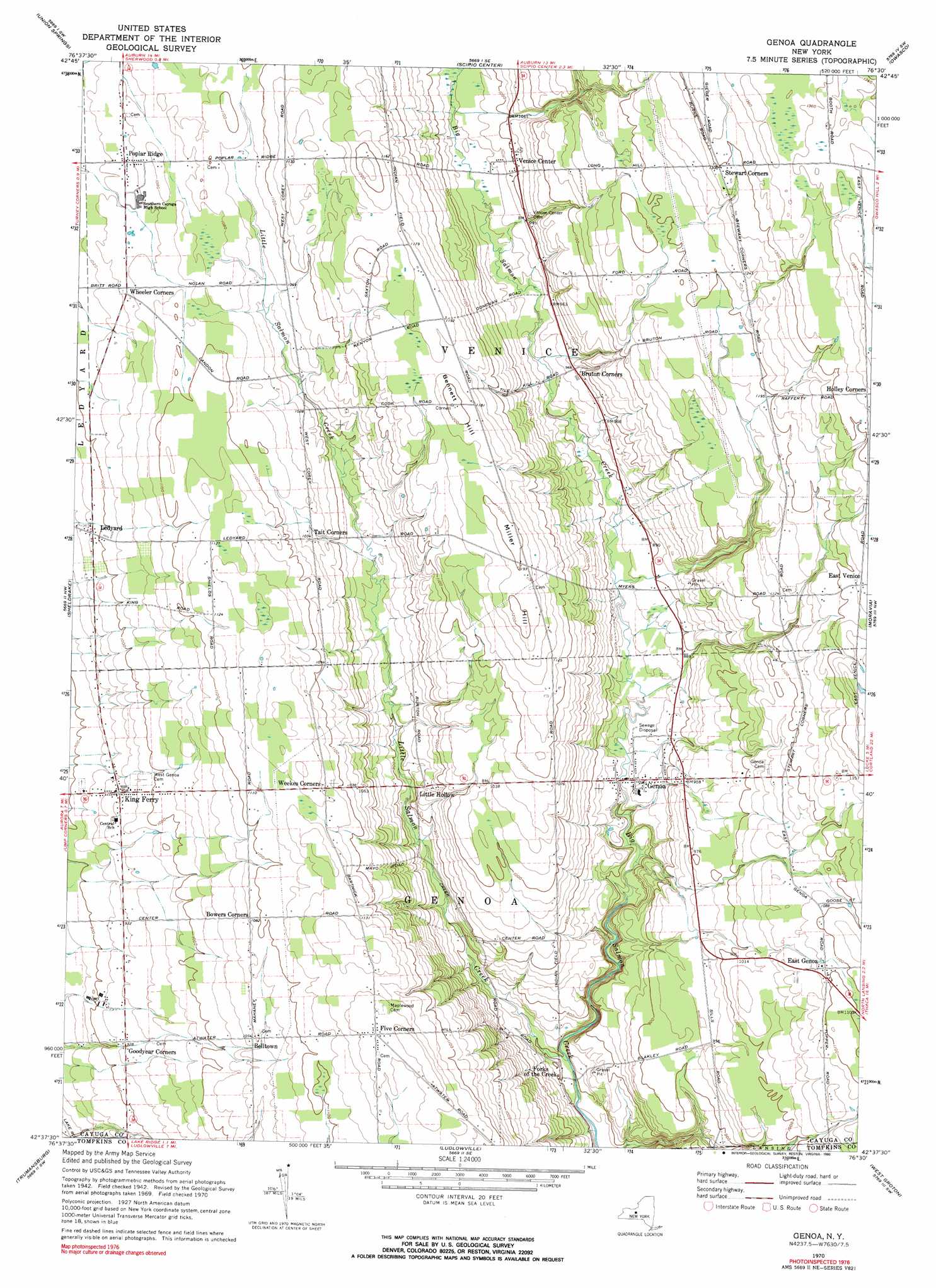
USGS Topo Quad 42076f5 - 1:24,000 scale
| Topo Map Name: | Genoa |
| USGS Topo Quad ID: | 42076f5 |
| Print Size: | ca. 21 1/4" wide x 27" high |
| Southeast Coordinates: | 42.625° N latitude / 76.5° W longitude |
| Map Center Coordinates: | 42.6875° N latitude / 76.5625° W longitude |
| U.S. State: | NY |
| Filename: | o42076f5.jpg |
| Download Map JPG Image: | Genoa topo map 1:24,000 scale |
| Map Type: | Topographic |
| Topo Series: | 7.5´ |
| Map Scale: | 1:24,000 |
| Source of Map Images: | United States Geological Survey (USGS) |
| Alternate Map Versions: |
Genoa NY 1942, updated 1960 Download PDF Buy paper map Genoa NY 1970, updated 1974 Download PDF Buy paper map Genoa NY 1970, updated 1990 Download PDF Buy paper map Genoa NY 2010 Download PDF Buy paper map Genoa NY 2013 Download PDF Buy paper map Genoa NY 2016 Download PDF Buy paper map |
1:24,000 Topo Quads surrounding Genoa
Seneca Falls |
Cayuga |
Auburn |
Skaneateles |
Marcellus |
Romulus |
Union Springs |
Scipio Center |
Owasco |
Spafford |
Ovid |
Sheldrake |
Genoa |
Moravia |
Sempronius |
Lodi |
Trumansburg |
Ludlowville |
West Groton |
Groton |
Burdett |
Mecklenburg |
Ithaca West |
Ithaca East |
Dryden |
> Back to 42076e1 at 1:100,000 scale
> Back to 42076a1 at 1:250,000 scale
> Back to U.S. Topo Maps home
Genoa topo map: Gazetteer
Genoa: Populated Places
Belltown elevation 321m 1053′Bowers Corner elevation 330m 1082′
East Genoa elevation 331m 1085′
East Venice elevation 374m 1227′
Five Corners elevation 356m 1167′
Genoa elevation 260m 853′
Goodyear Corners elevation 282m 925′
King Ferry elevation 291m 954′
Ledyard elevation 300m 984′
Little Hollow elevation 285m 935′
Poplar Ridge elevation 320m 1049′
Stewart Corners elevation 396m 1299′
Venice Center elevation 304m 997′
Weekes Corner elevation 345m 1131′
Genoa: Streams
Big Salmon Creek elevation 207m 679′Little Salmon Creek elevation 207m 679′
Genoa: Summits
Bennett Hill elevation 367m 1204′Miller Hill elevation 368m 1207′
Genoa digital topo map on disk
Buy this Genoa topo map showing relief, roads, GPS coordinates and other geographical features, as a high-resolution digital map file on DVD:
New York, Vermont, Connecticut & Western Massachusetts
Buy digital topo maps: New York, Vermont, Connecticut & Western Massachusetts