Dresden Topo Map New York
To zoom in, hover over the map of Dresden
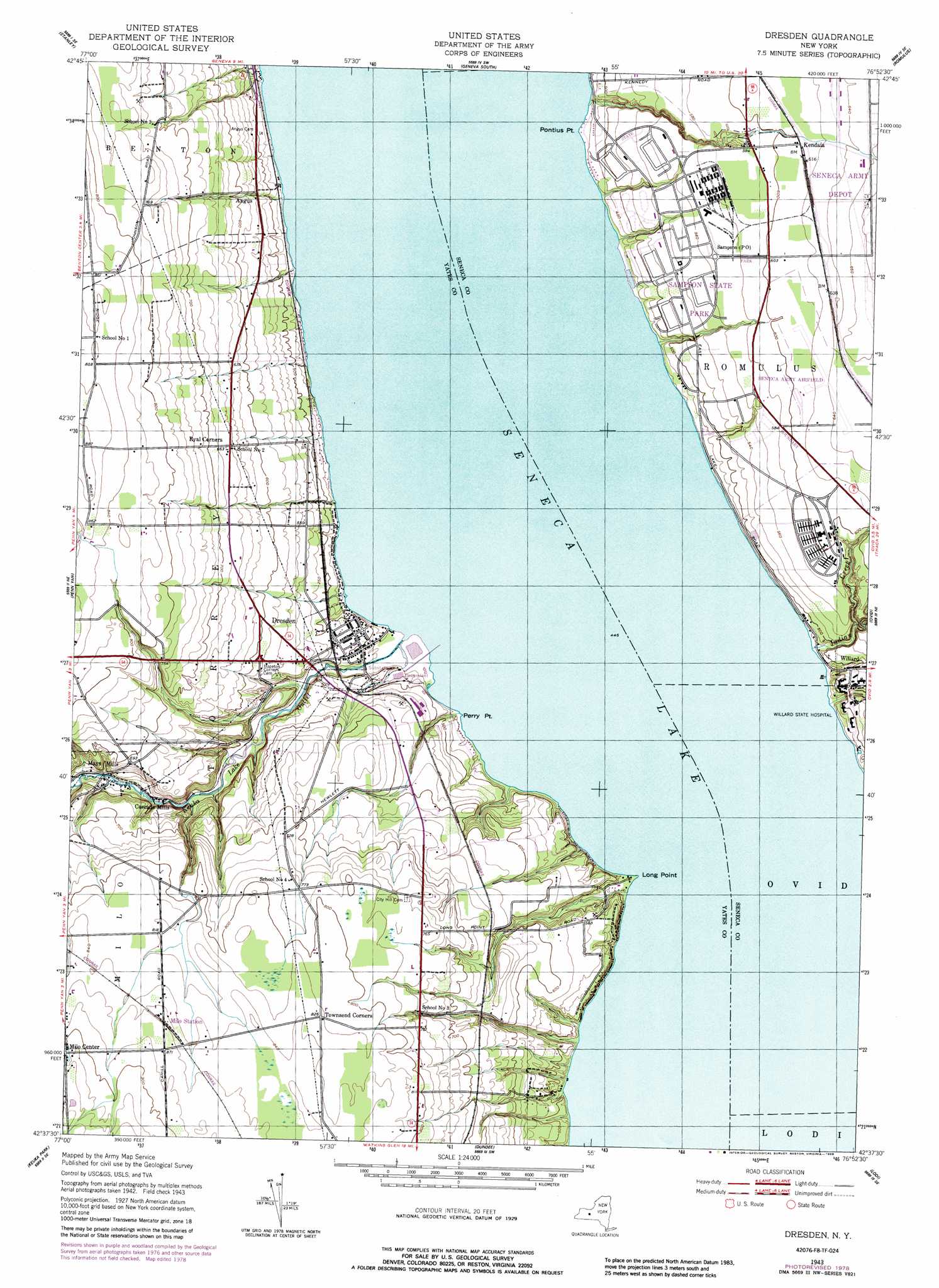
USGS Topo Quad 42076f8 - 1:24,000 scale
| Topo Map Name: | Dresden |
| USGS Topo Quad ID: | 42076f8 |
| Print Size: | ca. 21 1/4" wide x 27" high |
| Southeast Coordinates: | 42.625° N latitude / 76.875° W longitude |
| Map Center Coordinates: | 42.6875° N latitude / 76.9375° W longitude |
| U.S. State: | NY |
| Filename: | o42076f8.jpg |
| Download Map JPG Image: | Dresden topo map 1:24,000 scale |
| Map Type: | Topographic |
| Topo Series: | 7.5´ |
| Map Scale: | 1:24,000 |
| Source of Map Images: | United States Geological Survey (USGS) |
| Alternate Map Versions: |
Dresden NY 1943, updated 1954 Download PDF Buy paper map Dresden NY 1943, updated 1979 Download PDF Buy paper map Dresden NY 1943, updated 1988 Download PDF Buy paper map Dresden NY 2010 Download PDF Buy paper map Dresden NY 2013 Download PDF Buy paper map Dresden NY 2016 Download PDF Buy paper map |
1:24,000 Topo Quads surrounding Dresden
Clifton Springs |
Phelps |
Geneva North |
Seneca Falls |
Cayuga |
Rushville |
Stanley |
Geneva South |
Romulus |
Union Springs |
Potter |
Penn Yan |
Dresden |
Ovid |
Sheldrake |
Pulteney |
Keuka Park |
Dundee |
Lodi |
Trumansburg |
Hammondsport |
Wayne |
Reading Center |
Burdett |
Mecklenburg |
> Back to 42076e1 at 1:100,000 scale
> Back to 42076a1 at 1:250,000 scale
> Back to U.S. Topo Maps home
Dresden topo map: Gazetteer
Dresden: Airports
Seneca Army Air Field elevation 195m 639′Dresden: Capes
Long Point elevation 147m 482′Perry Point elevation 141m 462′
Pontius Point elevation 135m 442′
Dresden: Parks
Sampson State Park elevation 167m 547′Dresden: Populated Places
Angus elevation 169m 554′Dresden elevation 155m 508′
Kendaia elevation 185m 606′
Mays Mills elevation 177m 580′
Milo Center elevation 278m 912′
Sampson elevation 172m 564′
Dresden: Streams
Indian Creek elevation 135m 442′Keuka Lake Outlet elevation 135m 442′
Simpson Creek elevation 136m 446′
Dresden digital topo map on disk
Buy this Dresden topo map showing relief, roads, GPS coordinates and other geographical features, as a high-resolution digital map file on DVD:
New York, Vermont, Connecticut & Western Massachusetts
Buy digital topo maps: New York, Vermont, Connecticut & Western Massachusetts