Woodhull Topo Map New York
To zoom in, hover over the map of Woodhull
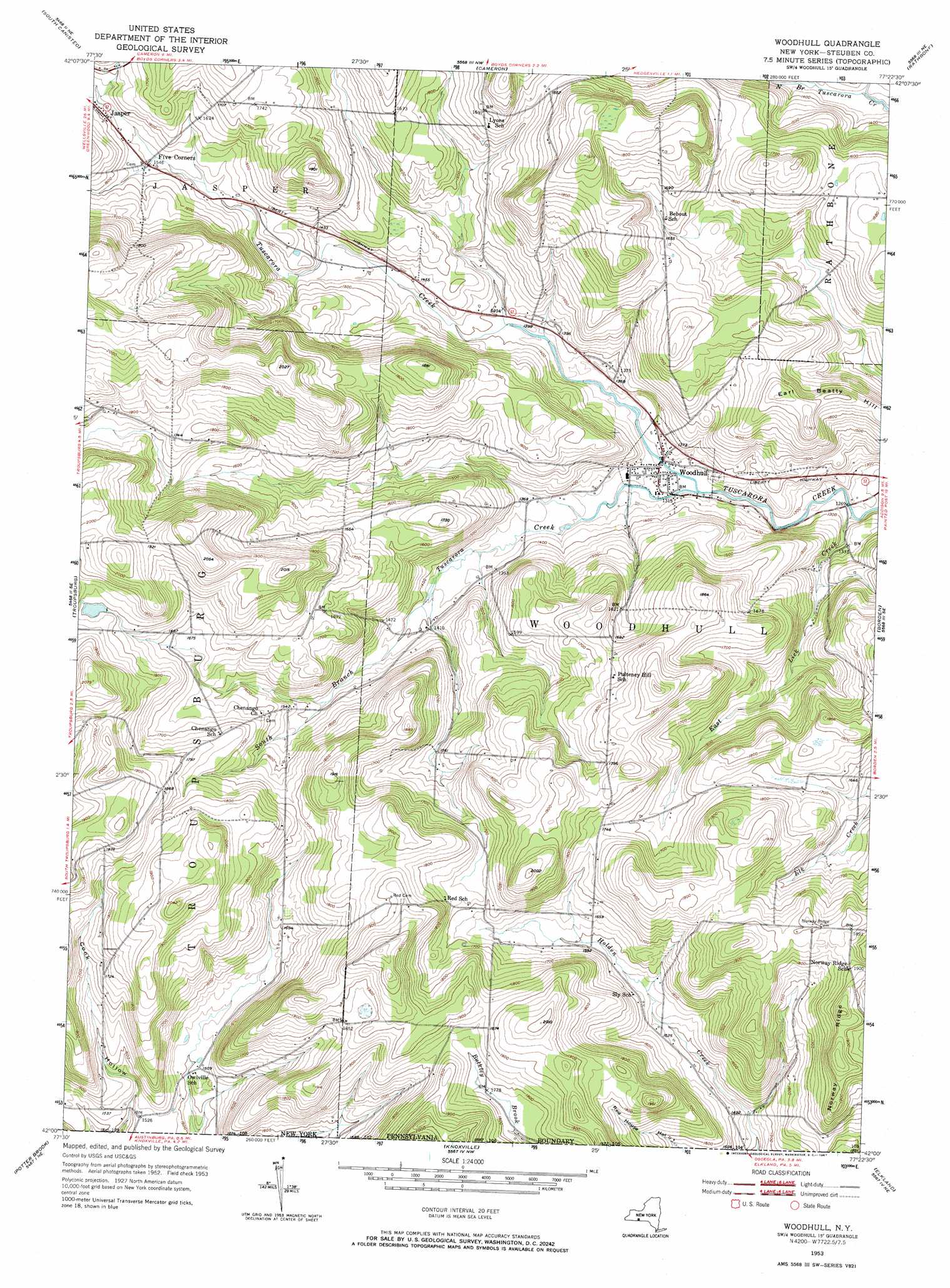
USGS Topo Quad 42077a4 - 1:24,000 scale
| Topo Map Name: | Woodhull |
| USGS Topo Quad ID: | 42077a4 |
| Print Size: | ca. 21 1/4" wide x 27" high |
| Southeast Coordinates: | 42° N latitude / 77.375° W longitude |
| Map Center Coordinates: | 42.0625° N latitude / 77.4375° W longitude |
| U.S. State: | NY |
| Filename: | o42077a4.jpg |
| Download Map JPG Image: | Woodhull topo map 1:24,000 scale |
| Map Type: | Topographic |
| Topo Series: | 7.5´ |
| Map Scale: | 1:24,000 |
| Source of Map Images: | United States Geological Survey (USGS) |
| Alternate Map Versions: |
Woodhull NY 1953, updated 1954 Download PDF Buy paper map Woodhull NY 1953, updated 1967 Download PDF Buy paper map Woodhull NY 2012 Download PDF Buy paper map Woodhull NY 2013 Download PDF Buy paper map Woodhull NY 2016 Download PDF Buy paper map |
1:24,000 Topo Quads surrounding Woodhull
Hornell |
Canisteo |
Towlesville |
Bath |
Savona |
Greenwood |
South Canisteo |
Cameron |
Rathbone |
Campbell |
Rexville |
Troupsburg |
Woodhull |
Borden |
Addison |
Harrison Valley |
Potter Brook |
Knoxville |
Elkland |
Tioga |
West Pike |
Sabinsville |
Asaph |
Keeneyville |
Crooked Creek |
> Back to 42077a1 at 1:100,000 scale
> Back to 42076a1 at 1:250,000 scale
> Back to U.S. Topo Maps home
Woodhull topo map: Gazetteer
Woodhull: Populated Places
Woodhull elevation 403m 1322′Woodhull: Ridges
Norway Ridge elevation 605m 1984′Woodhull: Streams
East Lick Creek elevation 381m 1250′South Branch Tuscarora Creek elevation 400m 1312′
Woodhull: Summits
Earl Beatty Hill elevation 534m 1751′Woodhull digital topo map on disk
Buy this Woodhull topo map showing relief, roads, GPS coordinates and other geographical features, as a high-resolution digital map file on DVD:
New York, Vermont, Connecticut & Western Massachusetts
Buy digital topo maps: New York, Vermont, Connecticut & Western Massachusetts