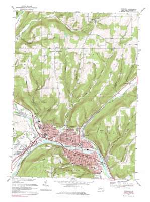
Corning Topo Map New York
To zoom in, hover over the map of Corning
USGS Topo Quad 42077b1 - 1:24,000 scale
| Topo Map Name: | Corning |
| USGS Topo Quad ID: | 42077b1 |
| Print Size: | ca. 21 1/4" wide x 27" high |
| Southeast Coordinates: | 42.125° N latitude / 77° W longitude |
| Map Center Coordinates: | 42.1875° N latitude / 77.0625° W longitude |
| U.S. State: | NY |
| Filename: | o42077b1.jpg |
| Download Map JPG Image: | Corning topo map 1:24,000 scale |
| Map Type: | Topographic |
| Topo Series: | 7.5´ |
| Map Scale: | 1:24,000 |
| Source of Map Images: | United States Geological Survey (USGS) |
| Alternate Map Versions: |
Corning NY 1953, updated 1955 Download PDF Buy paper map Corning NY 1953, updated 1965 Download PDF Buy paper map Corning NY 1969, updated 1971 Download PDF Buy paper map Corning NY 1969, updated 1976 Download PDF Buy paper map Corning NY 1969, updated 1983 Download PDF Buy paper map Corning NY 2010 Download PDF Buy paper map Corning NY 2013 Download PDF Buy paper map Corning NY 2016 Download PDF Buy paper map |
1:24,000 Topo Quads surrounding Corning
> Back to 42077a1 at 1:100,000 scale
> Back to 42076a1 at 1:250,000 scale
> Back to U.S. Topo Maps home
Corning topo map: Gazetteer
Corning: Airports
Corning-Painted Post Airport elevation 291m 954′Corning: Parks
Denison Park elevation 280m 918′Meadows Park elevation 356m 1167′
Memorial Stadium elevation 284m 931′
Stewart Park elevation 309m 1013′
Corning: Populated Places
Corning elevation 284m 931′Denmark elevation 301m 987′
Dyke elevation 468m 1535′
Ferenbaugh elevation 332m 1089′
Gang Mills elevation 285m 935′
Gibson elevation 284m 931′
Hornby elevation 464m 1522′
Painted Post elevation 287m 941′
Riverside elevation 286m 938′
Corning: Reservoirs
Northside Reservoir elevation 346m 1135′Southside Reservoir elevation 350m 1148′
Corning: Streams
Borden Creek elevation 332m 1089′Cohocton River elevation 285m 935′
Cutler Creek elevation 285m 935′
Erwin Creek elevation 351m 1151′
Gorton Creek elevation 275m 902′
Hodgmans Creek elevation 285m 935′
Meads Creek elevation 286m 938′
Monkey Run elevation 296m 971′
Narrows Creek elevation 276m 905′
Post Creek elevation 280m 918′
Stanton Creek elevation 334m 1095′
Tioga River elevation 285m 935′
Corning: Summits
Denmark Hill elevation 526m 1725′Higman Hill elevation 524m 1719′
Pine Hill elevation 545m 1788′
Corning: Valleys
Erwin Hollow elevation 298m 977′Mormon Hollow elevation 334m 1095′
Wilson Hollow elevation 334m 1095′
Corning digital topo map on disk
Buy this Corning topo map showing relief, roads, GPS coordinates and other geographical features, as a high-resolution digital map file on DVD:
New York, Vermont, Connecticut & Western Massachusetts
Buy digital topo maps: New York, Vermont, Connecticut & Western Massachusetts


