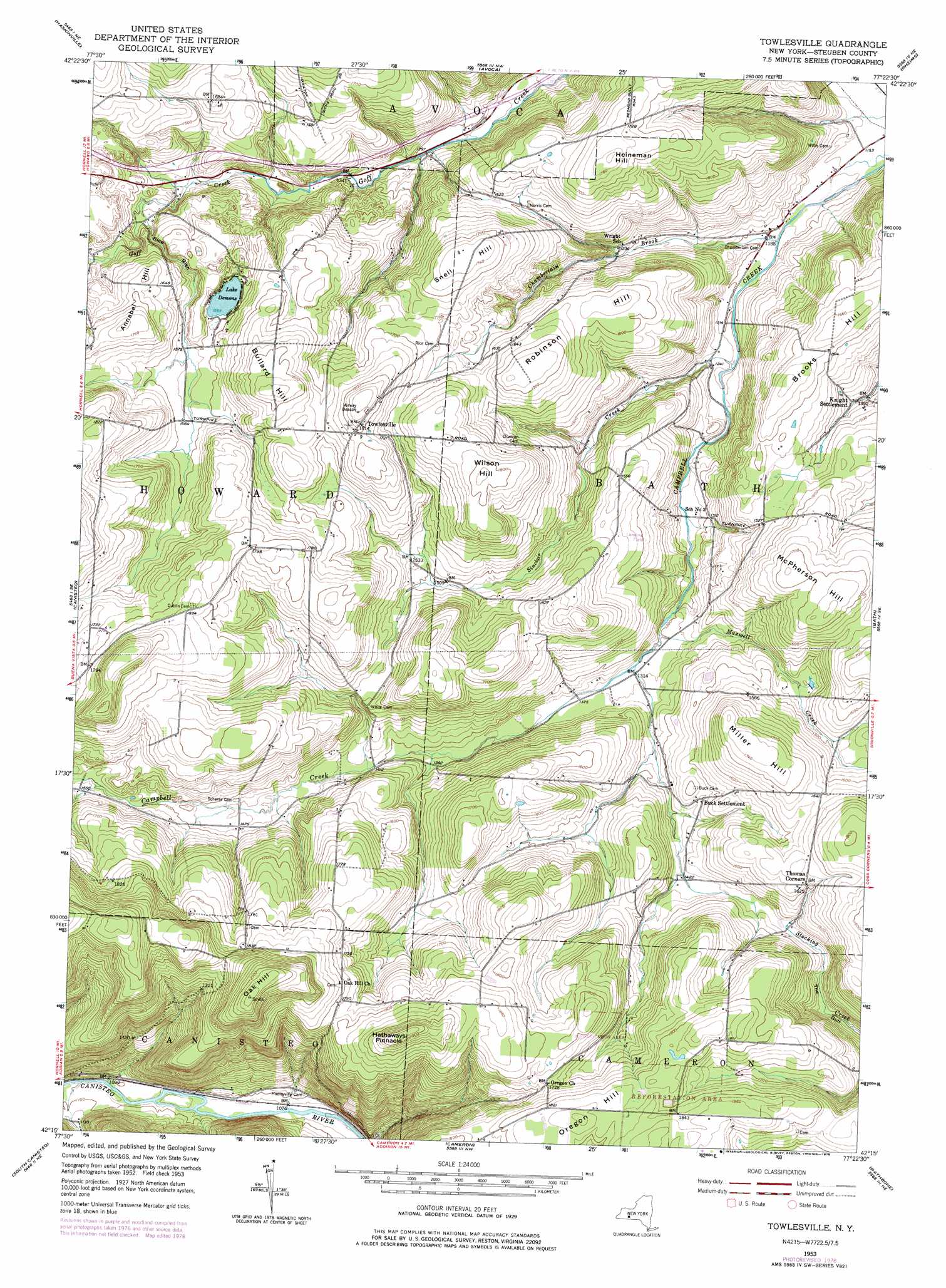
Towlesville Topo Map New York
To zoom in, hover over the map of Towlesville
USGS Topo Quad 42077c4 - 1:24,000 scale
| Topo Map Name: | Towlesville |
| USGS Topo Quad ID: | 42077c4 |
| Print Size: | ca. 21 1/4" wide x 27" high |
| Southeast Coordinates: | 42.25° N latitude / 77.375° W longitude |
| Map Center Coordinates: | 42.3125° N latitude / 77.4375° W longitude |
| U.S. State: | NY |
| Filename: | o42077c4.jpg |
| Download Map JPG Image: | Towlesville topo map 1:24,000 scale |
| Map Type: | Topographic |
| Topo Series: | 7.5´ |
| Map Scale: | 1:24,000 |
| Source of Map Images: | United States Geological Survey (USGS) |
| Alternate Map Versions: |
Towlesville NY 1953, updated 1955 Download PDF Buy paper map Towlesville NY 1953, updated 1971 Download PDF Buy paper map Towlesville NY 2010 Download PDF Buy paper map Towlesville NY 2013 Download PDF Buy paper map Towlesville NY 2016 Download PDF Buy paper map |
1:24,000 Topo Quads surrounding Towlesville
Dansville |
Wayland |
Naples |
Prattsburg |
Pulteney |
Arkport |
Haskinville |
Avoca |
Rheims |
Hammondsport |
Hornell |
Canisteo |
Towlesville |
Bath |
Savona |
Greenwood |
South Canisteo |
Cameron |
Rathbone |
Campbell |
Rexville |
Troupsburg |
Woodhull |
Borden |
Addison |
> Back to 42077a1 at 1:100,000 scale
> Back to 42076a1 at 1:250,000 scale
> Back to U.S. Topo Maps home
Towlesville topo map: Gazetteer
Towlesville: Airports
Dickinsons Airfield elevation 453m 1486′Gaskins Hilltop Airport elevation 525m 1722′
Towlesville: Lakes
Lake Demons elevation 478m 1568′Towlesville: Populated Places
Buck Settlement elevation 447m 1466′Towlesville elevation 552m 1811′
Towlesville: Streams
Chamberlain Brook elevation 359m 1177′Maxwell Creek elevation 396m 1299′
Sinclair Creek elevation 368m 1207′
Towlesville: Summits
Annabel Hill elevation 544m 1784′Brooks Hill elevation 507m 1663′
Bullard Hill elevation 562m 1843′
Hathaways Pinnacle elevation 615m 2017′
Heineman Hill elevation 543m 1781′
McPherson Hill elevation 531m 1742′
Miller Hill elevation 533m 1748′
Oak Hill elevation 662m 2171′
Oregon Hill elevation 568m 1863′
Robinson Hill elevation 530m 1738′
Snell Hill elevation 532m 1745′
Wilson Hill elevation 555m 1820′
Towlesville: Valleys
Mud Hollow elevation 336m 1102′Rice Glen elevation 441m 1446′
Towlesville digital topo map on disk
Buy this Towlesville topo map showing relief, roads, GPS coordinates and other geographical features, as a high-resolution digital map file on DVD:
New York, Vermont, Connecticut & Western Massachusetts
Buy digital topo maps: New York, Vermont, Connecticut & Western Massachusetts