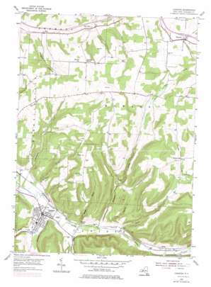
Canisteo Topo Map New York
To zoom in, hover over the map of Canisteo
USGS Topo Quad 42077c5 - 1:24,000 scale
| Topo Map Name: | Canisteo |
| USGS Topo Quad ID: | 42077c5 |
| Print Size: | ca. 21 1/4" wide x 27" high |
| Southeast Coordinates: | 42.25° N latitude / 77.5° W longitude |
| Map Center Coordinates: | 42.3125° N latitude / 77.5625° W longitude |
| U.S. State: | NY |
| Filename: | o42077c5.jpg |
| Download Map JPG Image: | Canisteo topo map 1:24,000 scale |
| Map Type: | Topographic |
| Topo Series: | 7.5´ |
| Map Scale: | 1:24,000 |
| Source of Map Images: | United States Geological Survey (USGS) |
| Alternate Map Versions: |
Canisteo NY 1954, updated 1956 Download PDF Buy paper map Canisteo NY 1954, updated 1971 Download PDF Buy paper map Canisteo NY 1954, updated 1977 Download PDF Buy paper map Canisteo NY 2010 Download PDF Buy paper map Canisteo NY 2013 Download PDF Buy paper map Canisteo NY 2016 Download PDF Buy paper map |
1:24,000 Topo Quads surrounding Canisteo
> Back to 42077a1 at 1:100,000 scale
> Back to 42076a1 at 1:250,000 scale
> Back to U.S. Topo Maps home
Canisteo topo map: Gazetteer
Canisteo: Populated Places
Adrian elevation 346m 1135′Big Creek elevation 467m 1532′
Buena Vista elevation 508m 1666′
Butcher Corner elevation 581m 1906′
Canisteo elevation 346m 1135′
Canisteo Center elevation 349m 1145′
Howard elevation 503m 1650′
Canisteo: Streams
Baker Creek elevation 334m 1095′Bennetts Creek elevation 337m 1105′
Colonel Bills Creek elevation 337m 1105′
Cunningham Creek elevation 338m 1108′
Hammer Creek elevation 341m 1118′
Purdy Creek elevation 350m 1148′
Stephens Creek elevation 338m 1108′
Tuttle Creek elevation 463m 1519′
Canisteo: Summits
Burt Hill elevation 647m 2122′Horton Hill elevation 592m 1942′
Canisteo: Valleys
Hungry Hollow elevation 417m 1368′Obes Glen elevation 337m 1105′
Taylor Hollow elevation 347m 1138′
Canisteo digital topo map on disk
Buy this Canisteo topo map showing relief, roads, GPS coordinates and other geographical features, as a high-resolution digital map file on DVD:
New York, Vermont, Connecticut & Western Massachusetts
Buy digital topo maps: New York, Vermont, Connecticut & Western Massachusetts


