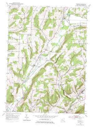
Rheims Topo Map New York
To zoom in, hover over the map of Rheims
USGS Topo Quad 42077d3 - 1:24,000 scale
| Topo Map Name: | Rheims |
| USGS Topo Quad ID: | 42077d3 |
| Print Size: | ca. 21 1/4" wide x 27" high |
| Southeast Coordinates: | 42.375° N latitude / 77.25° W longitude |
| Map Center Coordinates: | 42.4375° N latitude / 77.3125° W longitude |
| U.S. State: | NY |
| Filename: | o42077d3.jpg |
| Download Map JPG Image: | Rheims topo map 1:24,000 scale |
| Map Type: | Topographic |
| Topo Series: | 7.5´ |
| Map Scale: | 1:24,000 |
| Source of Map Images: | United States Geological Survey (USGS) |
| Alternate Map Versions: |
Rheims NY 1953, updated 1955 Download PDF Buy paper map Rheims NY 1953, updated 1970 Download PDF Buy paper map Rheims NY 2010 Download PDF Buy paper map Rheims NY 2013 Download PDF Buy paper map Rheims NY 2016 Download PDF Buy paper map |
1:24,000 Topo Quads surrounding Rheims
> Back to 42077a1 at 1:100,000 scale
> Back to 42076a1 at 1:250,000 scale
> Back to U.S. Topo Maps home
Rheims topo map: Gazetteer
Rheims: Lakes
Mud Lake elevation 393m 1289′Rheims: Populated Places
Dineharts elevation 399m 1309′Hermitage elevation 289m 948′
Marshalls elevation 368m 1207′
Mitchellsville elevation 414m 1358′
Pleasant Valley elevation 244m 800′
Renchans elevation 395m 1295′
Rheims elevation 245m 803′
Stickneys elevation 412m 1351′
Wheeler elevation 383m 1256′
Rheims: Streams
Cold Brook elevation 290m 951′Deer Lick Run elevation 451m 1479′
Mitchellsville Creek elevation 247m 810′
Softwater Creek elevation 290m 951′
Trout Run elevation 386m 1266′
Waldo Creek elevation 392m 1286′
Rheims: Summits
Hickory Hill elevation 544m 1784′Kershener Hill elevation 555m 1820′
Rheims digital topo map on disk
Buy this Rheims topo map showing relief, roads, GPS coordinates and other geographical features, as a high-resolution digital map file on DVD:
New York, Vermont, Connecticut & Western Massachusetts
Buy digital topo maps: New York, Vermont, Connecticut & Western Massachusetts


