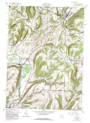
Naples Topo Map New York
To zoom in, hover over the map of Naples
USGS Topo Quad 42077e4 - 1:24,000 scale
| Topo Map Name: | Naples |
| USGS Topo Quad ID: | 42077e4 |
| Print Size: | ca. 21 1/4" wide x 27" high |
| Southeast Coordinates: | 42.5° N latitude / 77.375° W longitude |
| Map Center Coordinates: | 42.5625° N latitude / 77.4375° W longitude |
| U.S. State: | NY |
| Filename: | o42077e4.jpg |
| Download Map JPG Image: | Naples topo map 1:24,000 scale |
| Map Type: | Topographic |
| Topo Series: | 7.5´ |
| Map Scale: | 1:24,000 |
| Source of Map Images: | United States Geological Survey (USGS) |
| Alternate Map Versions: |
Naples NY 1942, updated 1960 Download PDF Buy paper map Naples NY 1942, updated 1981 Download PDF Buy paper map Naples NY 1942, updated 1988 Download PDF Buy paper map Naples NY 2010 Download PDF Buy paper map Naples NY 2013 Download PDF Buy paper map Naples NY 2016 Download PDF Buy paper map |
1:24,000 Topo Quads surrounding Naples
> Back to 42077e1 at 1:100,000 scale
> Back to 42076a1 at 1:250,000 scale
> Back to U.S. Topo Maps home
Naples topo map: Gazetteer
Naples: Populated Places
Atlanta elevation 399m 1309′Garlinghouse elevation 454m 1489′
Ingleside elevation 459m 1505′
Kirkwood elevation 407m 1335′
Lent Hill elevation 636m 2086′
Naples elevation 245m 803′
North Cohocton elevation 416m 1364′
Naples: Streams
Eelpot Creek elevation 239m 784′Grimes Creek elevation 239m 784′
Kirkwood Creek elevation 391m 1282′
Reservoir Creek elevation 249m 816′
Tannery Creek elevation 242m 793′
Naples: Summits
Hatch Hill elevation 549m 1801′Knapp Hill elevation 623m 2043′
Lent Hill elevation 641m 2103′
Pine Hill elevation 623m 2043′
Naples: Valleys
West Hollow elevation 244m 800′Naples digital topo map on disk
Buy this Naples topo map showing relief, roads, GPS coordinates and other geographical features, as a high-resolution digital map file on DVD:
New York, Vermont, Connecticut & Western Massachusetts
Buy digital topo maps: New York, Vermont, Connecticut & Western Massachusetts


