Ossian Topo Map New York
To zoom in, hover over the map of Ossian
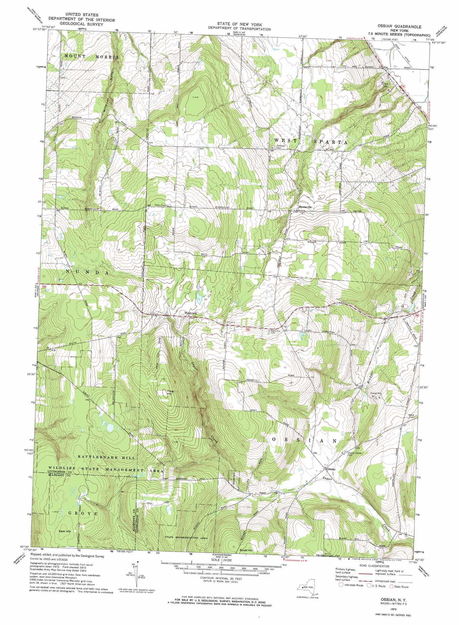
USGS Topo Quad 42077e7 - 1:24,000 scale
| Topo Map Name: | Ossian |
| USGS Topo Quad ID: | 42077e7 |
| Print Size: | ca. 21 1/4" wide x 27" high |
| Southeast Coordinates: | 42.5° N latitude / 77.75° W longitude |
| Map Center Coordinates: | 42.5625° N latitude / 77.8125° W longitude |
| U.S. State: | NY |
| Filename: | o42077e7.jpg |
| Download Map JPG Image: | Ossian topo map 1:24,000 scale |
| Map Type: | Topographic |
| Topo Series: | 7.5´ |
| Map Scale: | 1:24,000 |
| Source of Map Images: | United States Geological Survey (USGS) |
| Alternate Map Versions: |
Ossian NY 1943, updated 1960 Download PDF Buy paper map Ossian NY 1972, updated 1974 Download PDF Buy paper map Ossian NY 2010 Download PDF Buy paper map Ossian NY 2013 Download PDF Buy paper map Ossian NY 2016 Download PDF Buy paper map |
1:24,000 Topo Quads surrounding Ossian
Wyoming |
Leicester |
Geneseo |
Livonia |
Honeoye |
Castile |
Mount Morris |
Sonyea |
Conesus |
Springwater |
Portageville |
Nunda |
Ossian |
Dansville |
Wayland |
Fillmore |
Birdsall |
Canaseraga |
Arkport |
Haskinville |
Angelica |
West Almond |
Alfred |
Hornell |
Canisteo |
> Back to 42077e1 at 1:100,000 scale
> Back to 42076a1 at 1:250,000 scale
> Back to U.S. Topo Maps home
Ossian topo map: Gazetteer
Ossian: Populated Places
Byersville elevation 414m 1358′Ossian elevation 409m 1341′
Westview elevation 507m 1663′
Ossian: Summits
East Hill elevation 623m 2043′Frog Hill elevation 611m 2004′
Ossian digital topo map on disk
Buy this Ossian topo map showing relief, roads, GPS coordinates and other geographical features, as a high-resolution digital map file on DVD:
New York, Vermont, Connecticut & Western Massachusetts
Buy digital topo maps: New York, Vermont, Connecticut & Western Massachusetts