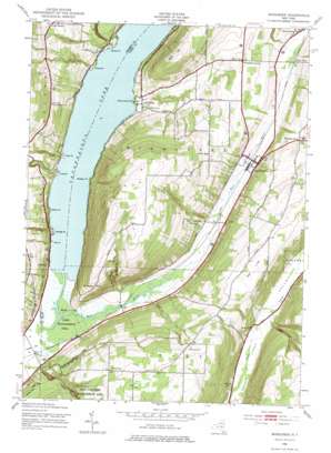
Middlesex Topo Map New York
To zoom in, hover over the map of Middlesex
USGS Topo Quad 42077f3 - 1:24,000 scale
| Topo Map Name: | Middlesex |
| USGS Topo Quad ID: | 42077f3 |
| Print Size: | ca. 21 1/4" wide x 27" high |
| Southeast Coordinates: | 42.625° N latitude / 77.25° W longitude |
| Map Center Coordinates: | 42.6875° N latitude / 77.3125° W longitude |
| U.S. State: | NY |
| Filename: | o42077f3.jpg |
| Download Map JPG Image: | Middlesex topo map 1:24,000 scale |
| Map Type: | Topographic |
| Topo Series: | 7.5´ |
| Map Scale: | 1:24,000 |
| Source of Map Images: | United States Geological Survey (USGS) |
| Alternate Map Versions: |
Middlesex NY 1942, updated 1954 Download PDF Buy paper map Middlesex NY 1942, updated 1967 Download PDF Buy paper map Middlesex NY 1942, updated 1974 Download PDF Buy paper map Middlesex NY 2010 Download PDF Buy paper map Middlesex NY 2013 Download PDF Buy paper map Middlesex NY 2016 Download PDF Buy paper map |
1:24,000 Topo Quads surrounding Middlesex
> Back to 42077e1 at 1:100,000 scale
> Back to 42076a1 at 1:250,000 scale
> Back to U.S. Topo Maps home
Middlesex topo map: Gazetteer
Middlesex: Capes
Cook Point elevation 211m 692′Coy Point elevation 210m 688′
Granger Point elevation 209m 685′
Hicks Point elevation 210m 688′
Long Point elevation 211m 692′
Seneca Point elevation 211m 692′
Walton Point elevation 216m 708′
Whiskey Point elevation 210m 688′
Willow Grove Point elevation 209m 685′
Middlesex: Flats
Parish Flat elevation 211m 692′Middlesex: Populated Places
Covel Corner elevation 365m 1197′Middlesex elevation 235m 770′
Pine Corners elevation 249m 816′
Valley View elevation 239m 784′
Vine Valley elevation 218m 715′
Williams Corner elevation 332m 1089′
Woodville elevation 210m 688′
Middlesex: Ridges
Sunnyside Point elevation 379m 1243′Middlesex: Streams
Naples Creek elevation 210m 688′West River elevation 210m 688′
Middlesex: Summits
Bare Hill elevation 470m 1541′East Hill elevation 488m 1601′
South Hill elevation 575m 1886′
Middlesex: Valleys
Clark Gully elevation 235m 770′Conklin Gully elevation 230m 754′
Corey Gully elevation 240m 787′
Seneca Point Gully elevation 218m 715′
Middlesex digital topo map on disk
Buy this Middlesex topo map showing relief, roads, GPS coordinates and other geographical features, as a high-resolution digital map file on DVD:
New York, Vermont, Connecticut & Western Massachusetts
Buy digital topo maps: New York, Vermont, Connecticut & Western Massachusetts


