Conesus Topo Map New York
To zoom in, hover over the map of Conesus
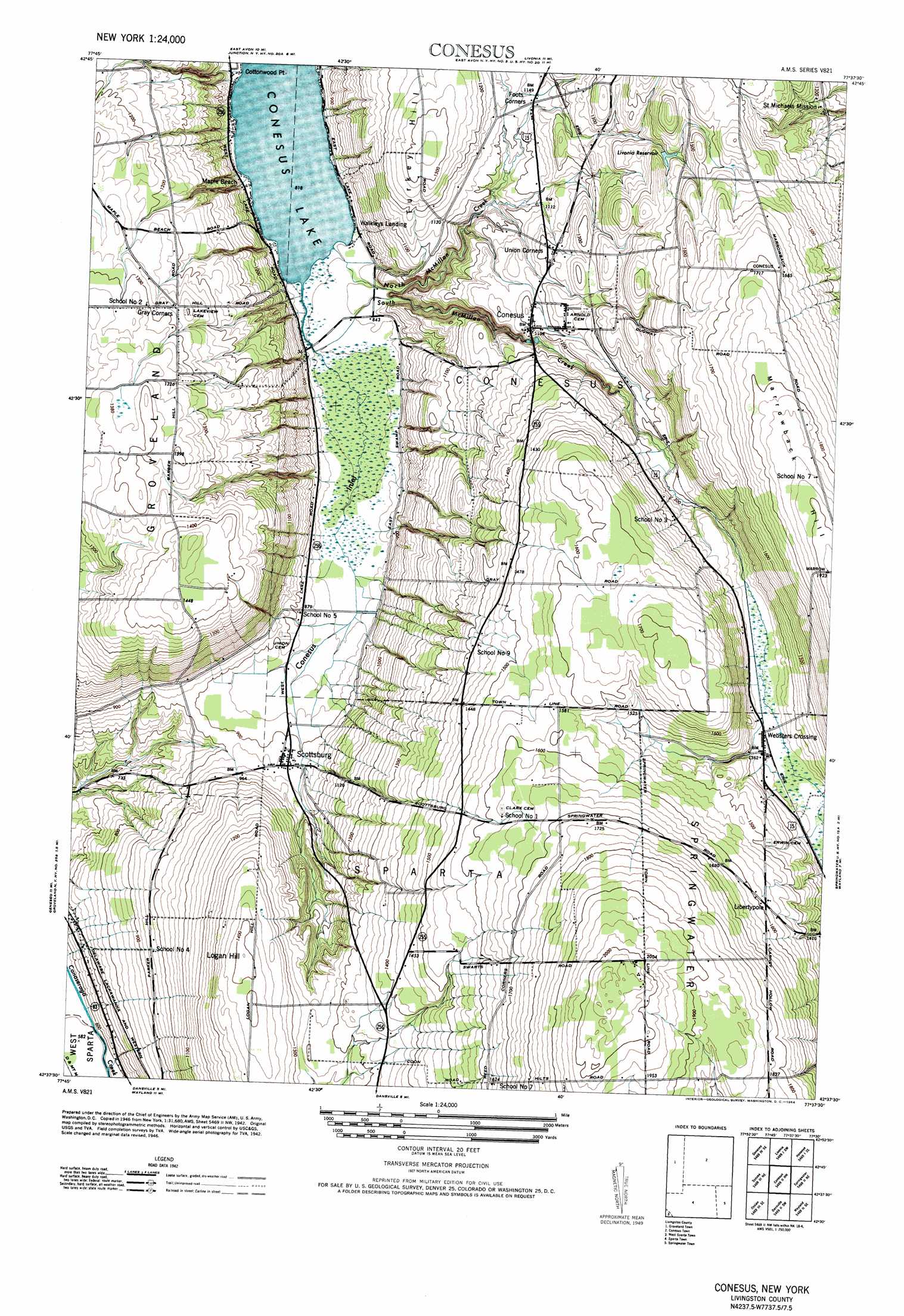
USGS Topo Quad 42077f6 - 1:24,000 scale
| Topo Map Name: | Conesus |
| USGS Topo Quad ID: | 42077f6 |
| Print Size: | ca. 21 1/4" wide x 27" high |
| Southeast Coordinates: | 42.625° N latitude / 77.625° W longitude |
| Map Center Coordinates: | 42.6875° N latitude / 77.6875° W longitude |
| U.S. State: | NY |
| Filename: | o42077f6.jpg |
| Download Map JPG Image: | Conesus topo map 1:24,000 scale |
| Map Type: | Topographic |
| Topo Series: | 7.5´ |
| Map Scale: | 1:24,000 |
| Source of Map Images: | United States Geological Survey (USGS) |
| Alternate Map Versions: |
Conesus NY 1957 Download PDF Buy paper map Conesus NY 1964 Download PDF Buy paper map Conesus NY 2010 Download PDF Buy paper map Conesus NY 2013 Download PDF Buy paper map Conesus NY 2016 Download PDF Buy paper map |
1:24,000 Topo Quads surrounding Conesus
Le Roy |
Caledonia |
Rush |
Honeoye Falls |
Victor |
Leicester |
Geneseo |
Livonia |
Honeoye |
Bristol Center |
Mount Morris |
Sonyea |
Conesus |
Springwater |
Bristol Springs |
Nunda |
Ossian |
Dansville |
Wayland |
Naples |
Birdsall |
Canaseraga |
Arkport |
Haskinville |
Avoca |
> Back to 42077e1 at 1:100,000 scale
> Back to 42076a1 at 1:250,000 scale
> Back to U.S. Topo Maps home
Conesus topo map: Gazetteer
Conesus: Populated Places
Conesus elevation 365m 1197′Foots Corners elevation 347m 1138′
Libertypole elevation 482m 1581′
Maple Beach elevation 252m 826′
Scottsburg elevation 282m 925′
Union Corners elevation 368m 1207′
Walkleys Landing elevation 249m 816′
Websters Crossing elevation 408m 1338′
Conesus: Reservoirs
Livonia Reservoir elevation 423m 1387′Conesus: Streams
Conesus Inlet elevation 249m 816′McMillan Creek elevation 251m 823′
North McMillan Creek elevation 249m 816′
Conesus: Summits
Logan Hill elevation 432m 1417′Turkey Hill elevation 403m 1322′
Conesus digital topo map on disk
Buy this Conesus topo map showing relief, roads, GPS coordinates and other geographical features, as a high-resolution digital map file on DVD:
New York, Vermont, Connecticut & Western Massachusetts
Buy digital topo maps: New York, Vermont, Connecticut & Western Massachusetts