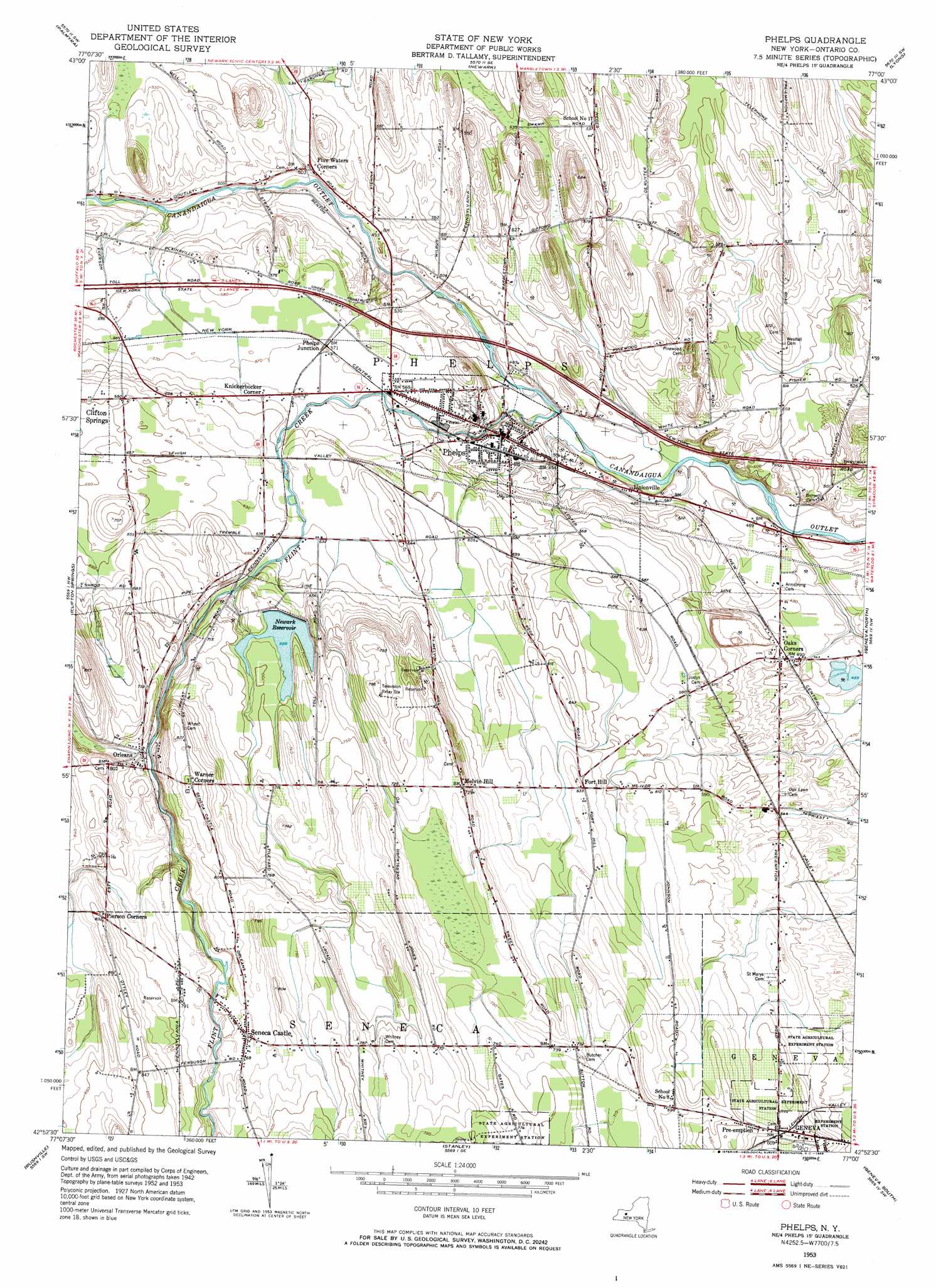
Phelps Topo Map New York
To zoom in, hover over the map of Phelps
USGS Topo Quad 42077h1 - 1:24,000 scale
| Topo Map Name: | Phelps |
| USGS Topo Quad ID: | 42077h1 |
| Print Size: | ca. 21 1/4" wide x 27" high |
| Southeast Coordinates: | 42.875° N latitude / 77° W longitude |
| Map Center Coordinates: | 42.9375° N latitude / 77.0625° W longitude |
| U.S. State: | NY |
| Filename: | o42077h1.jpg |
| Download Map JPG Image: | Phelps topo map 1:24,000 scale |
| Map Type: | Topographic |
| Topo Series: | 7.5´ |
| Map Scale: | 1:24,000 |
| Source of Map Images: | United States Geological Survey (USGS) |
| Alternate Map Versions: |
Phelps NY 1953, updated 1954 Download PDF Buy paper map Phelps NY 1953, updated 1968 Download PDF Buy paper map Phelps NY 2010 Download PDF Buy paper map Phelps NY 2013 Download PDF Buy paper map Phelps NY 2016 Download PDF Buy paper map |
1:24,000 Topo Quads surrounding Phelps
Ontario |
Williamson |
Sodus |
Rose |
Wolcott |
Macedon |
Palmyra |
Newark |
Lyons |
Savannah |
Canandaigua |
Clifton Springs |
Phelps |
Geneva North |
Seneca Falls |
Canandaigua Lake |
Rushville |
Stanley |
Geneva South |
Romulus |
Middlesex |
Potter |
Penn Yan |
Dresden |
Ovid |
> Back to 42077e1 at 1:100,000 scale
> Back to 42076a1 at 1:250,000 scale
> Back to U.S. Topo Maps home
Phelps topo map: Gazetteer
Phelps: Airports
Grammar Airport elevation 217m 711′Phelps: Parks
Redfield Common elevation 160m 524′Phelps: Populated Places
Fort Hill elevation 192m 629′Knickerbocker Corner elevation 178m 583′
Melvin Hill elevation 222m 728′
Oaks Corners elevation 150m 492′
Orleans elevation 222m 728′
Phelps elevation 159m 521′
Phelps Junction elevation 174m 570′
Pre-emption elevation 196m 643′
Seneca Castle elevation 232m 761′
Unionville elevation 146m 479′
Phelps: Reservoirs
Newark Reservoir elevation 209m 685′Phelps: Streams
Flint Creek elevation 139m 456′Phelps digital topo map on disk
Buy this Phelps topo map showing relief, roads, GPS coordinates and other geographical features, as a high-resolution digital map file on DVD:
New York, Vermont, Connecticut & Western Massachusetts
Buy digital topo maps: New York, Vermont, Connecticut & Western Massachusetts