Canandaigua Topo Map New York
To zoom in, hover over the map of Canandaigua
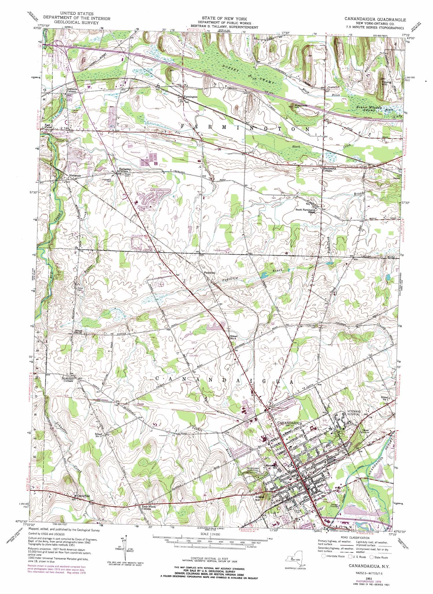
USGS Topo Quad 42077h3 - 1:24,000 scale
| Topo Map Name: | Canandaigua |
| USGS Topo Quad ID: | 42077h3 |
| Print Size: | ca. 21 1/4" wide x 27" high |
| Southeast Coordinates: | 42.875° N latitude / 77.25° W longitude |
| Map Center Coordinates: | 42.9375° N latitude / 77.3125° W longitude |
| U.S. State: | NY |
| Filename: | o42077h3.jpg |
| Download Map JPG Image: | Canandaigua topo map 1:24,000 scale |
| Map Type: | Topographic |
| Topo Series: | 7.5´ |
| Map Scale: | 1:24,000 |
| Source of Map Images: | United States Geological Survey (USGS) |
| Alternate Map Versions: |
Canandaigua NY 1951, updated 1952 Download PDF Buy paper map Canandaigua NY 1951, updated 1967 Download PDF Buy paper map Canandaigua NY 1951, updated 1978 Download PDF Buy paper map Canandaigua NY 2010 Download PDF Buy paper map Canandaigua NY 2013 Download PDF Buy paper map Canandaigua NY 2016 Download PDF Buy paper map |
1:24,000 Topo Quads surrounding Canandaigua
Rochester East |
Webster |
Ontario |
Williamson |
Sodus |
Pittsford |
Fairport |
Macedon |
Palmyra |
Newark |
Honeoye Falls |
Victor |
Canandaigua |
Clifton Springs |
Phelps |
Honeoye |
Bristol Center |
Canandaigua Lake |
Rushville |
Stanley |
Springwater |
Bristol Springs |
Middlesex |
Potter |
Penn Yan |
> Back to 42077e1 at 1:100,000 scale
> Back to 42076a1 at 1:250,000 scale
> Back to U.S. Topo Maps home
Canandaigua topo map: Gazetteer
Canandaigua: Airports
Canandaigua Airport elevation 244m 800′Troop E Heliport elevation 204m 669′
Canandaigua: Populated Places
Arsenal Hill elevation 250m 820′Centerfield elevation 287m 941′
Farmington elevation 183m 600′
Hathaway Corners elevation 197m 646′
Mertensia elevation 204m 669′
Padelford elevation 218m 715′
Canandaigua: Streams
Beaver Creek elevation 179m 587′Black Creek elevation 169m 554′
Canandaigua: Summits
Buttermilk Hill elevation 197m 646′Young Hill elevation 211m 692′
Canandaigua: Swamps
Beaver Meadow Swamp elevation 171m 561′Hozzey Swamp elevation 174m 570′
Canandaigua digital topo map on disk
Buy this Canandaigua topo map showing relief, roads, GPS coordinates and other geographical features, as a high-resolution digital map file on DVD:
New York, Vermont, Connecticut & Western Massachusetts
Buy digital topo maps: New York, Vermont, Connecticut & Western Massachusetts