Friendship Topo Map New York
To zoom in, hover over the map of Friendship
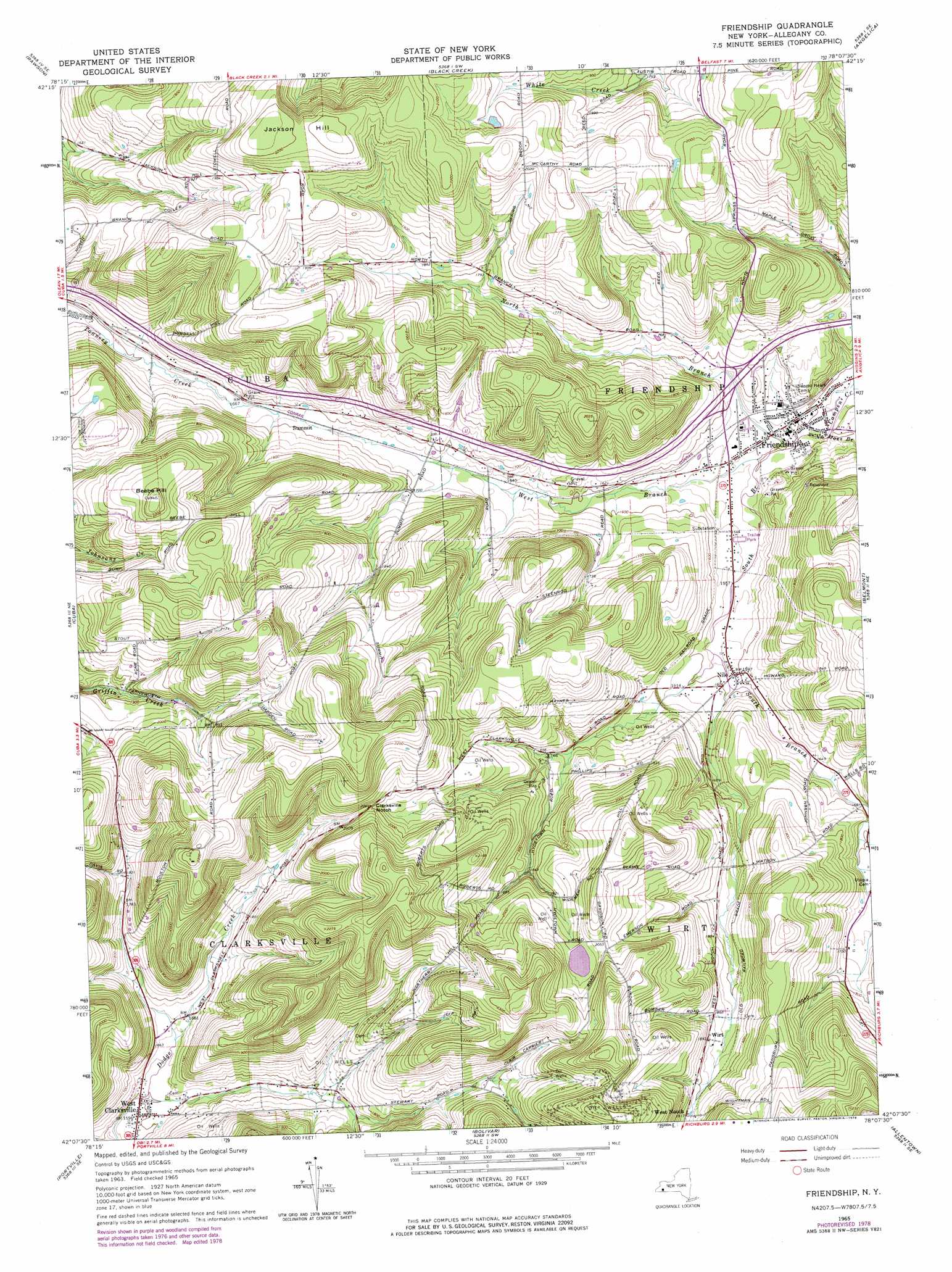
USGS Topo Quad 42078b2 - 1:24,000 scale
| Topo Map Name: | Friendship |
| USGS Topo Quad ID: | 42078b2 |
| Print Size: | ca. 21 1/4" wide x 27" high |
| Southeast Coordinates: | 42.125° N latitude / 78.125° W longitude |
| Map Center Coordinates: | 42.1875° N latitude / 78.1875° W longitude |
| U.S. State: | NY |
| Filename: | o42078b2.jpg |
| Download Map JPG Image: | Friendship topo map 1:24,000 scale |
| Map Type: | Topographic |
| Topo Series: | 7.5´ |
| Map Scale: | 1:24,000 |
| Source of Map Images: | United States Geological Survey (USGS) |
| Alternate Map Versions: |
Friendship NY 1965, updated 1966 Download PDF Buy paper map Friendship NY 1965, updated 1978 Download PDF Buy paper map Friendship NY 2010 Download PDF Buy paper map Friendship NY 2013 Download PDF Buy paper map Friendship NY 2016 Download PDF Buy paper map |
1:24,000 Topo Quads surrounding Friendship
Delevan |
Freedom |
Houghton |
Fillmore |
Birdsall |
Franklinville |
Rawson |
Black Creek |
Angelica |
West Almond |
Hinsdale |
Cuba |
Friendship |
Belmont |
Wellsville North |
Olean |
Portville |
Bolivar |
Allentown |
Wellsville South |
Eldred |
Bullis Mills |
Shinglehouse |
Oswayo |
Ellisburg |
> Back to 42078a1 at 1:100,000 scale
> Back to 42078a1 at 1:250,000 scale
> Back to U.S. Topo Maps home
Friendship topo map: Gazetteer
Friendship: Airports
Dew Airpark elevation 640m 2099′Friendship: Gaps
Clarksville Notch elevation 610m 2001′Friendship: Populated Places
Friendship elevation 459m 1505′Nile elevation 484m 1587′
West Clarksville elevation 484m 1587′
West Notch elevation 584m 1916′
Wirt elevation 572m 1876′
Friendship: Streams
North Branch Van Campen Creek elevation 457m 1499′South Branch Van Campen Creek elevation 457m 1499′
West Branch Van Campen Creek elevation 458m 1502′
Friendship: Summits
Beebe Hill elevation 685m 2247′Jackson Hill elevation 679m 2227′
Friendship digital topo map on disk
Buy this Friendship topo map showing relief, roads, GPS coordinates and other geographical features, as a high-resolution digital map file on DVD:
 map DVD")