West Valley Topo Map New York
To zoom in, hover over the map of West Valley
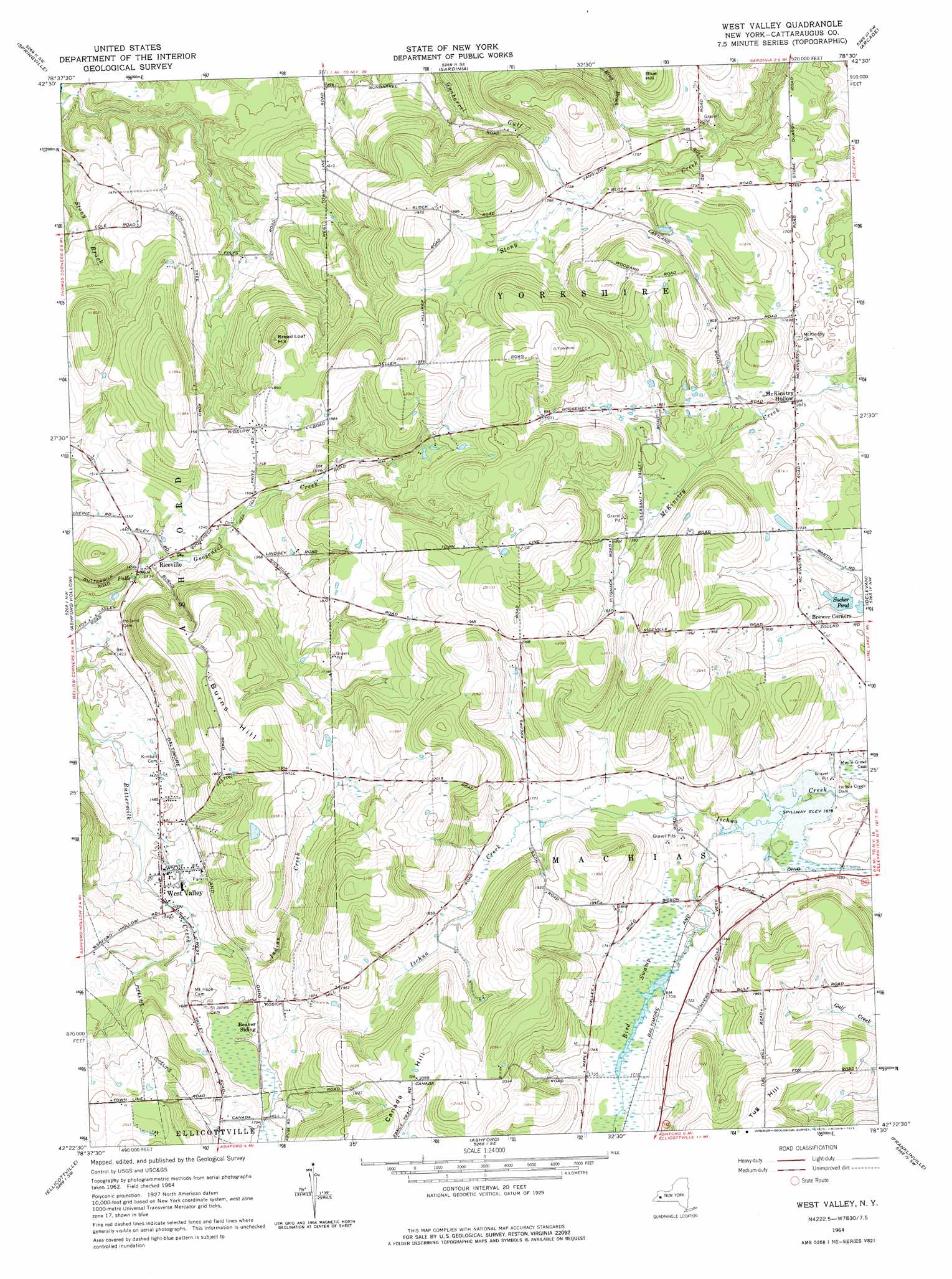
USGS Topo Quad 42078d5 - 1:24,000 scale
| Topo Map Name: | West Valley |
| USGS Topo Quad ID: | 42078d5 |
| Print Size: | ca. 21 1/4" wide x 27" high |
| Southeast Coordinates: | 42.375° N latitude / 78.5° W longitude |
| Map Center Coordinates: | 42.4375° N latitude / 78.5625° W longitude |
| U.S. State: | NY |
| Filename: | o42078d5.jpg |
| Download Map JPG Image: | West Valley topo map 1:24,000 scale |
| Map Type: | Topographic |
| Topo Series: | 7.5´ |
| Map Scale: | 1:24,000 |
| Source of Map Images: | United States Geological Survey (USGS) |
| Alternate Map Versions: |
West Valley NY 1964, updated 1965 Download PDF Buy paper map West Valley NY 1964, updated 1976 Download PDF Buy paper map West Valley NY 2010 Download PDF Buy paper map West Valley NY 2013 Download PDF Buy paper map West Valley NY 2016 Download PDF Buy paper map |
1:24,000 Topo Quads surrounding West Valley
Hamburg |
Colden |
Holland |
Strykersville |
Johnsonburg |
Langford |
Springville |
Sardinia |
Arcade |
Bliss |
Collins Center |
Ashford Hollow |
West Valley |
Delevan |
Freedom |
Cattaraugus |
Ellicottville |
Ashford |
Franklinville |
Rawson |
Little Valley |
Salamanca |
Humphrey |
Hinsdale |
Cuba |
> Back to 42078a1 at 1:100,000 scale
> Back to 42078a1 at 1:250,000 scale
> Back to U.S. Topo Maps home
West Valley topo map: Gazetteer
West Valley: Dams
Ischua Creek Dam elevation 505m 1656′West Valley: Lakes
Sucker Pond elevation 510m 1673′West Valley: Populated Places
McKinstry Hollow elevation 501m 1643′Riceville elevation 439m 1440′
West Valley elevation 464m 1522′
West Valley: Streams
Indian Creek elevation 460m 1509′West Valley: Summits
Bread Loaf Hill elevation 593m 1945′Burns Hill elevation 604m 1981′
West Valley: Swamps
Bird Swamp elevation 519m 1702′West Valley digital topo map on disk
Buy this West Valley topo map showing relief, roads, GPS coordinates and other geographical features, as a high-resolution digital map file on DVD:
 map DVD")