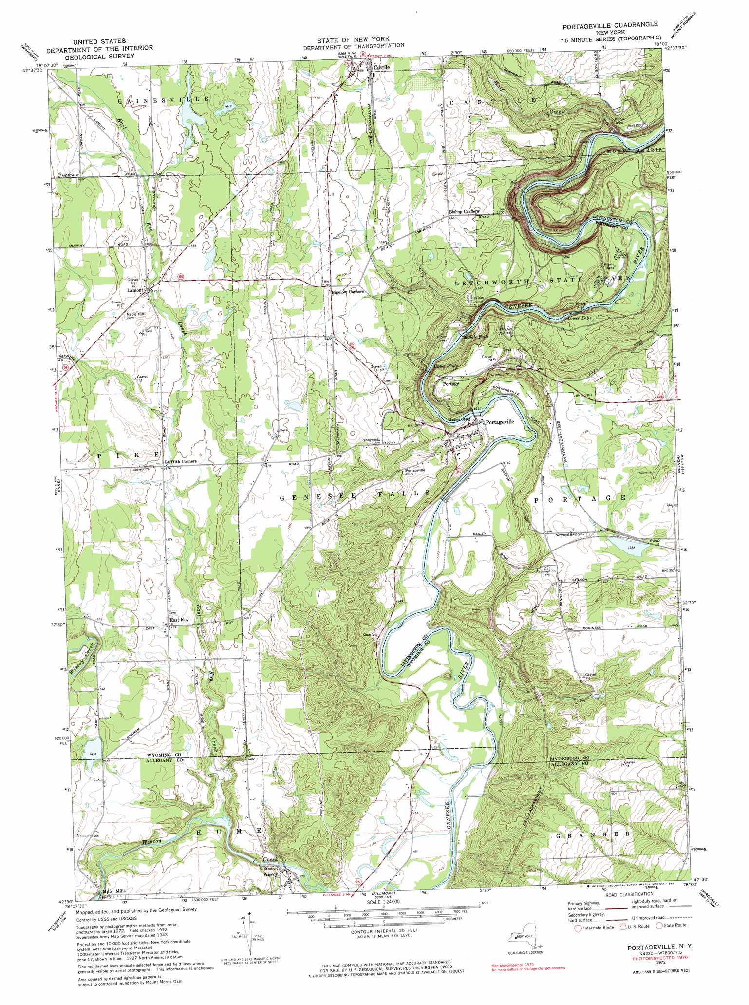
Portageville Topo Map New York
To zoom in, hover over the map of Portageville
USGS Topo Quad 42078e1 - 1:24,000 scale
| Topo Map Name: | Portageville |
| USGS Topo Quad ID: | 42078e1 |
| Print Size: | ca. 21 1/4" wide x 27" high |
| Southeast Coordinates: | 42.5° N latitude / 78° W longitude |
| Map Center Coordinates: | 42.5625° N latitude / 78.0625° W longitude |
| U.S. State: | NY |
| Filename: | o42078e1.jpg |
| Download Map JPG Image: | Portageville topo map 1:24,000 scale |
| Map Type: | Topographic |
| Topo Series: | 7.5´ |
| Map Scale: | 1:24,000 |
| Source of Map Images: | United States Geological Survey (USGS) |
| Alternate Map Versions: |
Portageville NY 1943, updated 1960 Download PDF Buy paper map Portageville NY 1972, updated 1974 Download PDF Buy paper map Portageville NY 1972, updated 1983 Download PDF Buy paper map Portageville NY 1972, updated 1983 Download PDF Buy paper map Portageville NY 2010 Download PDF Buy paper map Portageville NY 2013 Download PDF Buy paper map Portageville NY 2016 Download PDF Buy paper map |
1:24,000 Topo Quads surrounding Portageville
Attica |
Dale |
Wyoming |
Leicester |
Geneseo |
Johnsonburg |
Warsaw |
Castile |
Mount Morris |
Sonyea |
Bliss |
Pike |
Portageville |
Nunda |
Ossian |
Freedom |
Houghton |
Fillmore |
Birdsall |
Canaseraga |
Rawson |
Black Creek |
Angelica |
West Almond |
Alfred |
> Back to 42078e1 at 1:100,000 scale
> Back to 42078a1 at 1:250,000 scale
> Back to U.S. Topo Maps home
Portageville topo map: Gazetteer
Portageville: Falls
Lower Falls elevation 250m 820′Middle Falls elevation 285m 935′
Upper Falls elevation 303m 994′
Portageville: Populated Places
East Koy elevation 445m 1459′Lamont elevation 467m 1532′
Mills Mills elevation 416m 1364′
Portageville elevation 340m 1115′
Wiscoy elevation 359m 1177′
Portageville: Streams
East Koy Creek elevation 387m 1269′Wolf Creek elevation 206m 675′
Portageville digital topo map on disk
Buy this Portageville topo map showing relief, roads, GPS coordinates and other geographical features, as a high-resolution digital map file on DVD:
 map DVD")