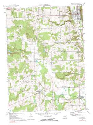
Warsaw Topo Map New York
To zoom in, hover over the map of Warsaw
USGS Topo Quad 42078f2 - 1:24,000 scale
| Topo Map Name: | Warsaw |
| USGS Topo Quad ID: | 42078f2 |
| Print Size: | ca. 21 1/4" wide x 27" high |
| Southeast Coordinates: | 42.625° N latitude / 78.125° W longitude |
| Map Center Coordinates: | 42.6875° N latitude / 78.1875° W longitude |
| U.S. State: | NY |
| Filename: | o42078f2.jpg |
| Download Map JPG Image: | Warsaw topo map 1:24,000 scale |
| Map Type: | Topographic |
| Topo Series: | 7.5´ |
| Map Scale: | 1:24,000 |
| Source of Map Images: | United States Geological Survey (USGS) |
| Alternate Map Versions: |
Warsaw NY 1943, updated 1959 Download PDF Buy paper map Warsaw NY 1972, updated 1974 Download PDF Buy paper map Warsaw NY 1972, updated 1990 Download PDF Buy paper map Warsaw NY 2010 Download PDF Buy paper map Warsaw NY 2013 Download PDF Buy paper map Warsaw NY 2016 Download PDF Buy paper map |
1:24,000 Topo Quads surrounding Warsaw
> Back to 42078e1 at 1:100,000 scale
> Back to 42078a1 at 1:250,000 scale
> Back to U.S. Topo Maps home
Warsaw topo map: Gazetteer
Warsaw: Parks
Village Park elevation 316m 1036′Warsaw: Populated Places
Gainesville elevation 493m 1617′Halls Corner elevation 505m 1656′
Hermitage elevation 511m 1676′
Martinsville elevation 324m 1062′
North Gainesville elevation 440m 1443′
South Warsaw elevation 328m 1076′
Warsaw elevation 309m 1013′
Wethersfield Springs elevation 522m 1712′
Warsaw: Streams
Relyea Creek elevation 322m 1056′Stony Creek elevation 307m 1007′
Warsaw digital topo map on disk
Buy this Warsaw topo map showing relief, roads, GPS coordinates and other geographical features, as a high-resolution digital map file on DVD:


