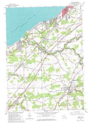
Eden Topo Map New York
To zoom in, hover over the map of Eden
USGS Topo Quad 42078f8 - 1:24,000 scale
| Topo Map Name: | Eden |
| USGS Topo Quad ID: | 42078f8 |
| Print Size: | ca. 21 1/4" wide x 27" high |
| Southeast Coordinates: | 42.625° N latitude / 78.875° W longitude |
| Map Center Coordinates: | 42.6875° N latitude / 78.9375° W longitude |
| U.S. State: | NY |
| Filename: | o42078f8.jpg |
| Download Map JPG Image: | Eden topo map 1:24,000 scale |
| Map Type: | Topographic |
| Topo Series: | 7.5´ |
| Map Scale: | 1:24,000 |
| Source of Map Images: | United States Geological Survey (USGS) |
| Alternate Map Versions: |
Eden NY 1949 Download PDF Buy paper map Eden NY 1965, updated 1967 Download PDF Buy paper map Eden NY 2010 Download PDF Buy paper map Eden NY 2013 Download PDF Buy paper map Eden NY 2016 Download PDF Buy paper map |
1:24,000 Topo Quads surrounding Eden
Buffalo Nw |
Buffalo Ne |
|||
Buffalo Se |
Orchard Park |
|||
Angola |
Eden |
Hamburg |
Colden |
|
Silver Creek |
Farnham |
North Collins |
Langford |
Springville |
Forestville |
Perrysburg |
Gowanda |
Collins Center |
Ashford Hollow |
> Back to 42078e1 at 1:100,000 scale
> Back to 42078a1 at 1:250,000 scale
> Back to U.S. Topo Maps home
Eden topo map: Gazetteer
Eden: Airports
Angola Airport (historical) elevation 210m 688′Hamburg Airport elevation 227m 744′
Eden: Populated Places
Clifton Heights elevation 185m 606′Clover Bank elevation 199m 652′
Derby elevation 214m 702′
Eden elevation 250m 820′
Highland-on-the-Lake elevation 209m 685′
Lake View elevation 219m 718′
North Evans elevation 214m 702′
Pinehurst elevation 193m 633′
Walden Cliffs elevation 198m 649′
Wanakah elevation 180m 590′
Weyer elevation 209m 685′
Eden: Streams
Eighteenmile Creek elevation 174m 570′Rythus Creek elevation 204m 669′
South Branch Eighteenmile Creek elevation 200m 656′
Eden digital topo map on disk
Buy this Eden topo map showing relief, roads, GPS coordinates and other geographical features, as a high-resolution digital map file on DVD:


