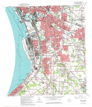
Buffalo Se Topo Map New York
To zoom in, hover over the map of Buffalo Se
USGS Topo Quad 42078g7 - 1:24,000 scale
| Topo Map Name: | Buffalo Se |
| USGS Topo Quad ID: | 42078g7 |
| Print Size: | ca. 21 1/4" wide x 27" high |
| Southeast Coordinates: | 42.75° N latitude / 78.75° W longitude |
| Map Center Coordinates: | 42.8125° N latitude / 78.8125° W longitude |
| U.S. State: | NY |
| Filename: | o42078g7.jpg |
| Download Map JPG Image: | Buffalo Se topo map 1:24,000 scale |
| Map Type: | Topographic |
| Topo Series: | 7.5´ |
| Map Scale: | 1:24,000 |
| Source of Map Images: | United States Geological Survey (USGS) |
| Alternate Map Versions: |
Buffalo SE NY 1948, updated 1959 Download PDF Buy paper map Buffalo SE NY 1950 Download PDF Buy paper map Buffalo SE NY 1965, updated 1967 Download PDF Buy paper map Buffalo SE NY 2010 Download PDF Buy paper map Buffalo SE NY 2013 Download PDF Buy paper map Buffalo SE NY 2016 Download PDF Buy paper map |
1:24,000 Topo Quads surrounding Buffalo Se
> Back to 42078e1 at 1:100,000 scale
> Back to 42078a1 at 1:250,000 scale
> Back to U.S. Topo Maps home
Buffalo Se topo map: Gazetteer
Buffalo Se: Airports
Heussler Hamburg Heliport elevation 177m 580′Mercy Hospital Heliport elevation 181m 593′
Richmond Flying Service Airport (historical) elevation 199m 652′
Buffalo Se: Bays
Buffalo Outer Harbor elevation 174m 570′Buffalo Se: Canals
Buffalo Ship Canal elevation 178m 583′Buffalo Ship Canal elevation 174m 570′
Lackawanna Canal elevation 174m 570′
South Entrance Inner Channel elevation 174m 570′
Union Canal elevation 174m 570′
Buffalo Se: Capes
Stony Point elevation 178m 583′Buffalo Se: Crossings
Interchange 54 elevation 183m 600′Interchange 55 elevation 190m 623′
Interchange 56 elevation 194m 636′
Buffalo Se: Harbors
Outer Harbor Turning Basin elevation 174m 570′Port of Buffalo Small Boat Harbor elevation 174m 570′
Buffalo Se: Parks
Cazenovia Park elevation 179m 587′Centennial Park elevation 195m 639′
Heacock Park elevation 178m 583′
Houghton Park elevation 180m 590′
Orchard Acres Park elevation 213m 698′
Ralph Wilson Stadium elevation 234m 767′
Seneca Indian Park elevation 184m 603′
South Park elevation 180m 590′
South Park Stadium elevation 182m 597′
Yates Park elevation 259m 849′
Buffalo Se: Populated Places
Athol Springs elevation 182m 597′Bay View elevation 179m 587′
Big Tree elevation 219m 718′
Blasdell elevation 186m 610′
Deonundaga (historical) elevation 219m 718′
Ebenezer elevation 195m 639′
Gardenville elevation 191m 626′
Lackawanna elevation 190m 623′
West Seneca elevation 182m 597′
Winchester elevation 181m 593′
Windom elevation 210m 688′
Woodlawn elevation 180m 590′
Buffalo Se: Reservoirs
Green Lake elevation 257m 843′Buffalo Se: Streams
Buffalo Creek elevation 180m 590′Cayuga Creek elevation 177m 580′
Cazenovia Creek elevation 174m 570′
Ebenezer Brook elevation 187m 613′
Rush Creek elevation 174m 570′
Smoke Creek elevation 174m 570′
South Branch Smoke Creek elevation 175m 574′
Buffalo Se digital topo map on disk
Buy this Buffalo Se topo map showing relief, roads, GPS coordinates and other geographical features, as a high-resolution digital map file on DVD:


