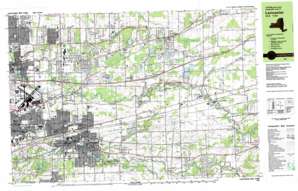
Clarence Topo Map New York
To zoom in, hover over the map of Clarence
USGS Topo Quad 42078h5 - 1:25,000 scale
| Topo Map Name: | Clarence |
| USGS Topo Quad ID: | 42078h5 |
| Print Size: | ca. 39" wide x 24" high |
| Southeast Coordinates: | 42.875° N latitude / 78.5° W longitude |
| Map Center Coordinates: | 42.9375° N latitude / 78.625° W longitude |
| U.S. State: | NY |
| Filename: | k42078h5.jpg |
| Download Map JPG Image: | Clarence topo map 1:25,000 scale |
| Map Type: | Topographic |
| Topo Series: | 7.5´x15´ |
| Map Scale: | 1:25,000 |
| Source of Map Images: | United States Geological Survey (USGS) |
| Alternate Map Versions: |
Lancaster NY 1982, updated 1983 Download PDF Buy paper map |
1:24,000 Topo Quads surrounding Clarence
> Back to 42078e1 at 1:100,000 scale
> Back to 42078a1 at 1:250,000 scale
> Back to U.S. Topo Maps home
Clarence topo map: Gazetteer
Clarence: Airports
Country Club Airport (historical) elevation 241m 790′Depew Airport (historical) elevation 203m 666′
Greater Buffalo International Airport elevation 216m 708′
Lancaster Airport Incorporated Airport elevation 229m 751′
Transit Airport (historical) elevation 202m 662′
Clarence: Crossings
Interchange 49 elevation 216m 708′Clarence: Lakes
Bonny Lake elevation 238m 780′Lake Jerome elevation 235m 770′
Clarence: Parks
Como Lake Park elevation 212m 695′Lancaster Rural Memorial Park elevation 214m 702′
Clarence: Populated Places
Alden Center elevation 252m 826′Bellevue elevation 192m 629′
Bowmansville elevation 216m 708′
Clarence elevation 225m 738′
Dellwood elevation 233m 764′
Depew elevation 205m 672′
East Lancaster elevation 217m 711′
Harris Hill elevation 222m 728′
Lancaster elevation 204m 669′
Looneyville elevation 238m 780′
Millgrove elevation 237m 777′
Pavement (historical) elevation 232m 761′
Peters Corners elevation 248m 813′
Sand Ridge elevation 242m 793′
South Newstead elevation 242m 793′
Town Line elevation 229m 751′
Town Line Station elevation 228m 748′
Wende elevation 238m 780′
West Alden elevation 258m 846′
Williamsville elevation 206m 675′
Clarence: Streams
Little Buffalo Creek elevation 210m 688′North Branch Plum Bottom Creek elevation 208m 682′
Plum Bottom Creek elevation 198m 649′
Clarence: Summits
East Hill elevation 239m 784′West Hill elevation 228m 748′
Clarence: Swamps
Cedar Swamp elevation 229m 751′Clarence digital topo map on disk
Buy this Clarence topo map showing relief, roads, GPS coordinates and other geographical features, as a high-resolution digital map file on DVD:


