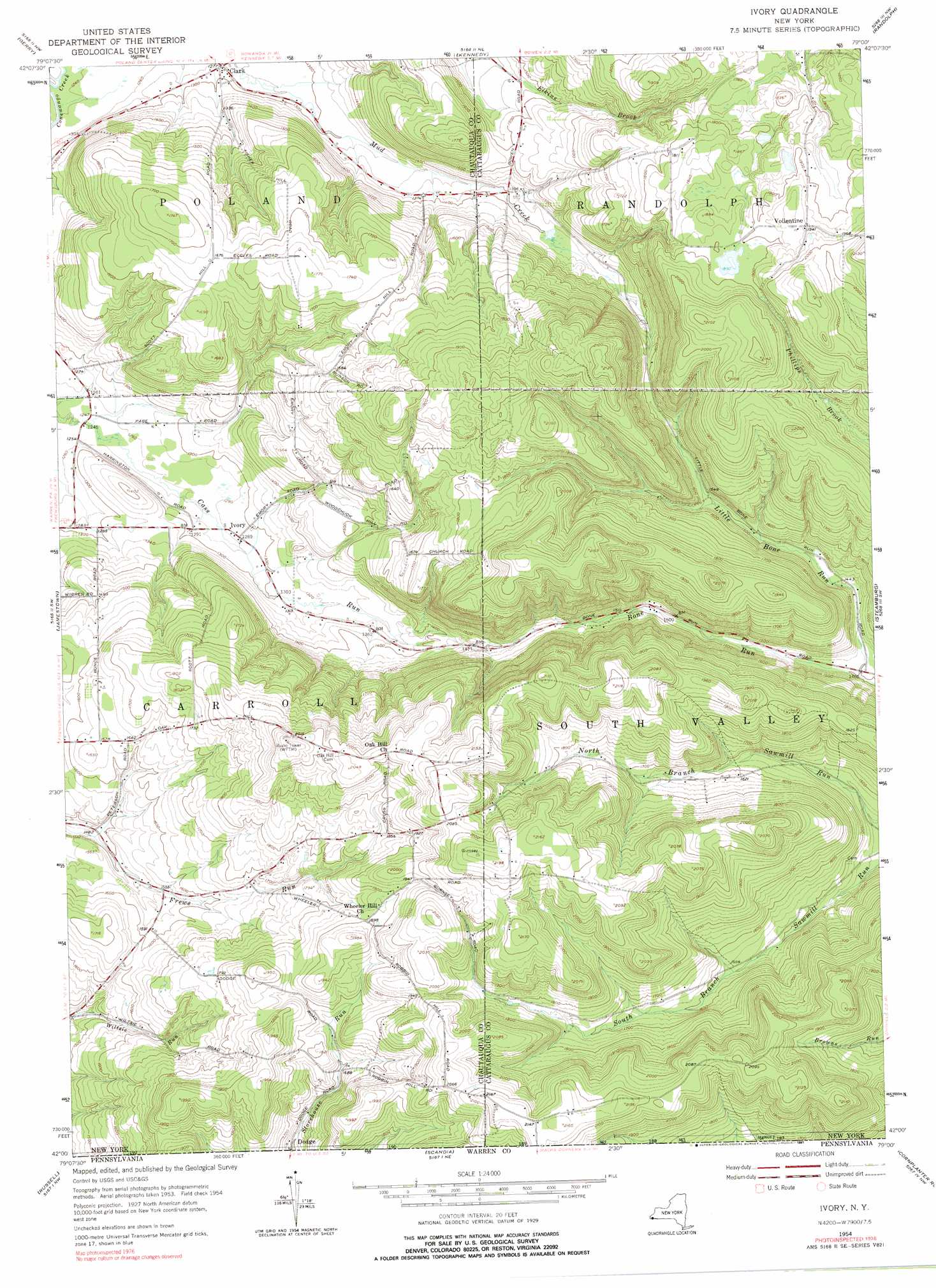
Ivory Topo Map New York
To zoom in, hover over the map of Ivory
USGS Topo Quad 42079a1 - 1:24,000 scale
| Topo Map Name: | Ivory |
| USGS Topo Quad ID: | 42079a1 |
| Print Size: | ca. 21 1/4" wide x 27" high |
| Southeast Coordinates: | 42° N latitude / 79° W longitude |
| Map Center Coordinates: | 42.0625° N latitude / 79.0625° W longitude |
| U.S. State: | NY |
| Filename: | o42079a1.jpg |
| Download Map JPG Image: | Ivory topo map 1:24,000 scale |
| Map Type: | Topographic |
| Topo Series: | 7.5´ |
| Map Scale: | 1:24,000 |
| Source of Map Images: | United States Geological Survey (USGS) |
| Alternate Map Versions: |
Ivory NY 1954, updated 1956 Download PDF Buy paper map Ivory NY 1954, updated 1966 Download PDF Buy paper map Ivory NY 1954, updated 1976 Download PDF Buy paper map Ivory NY 1954, updated 1991 Download PDF Buy paper map Ivory NY 2010 Download PDF Buy paper map Ivory NY 2013 Download PDF Buy paper map Ivory NY 2016 Download PDF Buy paper map |
1:24,000 Topo Quads surrounding Ivory
Cassadaga |
Hamlet |
Cherry Creek |
New Albion |
Cattaraugus |
Ellery Center |
Gerry |
Kennedy |
Randolph |
Little Valley |
Lakewood |
Jamestown |
Ivory |
Steamburg |
Red House |
Sugar Grove |
Russell |
Scandia |
Cornplanter Run |
Stickney |
Youngsville |
Warren |
Clarendon |
Cornplanter Bridge |
Westline |
> Back to 42079a1 at 1:100,000 scale
> Back to 42078a1 at 1:250,000 scale
> Back to U.S. Topo Maps home
Ivory topo map: Gazetteer
Ivory: Populated Places
Clark elevation 391m 1282′Dodge elevation 490m 1607′
Ivory elevation 392m 1286′
Vollentine elevation 592m 1942′
Ivory: Streams
Dry Brook elevation 374m 1227′Little Bone Run elevation 426m 1397′
Ivory digital topo map on disk
Buy this Ivory topo map showing relief, roads, GPS coordinates and other geographical features, as a high-resolution digital map file on DVD:
 map DVD")