Wattsburg Topo Map Pennsylvania
To zoom in, hover over the map of Wattsburg
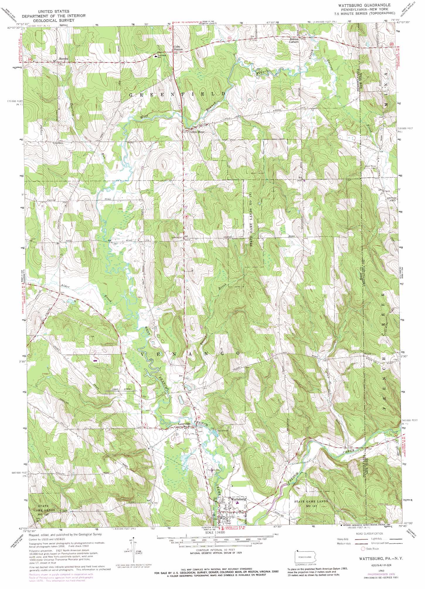
USGS Topo Quad 42079a7 - 1:24,000 scale
| Topo Map Name: | Wattsburg |
| USGS Topo Quad ID: | 42079a7 |
| Print Size: | ca. 21 1/4" wide x 27" high |
| Southeast Coordinates: | 42° N latitude / 79.75° W longitude |
| Map Center Coordinates: | 42.0625° N latitude / 79.8125° W longitude |
| U.S. States: | PA, NY |
| Filename: | o42079a7.jpg |
| Download Map JPG Image: | Wattsburg topo map 1:24,000 scale |
| Map Type: | Topographic |
| Topo Series: | 7.5´ |
| Map Scale: | 1:24,000 |
| Source of Map Images: | United States Geological Survey (USGS) |
| Alternate Map Versions: |
Wattsburg PA 1960, updated 1962 Download PDF Buy paper map Wattsburg PA 1960, updated 1962 Download PDF Buy paper map Wattsburg PA 1960, updated 1972 Download PDF Buy paper map Wattsburg PA 1960, updated 1989 Download PDF Buy paper map Wattsburg PA 2010 Download PDF Buy paper map Wattsburg PA 2013 Download PDF Buy paper map Wattsburg PA 2016 Download PDF Buy paper map |
1:24,000 Topo Quads surrounding Wattsburg
Ripley |
Westfield |
|||
Erie North |
Harborcreek |
North East |
South Ripley |
Sherman |
Erie South |
Hammett |
Wattsburg |
Clymer |
North Clymer |
Cambridge Springs Ne |
Waterford |
Union City |
Corry |
Columbus |
Cambridge Springs |
Millers Station |
Lake Canadohta |
Spartansburg |
Spring Creek |
> Back to 42079a1 at 1:100,000 scale
> Back to 42078a1 at 1:250,000 scale
> Back to U.S. Topo Maps home
Wattsburg topo map: Gazetteer
Wattsburg: Airports
Erie County Airport elevation 443m 1453′Strawberry Acres Airport elevation 397m 1302′
Wattsburg: Parks
State Game Lands Number 155 elevation 472m 1548′State Game Lands Number 191 elevation 488m 1601′
Wattsburg: Populated Places
Hornby elevation 448m 1469′Little Hope elevation 424m 1391′
Lowville elevation 396m 1299′
Wattsburg elevation 391m 1282′
Wattsburg: Ridges
Drumlins elevation 545m 1788′Wattsburg: Streams
Alder Brook elevation 399m 1309′Bailey Brook elevation 396m 1299′
Darrow Brook elevation 414m 1358′
Darrow Brook elevation 413m 1354′
Herrick Creek elevation 411m 1348′
Townley Run elevation 399m 1309′
Wattsburg digital topo map on disk
Buy this Wattsburg topo map showing relief, roads, GPS coordinates and other geographical features, as a high-resolution digital map file on DVD:
 map DVD")