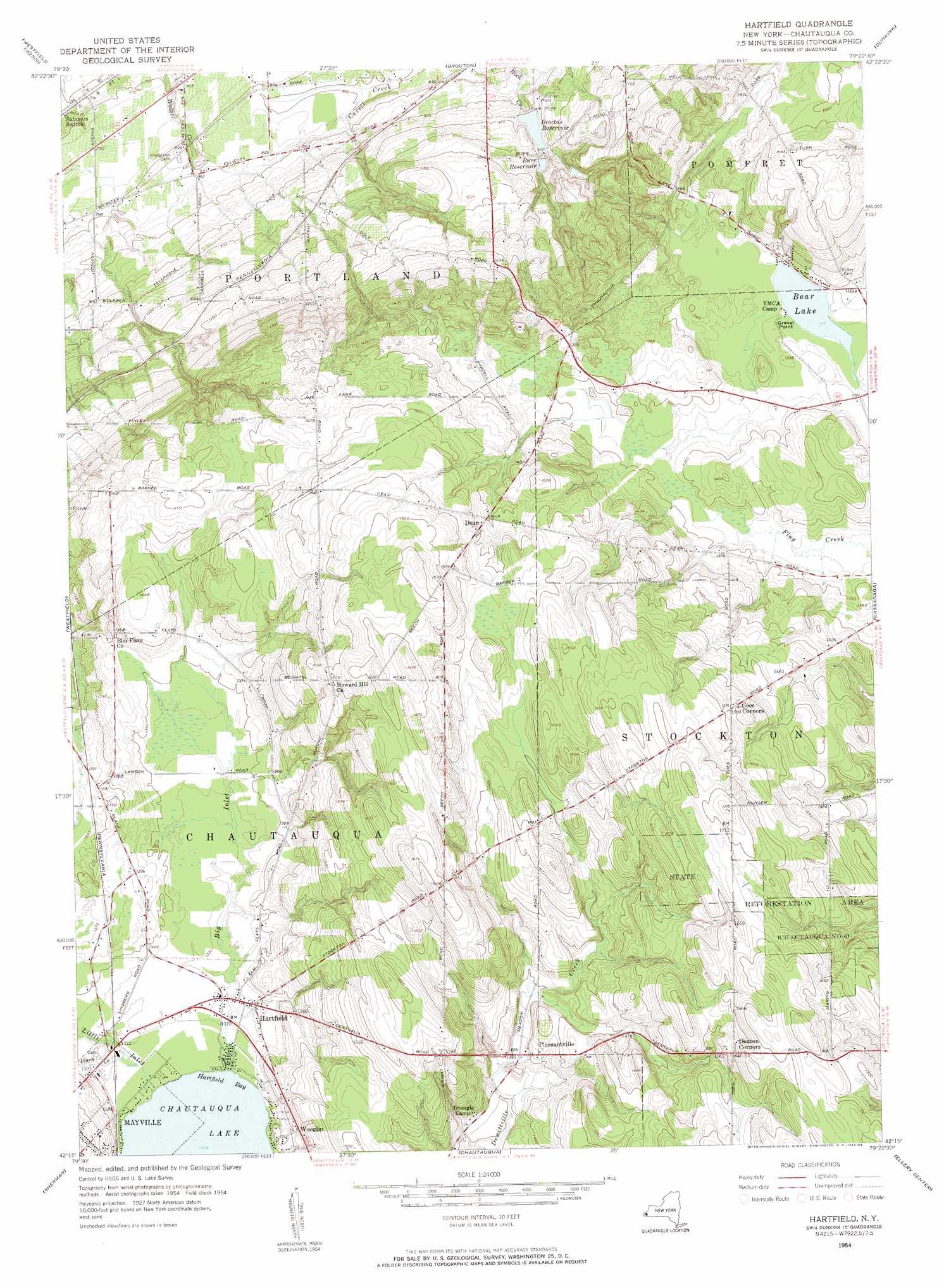
Hartfield Topo Map New York
To zoom in, hover over the map of Hartfield
USGS Topo Quad 42079c4 - 1:24,000 scale
| Topo Map Name: | Hartfield |
| USGS Topo Quad ID: | 42079c4 |
| Print Size: | ca. 21 1/4" wide x 27" high |
| Southeast Coordinates: | 42.25° N latitude / 79.375° W longitude |
| Map Center Coordinates: | 42.3125° N latitude / 79.4375° W longitude |
| U.S. State: | NY |
| Filename: | o42079c4.jpg |
| Download Map JPG Image: | Hartfield topo map 1:24,000 scale |
| Map Type: | Topographic |
| Topo Series: | 7.5´ |
| Map Scale: | 1:24,000 |
| Source of Map Images: | United States Geological Survey (USGS) |
| Alternate Map Versions: |
Hartfield NY 1954, updated 1956 Download PDF Buy paper map Hartfield NY 1954, updated 1956 Download PDF Buy paper map Hartfield NY 2010 Download PDF Buy paper map Hartfield NY 2013 Download PDF Buy paper map Hartfield NY 2016 Download PDF Buy paper map |
1:24,000 Topo Quads surrounding Hartfield
North Of Dunkirk |
Silver Creek |
|||
Brocton |
Dunkirk |
Forestville |
||
Ripley |
Westfield |
Hartfield |
Cassadaga |
Hamlet |
South Ripley |
Sherman |
Chautauqua |
Ellery Center |
Gerry |
Clymer |
North Clymer |
Panama |
Lakewood |
Jamestown |
> Back to 42079a1 at 1:100,000 scale
> Back to 42078a1 at 1:250,000 scale
> Back to U.S. Topo Maps home
Hartfield topo map: Gazetteer
Hartfield: Airports
Chautauqua Lake Airpark elevation 503m 1650′Dart Airport elevation 406m 1332′
Hartfield: Bays
Hartfield Bay elevation 399m 1309′Hartfield: Capes
Gravel Point elevation 402m 1318′Hartfield: Forests
State Reforestation Area elevation 507m 1663′Hartfield: Lakes
Bear Lake elevation 402m 1318′Hartfield: Populated Places
Dean elevation 443m 1453′Hartfield elevation 405m 1328′
Pleasantville elevation 429m 1407′
Wooglin elevation 417m 1368′
Hartfield: Reservoirs
Brocton Reservoir elevation 282m 925′Burr Reservoir elevation 296m 971′
Hartfield: Streams
Big Inlet elevation 399m 1309′Black Creek elevation 402m 1318′
Little Inlet elevation 399m 1309′
Hartfield digital topo map on disk
Buy this Hartfield topo map showing relief, roads, GPS coordinates and other geographical features, as a high-resolution digital map file on DVD:
 map DVD")