Ripley Topo Map New York
To zoom in, hover over the map of Ripley
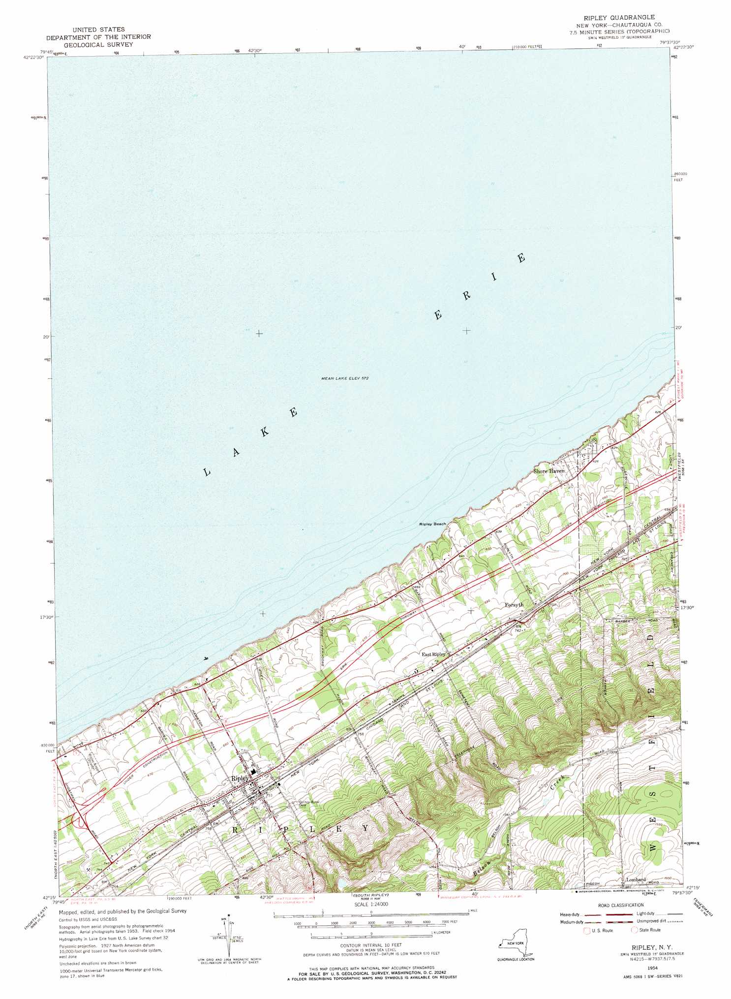
USGS Topo Quad 42079c6 - 1:24,000 scale
| Topo Map Name: | Ripley |
| USGS Topo Quad ID: | 42079c6 |
| Print Size: | ca. 21 1/4" wide x 27" high |
| Southeast Coordinates: | 42.25° N latitude / 79.625° W longitude |
| Map Center Coordinates: | 42.3125° N latitude / 79.6875° W longitude |
| U.S. State: | NY |
| Filename: | o42079c6.jpg |
| Download Map JPG Image: | Ripley topo map 1:24,000 scale |
| Map Type: | Topographic |
| Topo Series: | 7.5´ |
| Map Scale: | 1:24,000 |
| Source of Map Images: | United States Geological Survey (USGS) |
| Alternate Map Versions: |
Ripley NY 1954, updated 1956 Download PDF Buy paper map Ripley NY 1954, updated 1971 Download PDF Buy paper map Ripley NY 2010 Download PDF Buy paper map Ripley NY 2013 Download PDF Buy paper map Ripley NY 2016 Download PDF Buy paper map |
1:24,000 Topo Quads surrounding Ripley
Brocton |
||||
Ripley |
Westfield |
Hartfield |
||
Harborcreek |
North East |
South Ripley |
Sherman |
Chautauqua |
Hammett |
Wattsburg |
Clymer |
North Clymer |
Panama |
> Back to 42079a1 at 1:100,000 scale
> Back to 42078a1 at 1:250,000 scale
> Back to U.S. Topo Maps home
Ripley topo map: Gazetteer
Ripley: Airports
Ripley Airport elevation 195m 639′Ripley: Beaches
Ripley Beach elevation 186m 610′Ripley: Populated Places
East Ripley elevation 224m 734′Forsyth elevation 222m 728′
Lombard elevation 476m 1561′
Ripley elevation 224m 734′
Shore Haven elevation 190m 623′
Ripley digital topo map on disk
Buy this Ripley topo map showing relief, roads, GPS coordinates and other geographical features, as a high-resolution digital map file on DVD:
 map DVD")