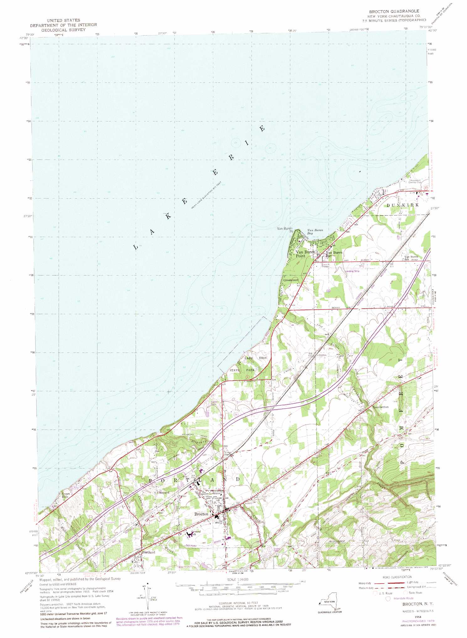
Brocton Topo Map New York
To zoom in, hover over the map of Brocton
USGS Topo Quad 42079d4 - 1:24,000 scale
| Topo Map Name: | Brocton |
| USGS Topo Quad ID: | 42079d4 |
| Print Size: | ca. 21 1/4" wide x 27" high |
| Southeast Coordinates: | 42.375° N latitude / 79.375° W longitude |
| Map Center Coordinates: | 42.4375° N latitude / 79.4375° W longitude |
| U.S. State: | NY |
| Filename: | o42079d4.jpg |
| Download Map JPG Image: | Brocton topo map 1:24,000 scale |
| Map Type: | Topographic |
| Topo Series: | 7.5´ |
| Map Scale: | 1:24,000 |
| Source of Map Images: | United States Geological Survey (USGS) |
| Alternate Map Versions: |
Brocton NY 1954, updated 1956 Download PDF Buy paper map Brocton NY 1954, updated 1979 Download PDF Buy paper map Brocton NY 2010 Download PDF Buy paper map Brocton NY 2013 Download PDF Buy paper map Brocton NY 2016 Download PDF Buy paper map |
1:24,000 Topo Quads surrounding Brocton
North Of Dunkirk |
Silver Creek |
|||
Brocton |
Dunkirk |
Forestville |
||
Ripley |
Westfield |
Hartfield |
Cassadaga |
Hamlet |
South Ripley |
Sherman |
Chautauqua |
Ellery Center |
Gerry |
> Back to 42079a1 at 1:100,000 scale
> Back to 42078a1 at 1:250,000 scale
> Back to U.S. Topo Maps home
Brocton topo map: Gazetteer
Brocton: Airports
Lakeview Shock Incarceration Center Heliport elevation 205m 672′Brocton: Bays
Van Buren Bay elevation 174m 570′Brocton: Capes
Van Buren Point elevation 179m 587′Brocton: Parks
Lake Erie State Park elevation 187m 613′Ryckman Park elevation 217m 711′
Brocton: Populated Places
Brocton elevation 224m 734′Crestview Estates elevation 211m 692′
Ellicott Estates elevation 253m 830′
Green Hills elevation 185m 606′
Greencrest elevation 180m 590′
Lamberton elevation 223m 731′
Portland elevation 232m 761′
Van Buren Bay elevation 178m 583′
Van Buren Point elevation 178m 583′
Vineyard elevation 203m 666′
Brocton: Streams
Corell Creek elevation 174m 570′Little Canadaway Creek elevation 174m 570′
Slippery Rock Creek elevation 174m 570′
Walker Creek elevation 174m 570′
Brocton digital topo map on disk
Buy this Brocton topo map showing relief, roads, GPS coordinates and other geographical features, as a high-resolution digital map file on DVD:
 map DVD")