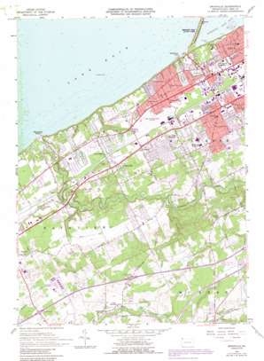
Swanville Topo Map Pennsylvania
To zoom in, hover over the map of Swanville
USGS Topo Quad 42080a2 - 1:24,000 scale
| Topo Map Name: | Swanville |
| USGS Topo Quad ID: | 42080a2 |
| Print Size: | ca. 21 1/4" wide x 27" high |
| Southeast Coordinates: | 42° N latitude / 80.125° W longitude |
| Map Center Coordinates: | 42.0625° N latitude / 80.1875° W longitude |
| U.S. State: | PA |
| Filename: | o42080a2.jpg |
| Download Map JPG Image: | Swanville topo map 1:24,000 scale |
| Map Type: | Topographic |
| Topo Series: | 7.5´ |
| Map Scale: | 1:24,000 |
| Source of Map Images: | United States Geological Survey (USGS) |
| Alternate Map Versions: |
Swanville PA 1957, updated 1959 Download PDF Buy paper map Swanville PA 1957, updated 1970 Download PDF Buy paper map Swanville PA 1957, updated 1976 Download PDF Buy paper map Swanville PA 1957, updated 1984 Download PDF Buy paper map Swanville PA 1957, updated 1990 Download PDF Buy paper map Swanville PA 1998, updated 1999 Download PDF Buy paper map Swanville PA 2010 Download PDF Buy paper map Swanville PA 2013 Download PDF Buy paper map Swanville PA 2016 Download PDF Buy paper map |
1:24,000 Topo Quads surrounding Swanville
> Back to 42080a1 at 1:100,000 scale
> Back to 42080a1 at 1:250,000 scale
> Back to U.S. Topo Maps home
Swanville topo map: Gazetteer
Swanville: Airports
A I R Helicopter Sales and Service Airport elevation 173m 567′Erie International Airport elevation 224m 734′
Fairview Evergreen Airport elevation 244m 800′
Melody Lane Heliport elevation 270m 885′
Millcreek Township Police Airport elevation 228m 748′
Waisley Airport elevation 295m 967′
Swanville: Crossings
Interchange 15 elevation 279m 915′Interchange 18 elevation 306m 1003′
Swanville: Parks
Ravine Park elevation 183m 600′Waldameer Park elevation 177m 580′
Swanville: Populated Places
Asbury elevation 233m 764′Charter Oaks elevation 227m 744′
Eaglehurst elevation 219m 718′
Glenruadh elevation 206m 675′
Highland Park elevation 234m 767′
Lakewood elevation 219m 718′
Manchester Beach elevation 178m 583′
Sterrettania elevation 269m 882′
Swanville elevation 233m 764′
Vernondale elevation 225m 738′
Weis Library elevation 253m 830′
West Millcreek elevation 237m 777′
Westminster elevation 240m 787′
Swanville: Post Offices
Eaglehurst Post Office (historical) elevation 219m 718′Presque Island Post Office elevation 221m 725′
Swanville: Streams
Bear Run elevation 200m 656′Walnut Creek elevation 173m 567′
Swanville digital topo map on disk
Buy this Swanville topo map showing relief, roads, GPS coordinates and other geographical features, as a high-resolution digital map file on DVD:


