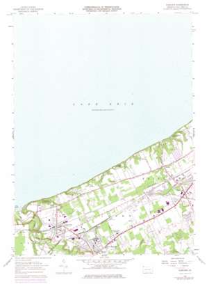
Fairview Topo Map Pennsylvania
To zoom in, hover over the map of Fairview
USGS Topo Quad 42080a3 - 1:24,000 scale
| Topo Map Name: | Fairview |
| USGS Topo Quad ID: | 42080a3 |
| Print Size: | ca. 21 1/4" wide x 27" high |
| Southeast Coordinates: | 42° N latitude / 80.25° W longitude |
| Map Center Coordinates: | 42.0625° N latitude / 80.3125° W longitude |
| U.S. State: | PA |
| Filename: | o42080a3.jpg |
| Download Map JPG Image: | Fairview topo map 1:24,000 scale |
| Map Type: | Topographic |
| Topo Series: | 7.5´ |
| Map Scale: | 1:24,000 |
| Source of Map Images: | United States Geological Survey (USGS) |
| Alternate Map Versions: |
Fairview PA 1957, updated 1958 Download PDF Buy paper map Fairview PA 1957, updated 1970 Download PDF Buy paper map Fairview PA 1957, updated 1970 Download PDF Buy paper map Fairview PA 1957, updated 1976 Download PDF Buy paper map Fairview PA 1998, updated 1999 Download PDF Buy paper map Fairview PA 2010 Download PDF Buy paper map Fairview PA 2013 Download PDF Buy paper map Fairview PA 2016 Download PDF Buy paper map |
1:24,000 Topo Quads surrounding Fairview
Erie North |
||||
Fairview Sw |
Fairview |
Swanville |
Erie South |
|
Conneaut |
East Springfield |
Albion |
Edinboro North |
Cambridge Springs Ne |
Pierpont |
Beaver Center |
Conneautville |
Edinboro South |
Cambridge Springs |
> Back to 42080a1 at 1:100,000 scale
> Back to 42080a1 at 1:250,000 scale
> Back to U.S. Topo Maps home
Fairview topo map: Gazetteer
Fairview: Bays
The Mouth elevation 174m 570′Fairview: Parks
Lake Erie Community Park elevation 206m 675′Fairview: Populated Places
Avonia elevation 205m 672′Fairplain elevation 208m 682′
Fairview elevation 243m 797′
Girard elevation 235m 770′
Girard Junction elevation 210m 688′
Lake City elevation 219m 718′
Wallace Junction elevation 229m 751′
Fairview: Streams
Elk Creek elevation 174m 570′Trout Run elevation 175m 574′
Fairview digital topo map on disk
Buy this Fairview topo map showing relief, roads, GPS coordinates and other geographical features, as a high-resolution digital map file on DVD:


