Rattle Run Topo Map Michigan
To zoom in, hover over the map of Rattle Run
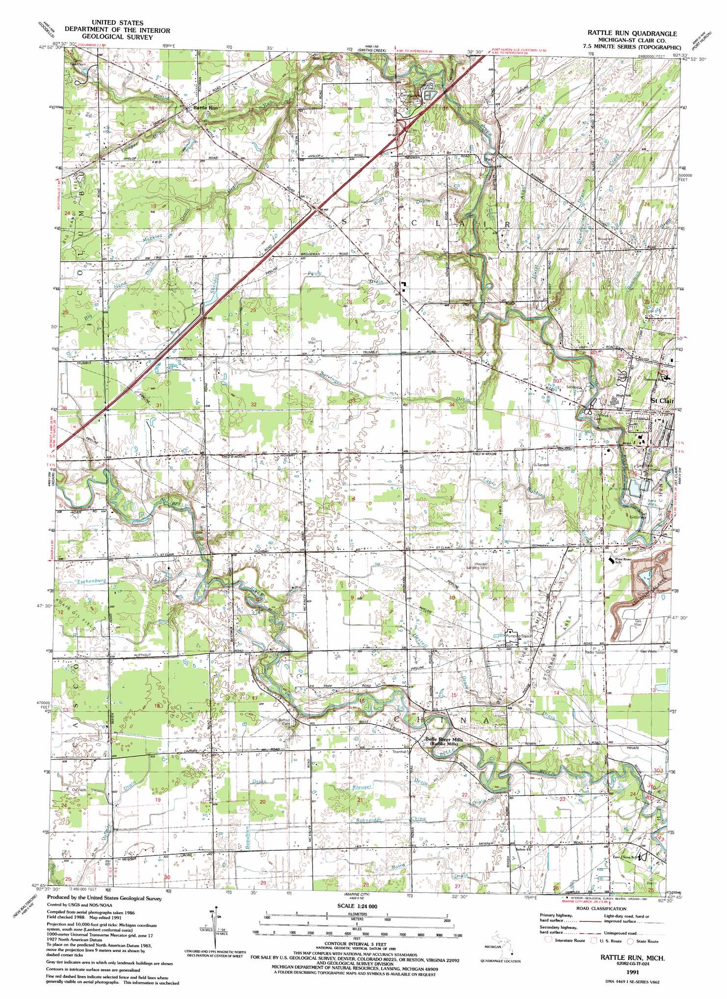
USGS Topo Quad 42082g5 - 1:24,000 scale
| Topo Map Name: | Rattle Run |
| USGS Topo Quad ID: | 42082g5 |
| Print Size: | ca. 21 1/4" wide x 27" high |
| Southeast Coordinates: | 42.75° N latitude / 82.5° W longitude |
| Map Center Coordinates: | 42.8125° N latitude / 82.5625° W longitude |
| U.S. State: | MI |
| Filename: | o42082g5.jpg |
| Download Map JPG Image: | Rattle Run topo map 1:24,000 scale |
| Map Type: | Topographic |
| Topo Series: | 7.5´ |
| Map Scale: | 1:24,000 |
| Source of Map Images: | United States Geological Survey (USGS) |
| Alternate Map Versions: |
Rattle Run MI 1942 Download PDF Buy paper map Rattle Run MI 1942 Download PDF Buy paper map Rattle Run MI 1952, updated 1954 Download PDF Buy paper map Rattle Run MI 1968, updated 1971 Download PDF Buy paper map Rattle Run MI 1991, updated 1991 Download PDF Buy paper map Rattle Run MI 2011 Download PDF Buy paper map Rattle Run MI 2014 Download PDF Buy paper map Rattle Run MI 2017 Download PDF Buy paper map |
1:24,000 Topo Quads surrounding Rattle Run
Brockway |
Avoca |
Ruby |
Lakeport |
|
Memphis |
Goodells |
Smiths Creek |
Port Huron |
|
Richmond |
Adair |
Rattle Run |
Saint Clair |
|
New Haven |
New Baltimore |
Marine City |
||
Mount Clemens East |
Saint Clair Flats |
Algonac |
> Back to 42082e1 at 1:100,000 scale
> Back to 42082a1 at 1:250,000 scale
> Back to U.S. Topo Maps home
Rattle Run topo map: Gazetteer
Rattle Run: Airports
Crystal Airport elevation 187m 613′Haydens Field elevation 185m 606′
Wenning Landing Area elevation 188m 616′
Rattle Run: Crossings
Interchange 262 elevation 194m 636′Rattle Run: Oilfields
Adair Gas and Oil Field elevation 193m 633′Belle River Mills Gas Storage Area elevation 180m 590′
Rattle Run: Populated Places
Rattle Run elevation 192m 629′Saint Clair Place Mobile Home Park elevation 187m 613′
Rattle Run: Post Offices
Rattlerun Post Office (historical) elevation 192m 629′Rattle Run: Streams
Angel Creek elevation 176m 577′Big Hand Drain elevation 192m 629′
Bowman Drain elevation 178m 583′
Brandywine Creek elevation 186m 610′
Eschenburg Drain elevation 184m 603′
Harris Drain elevation 177m 580′
Hextell Drain elevation 184m 603′
Hurst Drain elevation 176m 577′
Jordan Creek elevation 176m 577′
Kreusel Drain elevation 179m 587′
Mackley Drain elevation 190m 623′
Moak Drain elevation 179m 587′
Pauly Drain elevation 189m 620′
Schneider China Drain elevation 180m 590′
Sheldon Drain elevation 182m 597′
Wolf Drain elevation 180m 590′
Rattle Run digital topo map on disk
Buy this Rattle Run topo map showing relief, roads, GPS coordinates and other geographical features, as a high-resolution digital map file on DVD:
 map DVD")