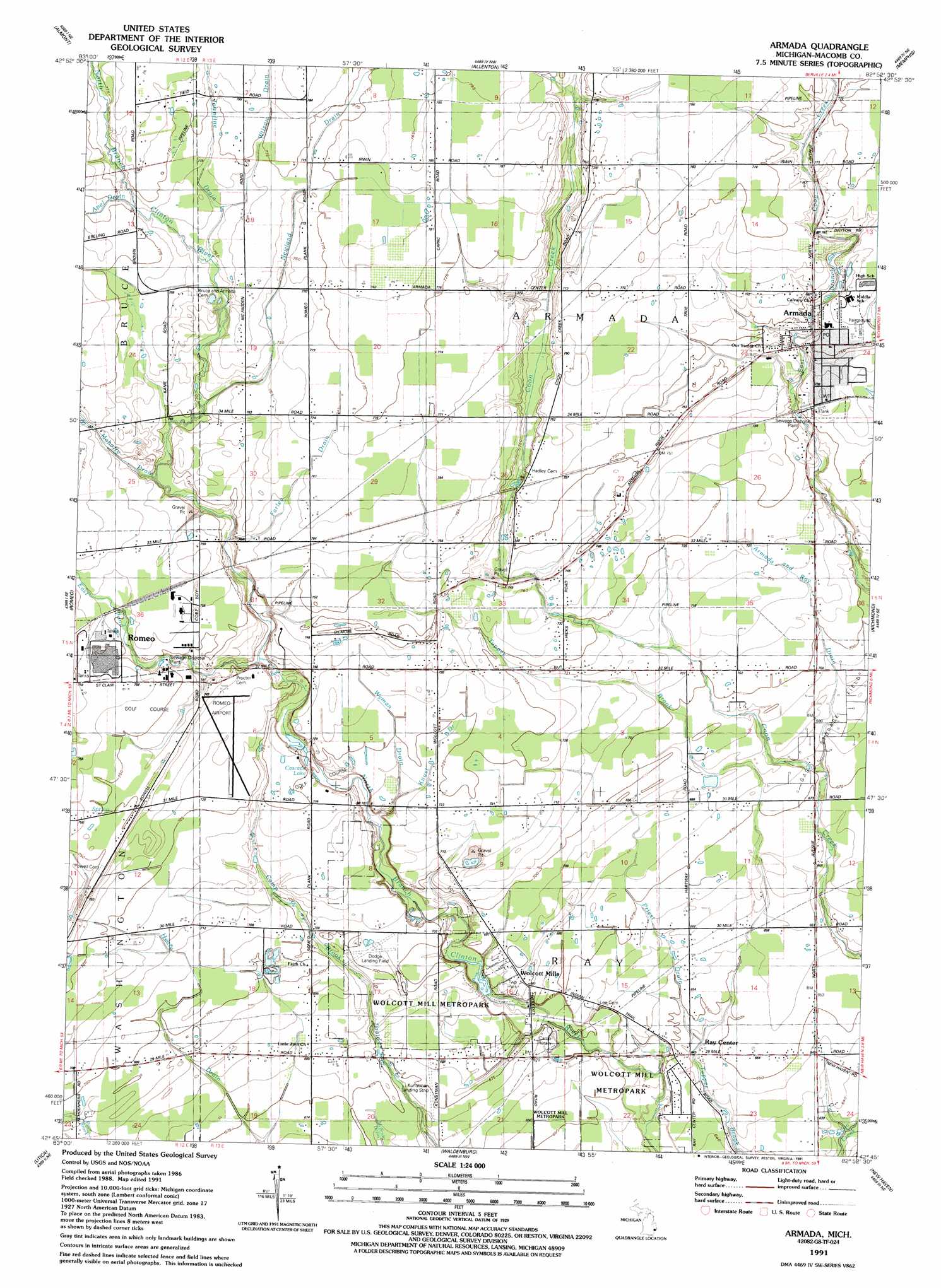
Armada Topo Map Michigan
To zoom in, hover over the map of Armada
USGS Topo Quad 42082g8 - 1:24,000 scale
| Topo Map Name: | Armada |
| USGS Topo Quad ID: | 42082g8 |
| Print Size: | ca. 21 1/4" wide x 27" high |
| Southeast Coordinates: | 42.75° N latitude / 82.875° W longitude |
| Map Center Coordinates: | 42.8125° N latitude / 82.9375° W longitude |
| U.S. State: | MI |
| Filename: | o42082g8.jpg |
| Download Map JPG Image: | Armada topo map 1:24,000 scale |
| Map Type: | Topographic |
| Topo Series: | 7.5´ |
| Map Scale: | 1:24,000 |
| Source of Map Images: | United States Geological Survey (USGS) |
| Alternate Map Versions: |
Armada MI 1945 Download PDF Buy paper map Armada MI 1952, updated 1954 Download PDF Buy paper map Armada MI 1968, updated 1970 Download PDF Buy paper map Armada MI 1968, updated 1974 Download PDF Buy paper map Armada MI 1991, updated 1991 Download PDF Buy paper map Armada MI 2011 Download PDF Buy paper map Armada MI 2014 Download PDF Buy paper map Armada MI 2017 Download PDF Buy paper map |
1:24,000 Topo Quads surrounding Armada
Attica |
Imlay City |
Capac |
Brockway |
Avoca |
Thornville |
Almont |
Allenton |
Memphis |
Goodells |
Lake Orion |
Romeo |
Armada |
Richmond |
Adair |
Rochester |
Utica |
Waldenburg |
New Haven |
New Baltimore |
Birmingham |
Warren |
Mount Clemens West |
Mount Clemens East |
Saint Clair Flats |
> Back to 42082e1 at 1:100,000 scale
> Back to 42082a1 at 1:250,000 scale
> Back to U.S. Topo Maps home
Armada topo map: Gazetteer
Armada: Airports
Dodge Airport elevation 210m 688′Kriewall Strip elevation 234m 767′
Romeo Airport elevation 223m 731′
Armada: Canals
Wilson Drain elevation 238m 780′Armada: Lakes
Cascade Lake elevation 215m 705′Armada: Parks
Ray Township Park elevation 208m 682′Wolcott Mill Metropark elevation 198m 649′
Armada: Populated Places
Armada elevation 229m 751′Ray Center elevation 195m 639′
Wolcott Mills elevation 207m 679′
Armada: Streams
Apel Drain elevation 233m 764′Armada and Ray Drain elevation 204m 669′
East Pond Creek elevation 219m 718′
Farley Drain elevation 224m 734′
Knust Drain elevation 216m 708′
Mahaffy Drain elevation 226m 741′
Newland Drain elevation 228m 748′
Priest Drain elevation 195m 639′
Woodbeck Drain elevation 221m 725′
Wyman Drain elevation 210m 688′
Armada digital topo map on disk
Buy this Armada topo map showing relief, roads, GPS coordinates and other geographical features, as a high-resolution digital map file on DVD:
 map DVD")