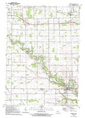
Memphis Topo Map Michigan
To zoom in, hover over the map of Memphis
USGS Topo Quad 42082h7 - 1:24,000 scale
| Topo Map Name: | Memphis |
| USGS Topo Quad ID: | 42082h7 |
| Print Size: | ca. 21 1/4" wide x 27" high |
| Southeast Coordinates: | 42.875° N latitude / 82.75° W longitude |
| Map Center Coordinates: | 42.9375° N latitude / 82.8125° W longitude |
| U.S. State: | MI |
| Filename: | o42082h7.jpg |
| Download Map JPG Image: | Memphis topo map 1:24,000 scale |
| Map Type: | Topographic |
| Topo Series: | 7.5´ |
| Map Scale: | 1:24,000 |
| Source of Map Images: | United States Geological Survey (USGS) |
| Alternate Map Versions: |
Memphis MI 1944, updated 1944 Download PDF Buy paper map Memphis MI 1952, updated 1953 Download PDF Buy paper map Memphis MI 1968, updated 1970 Download PDF Buy paper map Memphis MI 1991, updated 1991 Download PDF Buy paper map Memphis MI 2011 Download PDF Buy paper map Memphis MI 2014 Download PDF Buy paper map Memphis MI 2017 Download PDF Buy paper map |
1:24,000 Topo Quads surrounding Memphis
> Back to 42082e1 at 1:100,000 scale
> Back to 42082a1 at 1:250,000 scale
> Back to U.S. Topo Maps home
Memphis topo map: Gazetteer
Memphis: Canals
Cowhy Drain elevation 236m 774′Parker Drain elevation 236m 774′
Shaver Drain elevation 232m 761′
Smith Drain elevation 233m 764′
Memphis: Crossings
Interchange 180 elevation 249m 816′Interchange 184 elevation 241m 790′
Memphis: Parks
John F Farrell Historical Marker elevation 235m 770′Our Lady of Mount Carmel Parish Historical Marker elevation 235m 770′
Memphis: Populated Places
Emmett elevation 236m 774′Memphis elevation 230m 754′
Riley Center elevation 238m 780′
Memphis: Post Offices
Doyle Post Office (historical) elevation 239m 784′Emmett Post Office elevation 235m 770′
Riley Center Post Office (historical) elevation 236m 774′
Memphis: Streams
Beaver Creek elevation 220m 721′Burgess Drain elevation 230m 754′
Loomis Drain elevation 230m 754′
Sage Creek elevation 218m 715′
Sumner Drain elevation 238m 780′
Tallmadge Drain elevation 235m 770′
Memphis digital topo map on disk
Buy this Memphis topo map showing relief, roads, GPS coordinates and other geographical features, as a high-resolution digital map file on DVD:


