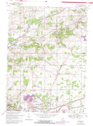
Denton Topo Map Michigan
To zoom in, hover over the map of Denton
USGS Topo Quad 42083c5 - 1:24,000 scale
| Topo Map Name: | Denton |
| USGS Topo Quad ID: | 42083c5 |
| Print Size: | ca. 21 1/4" wide x 27" high |
| Southeast Coordinates: | 42.25° N latitude / 83.5° W longitude |
| Map Center Coordinates: | 42.3125° N latitude / 83.5625° W longitude |
| U.S. State: | MI |
| Filename: | o42083c5.jpg |
| Download Map JPG Image: | Denton topo map 1:24,000 scale |
| Map Type: | Topographic |
| Topo Series: | 7.5´ |
| Map Scale: | 1:24,000 |
| Source of Map Images: | United States Geological Survey (USGS) |
| Alternate Map Versions: |
Denton MI 1942, updated 1942 Download PDF Buy paper map Denton MI 1953, updated 1955 Download PDF Buy paper map Denton MI 1953, updated 1966 Download PDF Buy paper map Denton MI 1969, updated 1971 Download PDF Buy paper map Denton MI 1969, updated 1974 Download PDF Buy paper map Denton MI 1969, updated 1981 Download PDF Buy paper map Denton MI 1969, updated 1981 Download PDF Buy paper map Denton MI 2011 Download PDF Buy paper map Denton MI 2014 Download PDF Buy paper map Denton MI 2017 Download PDF Buy paper map |
1:24,000 Topo Quads surrounding Denton
> Back to 42083a1 at 1:100,000 scale
> Back to 42082a1 at 1:250,000 scale
> Back to U.S. Topo Maps home
Denton topo map: Gazetteer
Denton: Lakes
Frain Lake elevation 251m 823′Murray Lake elevation 251m 823′
Denton: Parks
Apple Ridge Park elevation 223m 731′Superior Center Park elevation 246m 807′
Denton: Populated Places
Cherry Hill elevation 223m 731′Denton elevation 215m 705′
Frain Lake elevation 254m 833′
Willow Run elevation 231m 757′
Denton: Streams
Apple Run elevation 209m 685′Bazley and Foster Drain elevation 219m 718′
Crippen Drain elevation 241m 790′
Fowler Creek elevation 207m 679′
Goodell Drain elevation 210m 688′
Horner Drain elevation 210m 688′
Ingall Drain elevation 245m 803′
Nelson Drain elevation 254m 833′
Parks Drain elevation 220m 721′
South Branch Fellows Creek elevation 214m 702′
Superior Number One Drain elevation 213m 698′
Wagner Drain elevation 254m 833′
Denton digital topo map on disk
Buy this Denton topo map showing relief, roads, GPS coordinates and other geographical features, as a high-resolution digital map file on DVD:


