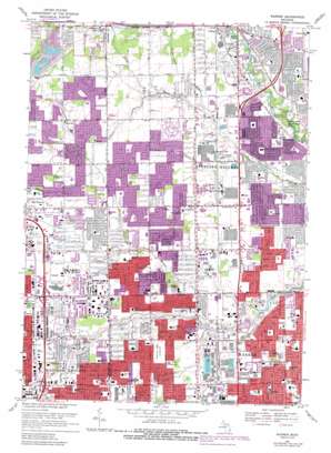
Warren Topo Map Michigan
To zoom in, hover over the map of Warren
USGS Topo Quad 42083e1 - 1:24,000 scale
| Topo Map Name: | Warren |
| USGS Topo Quad ID: | 42083e1 |
| Print Size: | ca. 21 1/4" wide x 27" high |
| Southeast Coordinates: | 42.5° N latitude / 83° W longitude |
| Map Center Coordinates: | 42.5625° N latitude / 83.0625° W longitude |
| U.S. State: | MI |
| Filename: | o42083e1.jpg |
| Download Map JPG Image: | Warren topo map 1:24,000 scale |
| Map Type: | Topographic |
| Topo Series: | 7.5´ |
| Map Scale: | 1:24,000 |
| Source of Map Images: | United States Geological Survey (USGS) |
| Alternate Map Versions: |
Warren MI 1946 Download PDF Buy paper map Warren MI 1952, updated 1953 Download PDF Buy paper map Warren MI 1968, updated 1971 Download PDF Buy paper map Warren MI 1968, updated 1974 Download PDF Buy paper map Warren MI 1968, updated 1981 Download PDF Buy paper map Warren MI 1968, updated 1989 Download PDF Buy paper map Warren MI 1968, updated 1989 Download PDF Buy paper map Warren MI 2011 Download PDF Buy paper map Warren MI 2014 Download PDF Buy paper map Warren MI 2017 Download PDF Buy paper map |
1:24,000 Topo Quads surrounding Warren
> Back to 42083e1 at 1:100,000 scale
> Back to 42082a1 at 1:250,000 scale
> Back to U.S. Topo Maps home
Warren topo map: Gazetteer
Warren: Airports
Big Beaver Airport elevation 197m 646′Warren: Canals
Greens Ditch elevation 196m 643′Warren: Parks
Dodge Brothers State Park Number 8 elevation 185m 606′Eckstein Park elevation 185m 606′
Greenleaf Park elevation 193m 633′
Halmich Park elevation 190m 623′
Mark Twain Park elevation 196m 643′
Riverland Amusement Park elevation 188m 616′
Tiger Land Park elevation 188m 616′
Warren: Populated Places
Big Beaver elevation 200m 656′Sterling Heights elevation 187m 613′
Warren: Streams
Bear Creek elevation 181m 593′Big Beaver Creek elevation 181m 593′
Chrissman Drain elevation 187m 613′
Gamble Drain elevation 184m 603′
Gibson Drain elevation 190m 623′
Hawthorn Drain elevation 190m 623′
Lawson Drain elevation 185m 606′
McCoy Drain elevation 187m 613′
Meckler Drain elevation 180m 590′
Moore Drain elevation 185m 606′
Shanahan Drain elevation 193m 633′
Spencer Drain elevation 188m 616′
Sturgis Drain elevation 190m 623′
Warren digital topo map on disk
Buy this Warren topo map showing relief, roads, GPS coordinates and other geographical features, as a high-resolution digital map file on DVD:


