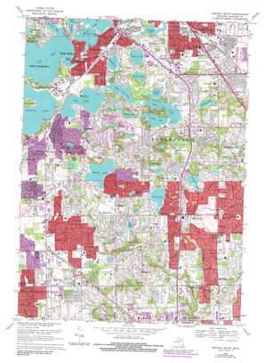
Pontiac South Topo Map Michigan
To zoom in, hover over the map of Pontiac South
USGS Topo Quad 42083e3 - 1:24,000 scale
| Topo Map Name: | Pontiac South |
| USGS Topo Quad ID: | 42083e3 |
| Print Size: | ca. 21 1/4" wide x 27" high |
| Southeast Coordinates: | 42.5° N latitude / 83.25° W longitude |
| Map Center Coordinates: | 42.5625° N latitude / 83.3125° W longitude |
| U.S. State: | MI |
| Filename: | o42083e3.jpg |
| Download Map JPG Image: | Pontiac South topo map 1:24,000 scale |
| Map Type: | Topographic |
| Topo Series: | 7.5´ |
| Map Scale: | 1:24,000 |
| Source of Map Images: | United States Geological Survey (USGS) |
| Alternate Map Versions: |
Pontiac South MI 1943 Download PDF Buy paper map Pontiac South MI 1952, updated 1954 Download PDF Buy paper map Pontiac South MI 1968, updated 1971 Download PDF Buy paper map Pontiac South MI 1968, updated 1974 Download PDF Buy paper map Pontiac South MI 1968, updated 1984 Download PDF Buy paper map Pontiac South MI 1997, updated 1999 Download PDF Buy paper map Pontiac South MI 2011 Download PDF Buy paper map Pontiac South MI 2014 Download PDF Buy paper map Pontiac South MI 2017 Download PDF Buy paper map |
1:24,000 Topo Quads surrounding Pontiac South
> Back to 42083e1 at 1:100,000 scale
> Back to 42082a1 at 1:250,000 scale
> Back to U.S. Topo Maps home
Pontiac South topo map: Gazetteer
Pontiac South: Bays
Coles Bay elevation 283m 928′Pontiac South: Capes
Wards Point elevation 283m 928′Pontiac South: Islands
Apple Island elevation 289m 948′Pontiac South: Lakes
Bloomfield Lake elevation 282m 925′Cass Lake elevation 283m 928′
Chalmers Lake elevation 274m 898′
Crystal Lake elevation 279m 915′
Dollar Lake elevation 283m 928′
Dow Lake elevation 283m 928′
Evans Lake elevation 266m 872′
Forest Lake elevation 278m 912′
Gilbert Lake elevation 254m 833′
Hadsells Pond elevation 292m 958′
Haines Lake elevation 275m 902′
Hammond Lake elevation 280m 918′
Harris Lake elevation 265m 869′
Hess Lake elevation 283m 928′
Island Lake elevation 278m 912′
Kirkwood Lake elevation 271m 889′
Lower Long Lake elevation 278m 912′
Meadow Lake elevation 250m 820′
Minnow Lake elevation 265m 869′
Mirror Lake elevation 276m 905′
Moon Lake elevation 281m 921′
Mud Lake elevation 278m 912′
Orange Lake elevation 274m 898′
Orchard Lake elevation 283m 928′
Pine Lake elevation 283m 928′
Simpson Lake elevation 265m 869′
Sodon Lake elevation 270m 885′
Square Lake elevation 284m 931′
Sylvan Lake elevation 283m 928′
Turtle Lake elevation 279m 915′
Upper Long Lake elevation 278m 912′
Wabeek Lake elevation 281m 921′
Walnut Lake elevation 269m 882′
Wing Lake elevation 259m 849′
Pontiac South: Parks
Beaudette Park elevation 284m 931′Community Center Park elevation 284m 931′
Dodge Brothers State Park Number 2 elevation 294m 964′
Ferndale Park elevation 283m 928′
Pontiac South: Populated Places
Bingham Farms elevation 217m 711′Franklin elevation 254m 833′
Keego Harbor elevation 284m 931′
Orchard Lake elevation 294m 964′
Sylvan Lake elevation 292m 958′
Wood Creek Farms elevation 239m 784′
Pontiac South: Post Offices
Keego Harbor Post Office elevation 284m 931′Pontiac South: Reservoirs
Dawsons Millpond elevation 282m 925′Pontiac South digital topo map on disk
Buy this Pontiac South topo map showing relief, roads, GPS coordinates and other geographical features, as a high-resolution digital map file on DVD:


