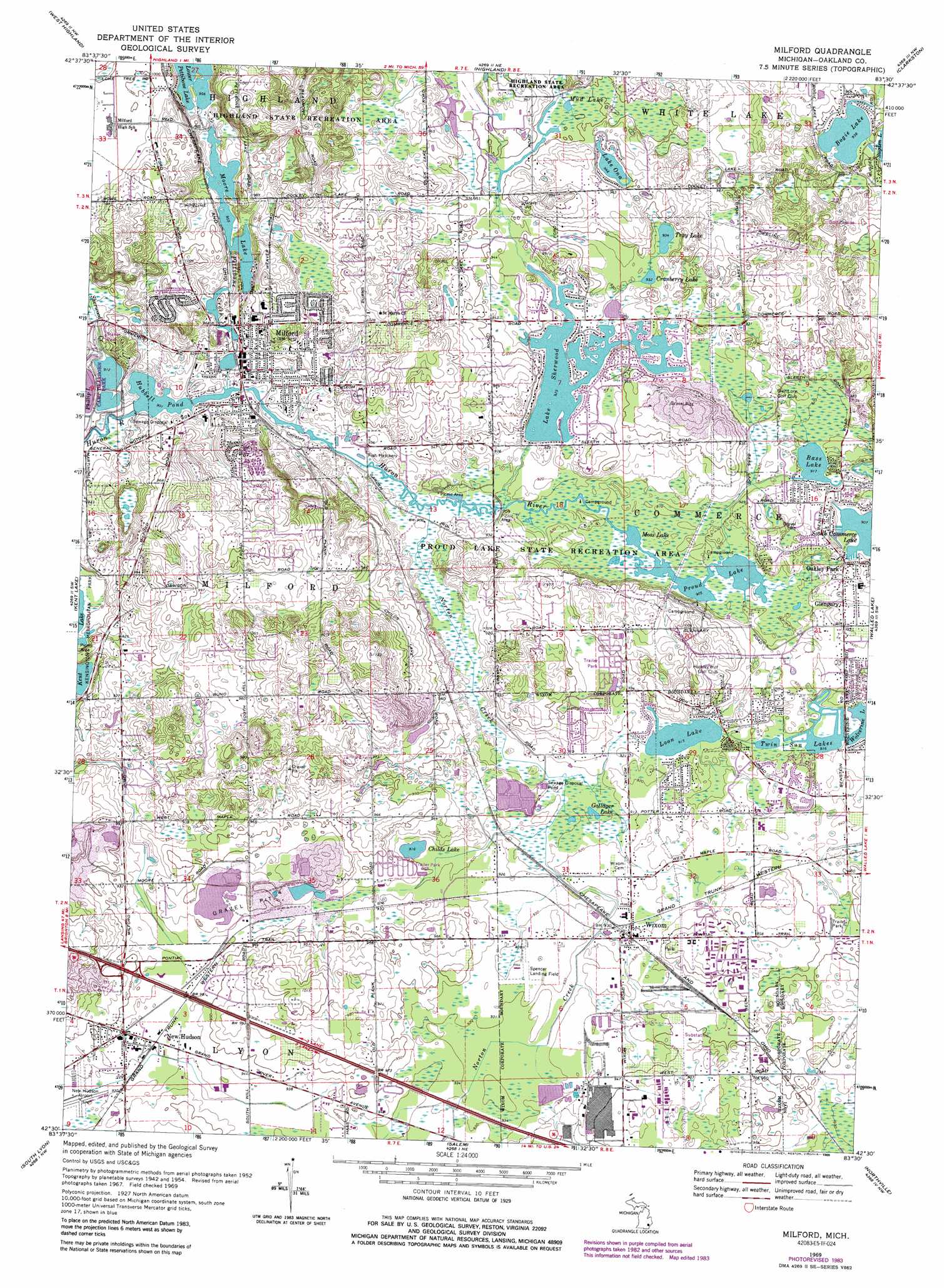
Milford Topo Map Michigan
To zoom in, hover over the map of Milford
USGS Topo Quad 42083e5 - 1:24,000 scale
| Topo Map Name: | Milford |
| USGS Topo Quad ID: | 42083e5 |
| Print Size: | ca. 21 1/4" wide x 27" high |
| Southeast Coordinates: | 42.5° N latitude / 83.5° W longitude |
| Map Center Coordinates: | 42.5625° N latitude / 83.5625° W longitude |
| U.S. State: | MI |
| Filename: | o42083e5.jpg |
| Download Map JPG Image: | Milford topo map 1:24,000 scale |
| Map Type: | Topographic |
| Topo Series: | 7.5´ |
| Map Scale: | 1:24,000 |
| Source of Map Images: | United States Geological Survey (USGS) |
| Alternate Map Versions: |
Wixom MI 1945 Download PDF Buy paper map Milford MI 1954, updated 1955 Download PDF Buy paper map Milford MI 1969, updated 1971 Download PDF Buy paper map Milford MI 1969, updated 1974 Download PDF Buy paper map Milford MI 1969, updated 1984 Download PDF Buy paper map Milford MI 1969, updated 1989 Download PDF Buy paper map Milford MI 1969, updated 1989 Download PDF Buy paper map Milford MI 2011 Download PDF Buy paper map Milford MI 2014 Download PDF Buy paper map Milford MI 2017 Download PDF Buy paper map |
1:24,000 Topo Quads surrounding Milford
Linden |
Fenton |
Davisburg |
Ortonville |
Oxford |
Hartland |
West Highland |
Highland |
Clarkston |
Pontiac North |
Brighton |
Kent Lake |
Milford |
Walled Lake |
Pontiac South |
Hamburg |
South Lyon |
Salem |
Northville |
Redford |
Ann Arbor West |
Ann Arbor East |
Denton |
Wayne |
Inkster |
> Back to 42083e1 at 1:100,000 scale
> Back to 42082a1 at 1:250,000 scale
> Back to U.S. Topo Maps home
Milford topo map: Gazetteer
Milford: Airports
New Hudson Airport elevation 281m 921′Spencer Field elevation 283m 928′
T and M Companies Heliport elevation 285m 935′
Milford: Lakes
Bass Lake elevation 279m 915′Bogie Lake elevation 285m 935′
Childs Lake elevation 279m 915′
Cranberry Lake elevation 285m 935′
Gallager Lake elevation 277m 908′
Hubbell Pond elevation 275m 902′
Lake Ona elevation 288m 944′
Lake Sherwood elevation 282m 925′
Loon Lake elevation 279m 915′
Moore Lake elevation 291m 954′
Moss Lake elevation 276m 905′
Mud Lake elevation 288m 944′
Proud Lake elevation 276m 905′
Tray Lake elevation 285m 935′
Twin Sun Lakes elevation 279m 915′
Milford: Parks
Proud Lake State Recreation Area elevation 277m 908′Milford: Populated Places
Glengary elevation 282m 925′Milford elevation 293m 961′
New Hudson elevation 285m 935′
Wixom elevation 283m 928′
Milford: Streams
Norton Creek elevation 275m 902′Pettibone Creek elevation 276m 905′
Sherwood Creek elevation 280m 918′
Milford digital topo map on disk
Buy this Milford topo map showing relief, roads, GPS coordinates and other geographical features, as a high-resolution digital map file on DVD:
 map DVD")