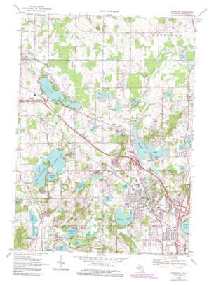
Brighton Topo Map Michigan
To zoom in, hover over the map of Brighton
USGS Topo Quad 42083e7 - 1:24,000 scale
| Topo Map Name: | Brighton |
| USGS Topo Quad ID: | 42083e7 |
| Print Size: | ca. 21 1/4" wide x 27" high |
| Southeast Coordinates: | 42.5° N latitude / 83.75° W longitude |
| Map Center Coordinates: | 42.5625° N latitude / 83.8125° W longitude |
| U.S. State: | MI |
| Filename: | o42083e7.jpg |
| Download Map JPG Image: | Brighton topo map 1:24,000 scale |
| Map Type: | Topographic |
| Topo Series: | 7.5´ |
| Map Scale: | 1:24,000 |
| Source of Map Images: | United States Geological Survey (USGS) |
| Alternate Map Versions: |
Brighton MI 1968, updated 1970 Download PDF Buy paper map Brighton MI 1968, updated 1976 Download PDF Buy paper map Brighton MI 1968, updated 1984 Download PDF Buy paper map Brighton MI 2011 Download PDF Buy paper map Brighton MI 2014 Download PDF Buy paper map Brighton MI 2017 Download PDF Buy paper map |
1:24,000 Topo Quads surrounding Brighton
> Back to 42083e1 at 1:100,000 scale
> Back to 42082a1 at 1:250,000 scale
> Back to U.S. Topo Maps home
Brighton topo map: Gazetteer
Brighton: Airports
Brighton Airport elevation 296m 971′Haigh Airport elevation 296m 971′
Brighton: Forests
Southern Michigan State Forest Nursery elevation 281m 921′Brighton: Lakes
Ackerman Lake elevation 293m 961′Appleton Lake elevation 267m 875′
Baetcke Lake elevation 285m 935′
Blaine Lake elevation 291m 954′
Brighton Lake elevation 274m 898′
Clark Lake elevation 290m 951′
Clifford Lake elevation 287m 941′
Cunningham Lake elevation 267m 875′
Divine Lake elevation 288m 944′
Durfee Lake elevation 281m 921′
East Crooked Lake elevation 286m 938′
Euler Lake elevation 294m 964′
Fonda Lake elevation 273m 895′
Grubb Lake elevation 288m 944′
Lake Chemung elevation 291m 954′
Lime Lake elevation 273m 895′
Little Appleton Lake elevation 267m 875′
Lyons Lake elevation 278m 912′
Morse Lake elevation 288m 944′
Murray Lake elevation 266m 872′
Osborn Lake elevation 290m 951′
Pete Lake elevation 300m 984′
Reed Lake elevation 267m 875′
West Crooked Lake elevation 286m 938′
Woodland Lake elevation 283m 928′
Worden Lake elevation 277m 908′
Brighton: Parks
Brighton State Recreation Area elevation 287m 941′Brighton: Populated Places
Brighton elevation 281m 921′Chilson elevation 285m 935′
Brighton: Reservoirs
Chilson Impoundment elevation 278m 912′Brighton: Swamps
Spruce Swamp elevation 286m 938′Brighton digital topo map on disk
Buy this Brighton topo map showing relief, roads, GPS coordinates and other geographical features, as a high-resolution digital map file on DVD:


