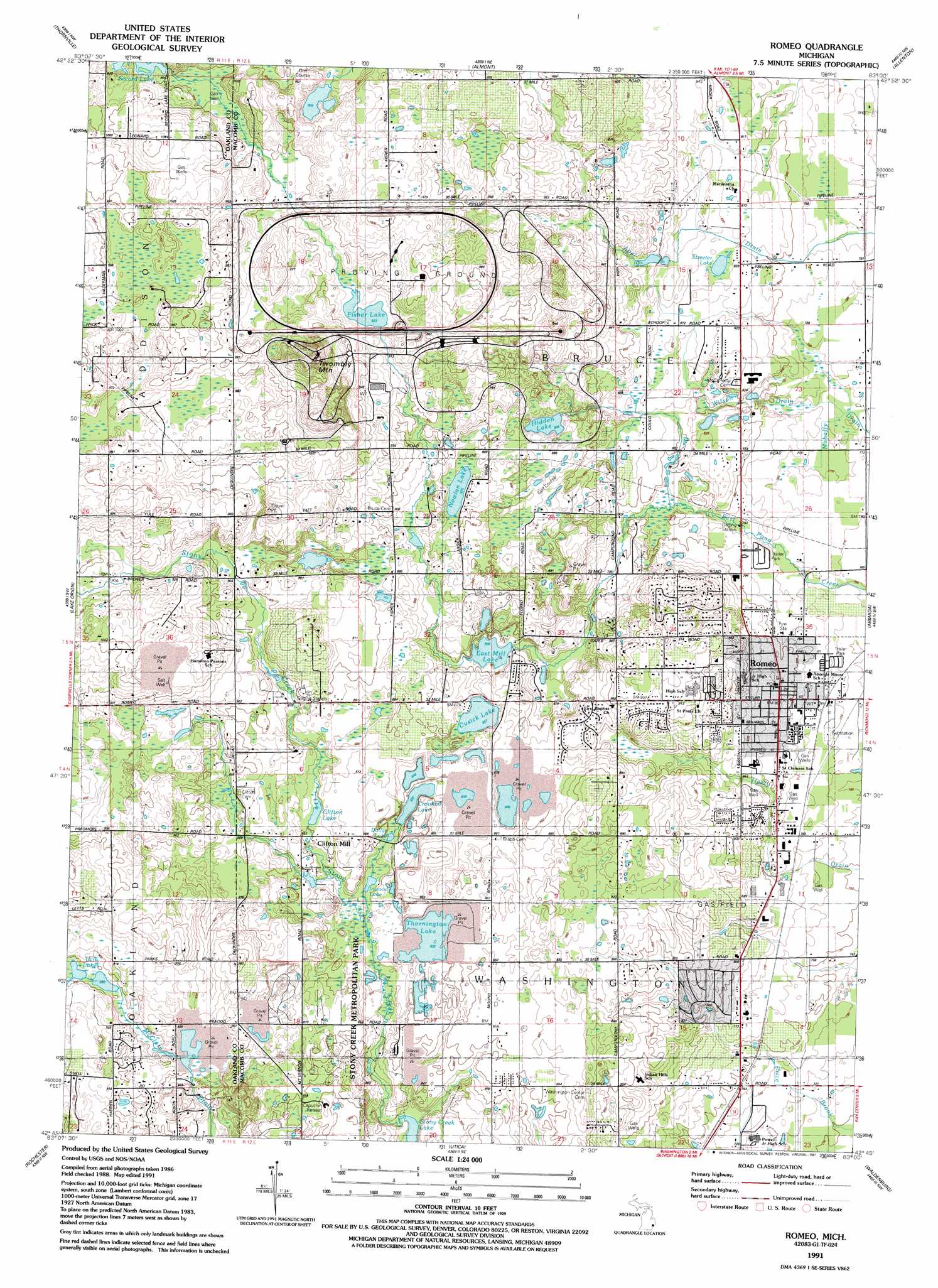
Romeo Topo Map Michigan
To zoom in, hover over the map of Romeo
USGS Topo Quad 42083g1 - 1:24,000 scale
| Topo Map Name: | Romeo |
| USGS Topo Quad ID: | 42083g1 |
| Print Size: | ca. 21 1/4" wide x 27" high |
| Southeast Coordinates: | 42.75° N latitude / 83° W longitude |
| Map Center Coordinates: | 42.8125° N latitude / 83.0625° W longitude |
| U.S. State: | MI |
| Filename: | o42083g1.jpg |
| Download Map JPG Image: | Romeo topo map 1:24,000 scale |
| Map Type: | Topographic |
| Topo Series: | 7.5´ |
| Map Scale: | 1:24,000 |
| Source of Map Images: | United States Geological Survey (USGS) |
| Alternate Map Versions: |
Romeo MI 1943, updated 1965 Download PDF Buy paper map Romeo MI 1945 Download PDF Buy paper map Romeo MI 1968, updated 1970 Download PDF Buy paper map Romeo MI 1968, updated 1974 Download PDF Buy paper map Romeo MI 1991, updated 1991 Download PDF Buy paper map Romeo MI 2011 Download PDF Buy paper map Romeo MI 2014 Download PDF Buy paper map Romeo MI 2017 Download PDF Buy paper map |
1:24,000 Topo Quads surrounding Romeo
Lapeer |
Attica |
Imlay City |
Capac |
Brockway |
Metamora |
Thornville |
Almont |
Allenton |
Memphis |
Oxford |
Lake Orion |
Romeo |
Armada |
Richmond |
Pontiac North |
Rochester |
Utica |
Waldenburg |
New Haven |
Pontiac South |
Birmingham |
Warren |
Mount Clemens West |
Mount Clemens East |
> Back to 42083e1 at 1:100,000 scale
> Back to 42082a1 at 1:250,000 scale
> Back to U.S. Topo Maps home
Romeo topo map: Gazetteer
Romeo: Lakes
Cusick Lake elevation 261m 856′Dollar Lake elevation 255m 836′
East Mill Lake elevation 254m 833′
Fisher Lake elevation 281m 921′
Hidden Lake elevation 261m 856′
Inwood Lake elevation 252m 826′
Mount Vernon Lake elevation 255m 836′
Nowlan Lake elevation 267m 875′
Streeter Lake elevation 249m 816′
Thorington Lake elevation 253m 830′
Twin Lakes elevation 273m 895′
Romeo: Populated Places
Clifton Mill elevation 259m 849′Romeo elevation 247m 810′
Romeo: Reservoirs
Clifton Lake elevation 260m 853′Crooked Lake elevation 256m 839′
Romeo: Streams
Krohn Drain elevation 284m 931′Wilson Drain elevation 234m 767′
Romeo: Summits
Twombly Mountain elevation 351m 1151′Romeo digital topo map on disk
Buy this Romeo topo map showing relief, roads, GPS coordinates and other geographical features, as a high-resolution digital map file on DVD:
 map DVD")