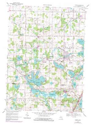
Linden Topo Map Michigan
To zoom in, hover over the map of Linden
USGS Topo Quad 42083g7 - 1:24,000 scale
| Topo Map Name: | Linden |
| USGS Topo Quad ID: | 42083g7 |
| Print Size: | ca. 21 1/4" wide x 27" high |
| Southeast Coordinates: | 42.75° N latitude / 83.75° W longitude |
| Map Center Coordinates: | 42.8125° N latitude / 83.8125° W longitude |
| U.S. State: | MI |
| Filename: | o42083g7.jpg |
| Download Map JPG Image: | Linden topo map 1:24,000 scale |
| Map Type: | Topographic |
| Topo Series: | 7.5´ |
| Map Scale: | 1:24,000 |
| Source of Map Images: | United States Geological Survey (USGS) |
| Alternate Map Versions: |
Linden MI 1969, updated 1971 Download PDF Buy paper map Linden MI 1969, updated 1976 Download PDF Buy paper map Linden MI 1969, updated 1984 Download PDF Buy paper map Linden MI 2011 Download PDF Buy paper map Linden MI 2014 Download PDF Buy paper map Linden MI 2017 Download PDF Buy paper map |
1:24,000 Topo Quads surrounding Linden
> Back to 42083e1 at 1:100,000 scale
> Back to 42082a1 at 1:250,000 scale
> Back to U.S. Topo Maps home
Linden topo map: Gazetteer
Linden: Airports
Cole Field elevation 253m 830′Prices Airport elevation 279m 915′
Stan Nowiki Airport elevation 262m 859′
Linden: Canals
McCollom Drain elevation 252m 826′Linden: Islands
Blue Gill Island elevation 267m 875′Stage Island elevation 261m 856′
Linden: Lakes
Bass Lake elevation 258m 846′Bennett Lake elevation 260m 853′
Buckbee Lake elevation 279m 915′
Byram Lake elevation 263m 862′
Croft Lake elevation 254m 833′
Hoisington Lake elevation 260m 853′
Lamb Lake elevation 264m 866′
Loon Lake elevation 266m 872′
Marl Lake elevation 266m 872′
McCaslin Lake elevation 257m 843′
Mud Lake elevation 260m 853′
Mud Lake elevation 257m 843′
Murray Lake elevation 257m 843′
Otter Lake elevation 257m 843′
Pine Lake elevation 267m 875′
Root Lake elevation 260m 853′
Runyan Lake elevation 272m 892′
Ryan Lake elevation 260m 853′
Shiawassee Lake elevation 257m 843′
Softwater Lake elevation 264m 866′
Stearns Lake elevation 261m 856′
Tupper Lake elevation 263m 862′
Linden: Parks
Linden Mills Historical Marker elevation 264m 866′Linden Park elevation 282m 925′
Linden Presbyterian Church Historical Marker elevation 266m 872′
Linden: Populated Places
Argentine elevation 266m 872′Linden elevation 267m 875′
North Bay Harbor Club Mobile Home Park elevation 271m 889′
Pine Ridge Mobile Home Park elevation 263m 862′
Linden: Post Offices
Argentine Post Office (historical) elevation 266m 872′Linden Post Office elevation 269m 882′
Linden: Reservoirs
Lobdell Lake elevation 262m 859′Linden: Streams
North Ore Creek elevation 256m 839′Runyan Creek elevation 260m 853′
Linden digital topo map on disk
Buy this Linden topo map showing relief, roads, GPS coordinates and other geographical features, as a high-resolution digital map file on DVD:


