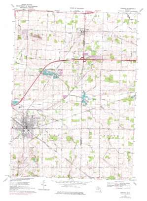
Durand Topo Map Michigan
To zoom in, hover over the map of Durand
USGS Topo Quad 42083h8 - 1:24,000 scale
| Topo Map Name: | Durand |
| USGS Topo Quad ID: | 42083h8 |
| Print Size: | ca. 21 1/4" wide x 27" high |
| Southeast Coordinates: | 42.875° N latitude / 83.875° W longitude |
| Map Center Coordinates: | 42.9375° N latitude / 83.9375° W longitude |
| U.S. State: | MI |
| Filename: | o42083h8.jpg |
| Download Map JPG Image: | Durand topo map 1:24,000 scale |
| Map Type: | Topographic |
| Topo Series: | 7.5´ |
| Map Scale: | 1:24,000 |
| Source of Map Images: | United States Geological Survey (USGS) |
| Alternate Map Versions: |
Durand MI 1969, updated 1971 Download PDF Buy paper map Durand MI 2011 Download PDF Buy paper map Durand MI 2014 Download PDF Buy paper map Durand MI 2017 Download PDF Buy paper map |
1:24,000 Topo Quads surrounding Durand
> Back to 42083e1 at 1:100,000 scale
> Back to 42082a1 at 1:250,000 scale
> Back to U.S. Topo Maps home
Durand topo map: Gazetteer
Durand: Canals
Brown Drain elevation 233m 764′Chalker Drain elevation 233m 764′
Corrigall Drain elevation 245m 803′
Davison Drain elevation 239m 784′
Fullmer Drain elevation 241m 790′
Gansley Drain elevation 233m 764′
Guest Drain elevation 235m 770′
Lennon Drain elevation 233m 764′
Limbarg Drain elevation 229m 751′
Mikan Drain elevation 241m 790′
Sickles Drain elevation 250m 820′
Terry Drain elevation 241m 790′
Durand: Crossings
Interchange 123 elevation 238m 780′Durand: Lakes
Leisure Lake elevation 230m 754′Durand: Parks
Durand Railroad History Historical Marker elevation 242m 793′Durand Union Station Historical Marker elevation 242m 793′
Fitch Park elevation 241m 790′
Knights Templar Special Historical Marker elevation 242m 793′
Optimist Park elevation 240m 787′
Shaw Park elevation 241m 790′
Trumble Park elevation 239m 784′
Durand: Populated Places
Duffield elevation 238m 780′Durand elevation 242m 793′
Lennon elevation 242m 793′
Durand: Post Offices
Duffield Post Office (historical) elevation 238m 780′Durand Post Office elevation 241m 790′
Lennon Post Office elevation 239m 784′
Durand: Streams
Atherton Drain elevation 241m 790′Jones Creek elevation 234m 767′
Porter Drain elevation 245m 803′
Threemile Creek elevation 233m 764′
Durand: Wells
Swartz Creek City Wells elevation 238m 780′Durand digital topo map on disk
Buy this Durand topo map showing relief, roads, GPS coordinates and other geographical features, as a high-resolution digital map file on DVD:


